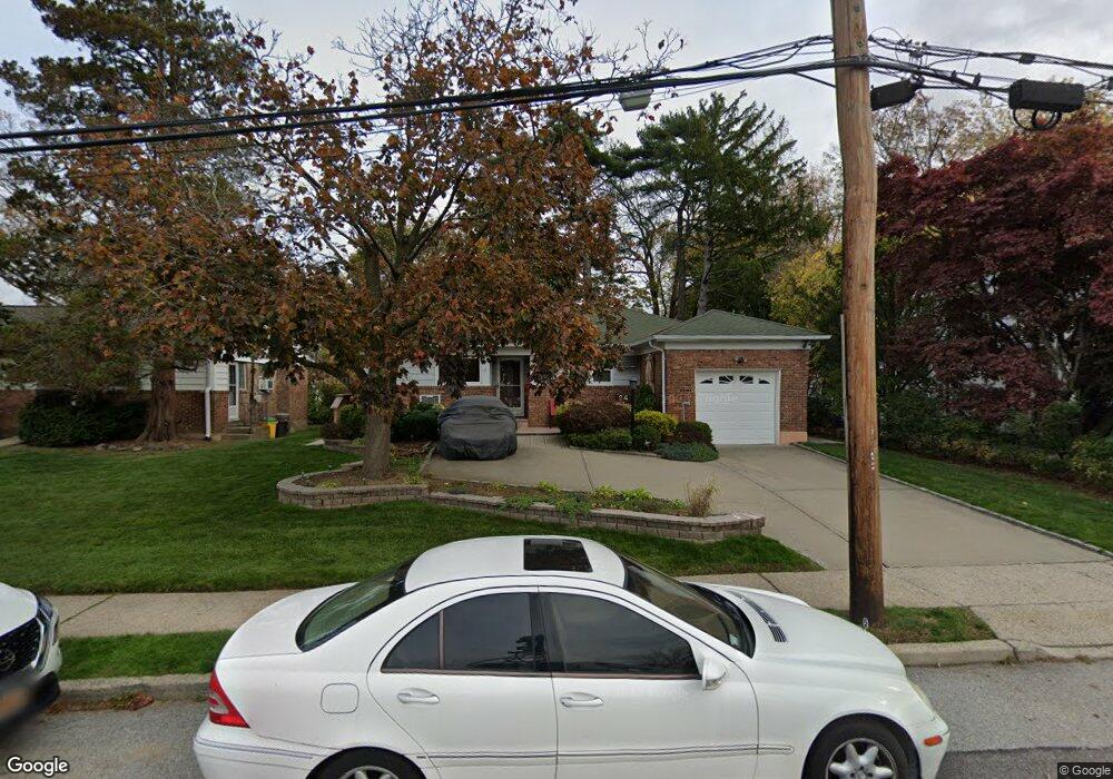
24 Herkimer Ave Hewlett, NY 11557
Estimated Value: $774,000 - $797,252
3
Beds
2
Baths
1,715
Sq Ft
$458/Sq Ft
Est. Value
About This Home
This home is located at 24 Herkimer Ave, Hewlett, NY 11557 and is currently estimated at $785,626, approximately $458 per square foot. 24 Herkimer Ave is a home located in Nassau County with nearby schools including George W Hewlett High School, Yeshiva of South Shore, and Reenas Bais Yaakov.
Ownership History
Date
Name
Owned For
Owner Type
Purchase Details
Closed on
Nov 7, 2016
Sold by
Goodman David F and Goodman Epifania M
Bought by
Lewis Laxton and Lewis Sharon Evans
Current Estimated Value
Purchase Details
Closed on
Jul 22, 2010
Sold by
Goodman Scott E
Bought by
Goodman David F and Goodman Epifania M
Home Financials for this Owner
Home Financials are based on the most recent Mortgage that was taken out on this home.
Original Mortgage
$326,000
Interest Rate
4.73%
Mortgage Type
Unknown
Create a Home Valuation Report for This Property
The Home Valuation Report is an in-depth analysis detailing your home's value as well as a comparison with similar homes in the area
Home Values in the Area
Average Home Value in this Area
Purchase History
| Date | Buyer | Sale Price | Title Company |
|---|---|---|---|
| Lewis Laxton | $420,000 | Citi Abstract | |
| Goodman David F | $407,500 | -- |
Source: Public Records
Mortgage History
| Date | Status | Borrower | Loan Amount |
|---|---|---|---|
| Previous Owner | Goodman David F | $326,000 |
Source: Public Records
Tax History Compared to Growth
Tax History
| Year | Tax Paid | Tax Assessment Tax Assessment Total Assessment is a certain percentage of the fair market value that is determined by local assessors to be the total taxable value of land and additions on the property. | Land | Improvement |
|---|---|---|---|---|
| 2025 | $15,707 | $499 | $198 | $301 |
| 2024 | $3,519 | $497 | $197 | $300 |
| 2023 | $15,491 | $537 | $213 | $324 |
| 2022 | $15,491 | $521 | $207 | $314 |
| 2021 | $21,363 | $511 | $203 | $308 |
| 2020 | $18,822 | $630 | $629 | $1 |
| 2019 | $13,926 | $675 | $674 | $1 |
| 2018 | $14,017 | $720 | $0 | $0 |
| 2017 | $11,981 | $942 | $731 | $211 |
| 2016 | $15,986 | $942 | $731 | $211 |
| 2015 | $3,703 | $942 | $731 | $211 |
| 2014 | $3,703 | $942 | $731 | $211 |
| 2013 | $3,458 | $942 | $731 | $211 |
Source: Public Records
Map
Nearby Homes
- 1584 Kew Ave
- 51 Stevenson Rd
- 29 Avon Rd
- 165 Page Rd
- 75 Peninsula Blvd
- 127 Gordon Rd
- 32 Harvard Ave
- 29 Orleans Rd
- 131 Peninsula Blvd
- 1434 Noel Ave
- 88 Marlboro Rd
- 80 Munro Blvd
- 21 Fremont Rd
- 3 N Brook Dr
- 1555 Stevenson Rd
- 1390 Broadway Unit 116
- 1390 Broadway Unit 107
- 1390 Broadway Unit 118
- 375 Cochran Place
- 1385 Broadway Unit A31
- 30 Herkimer Ave
- 18 Herkimer Ave
- 23 Stevenson Rd
- 14 Herkimer Ave
- 36 Herkimer Ave
- 29 Stevenson Rd
- 35 Stevenson Rd
- 8 Herkimer Ave
- 1581 Kew Ave
- 15 Stevenson Rd
- 41 Stevenson Rd
- 1584 Broadway
- 1598 Broadway Unit 3
- 30 Stevenson Rd
- 20 Stevenson Rd
- 34 Stevenson Rd
- 1588 Broadway
- 18 Stevenson Rd
- 14 Stevenson Rd
- 1578 Kew Ave