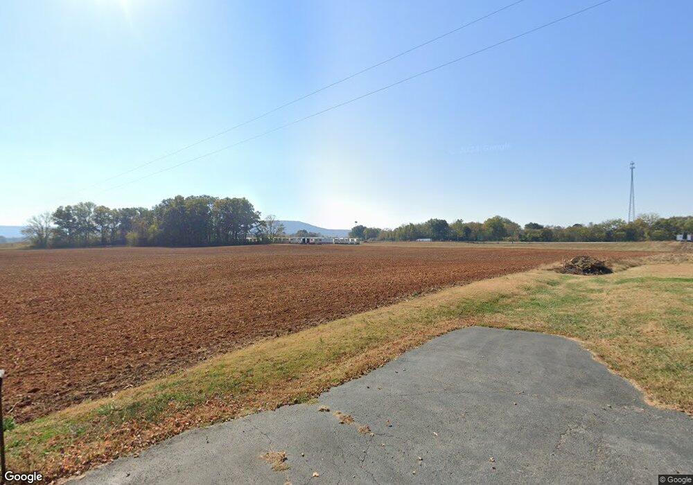
24 I Pelham, TN 37366
Estimated Value: $378,000 - $1,299,527
--
Bed
2
Baths
2,261
Sq Ft
$332/Sq Ft
Est. Value
About This Home
This home is located at 24 I, Pelham, TN 37366 and is currently estimated at $751,176, approximately $332 per square foot. 24 I is a home located in Grundy County.
Ownership History
Date
Name
Owned For
Owner Type
Purchase Details
Closed on
Oct 15, 2024
Sold by
Pelham I-24 Llc
Bought by
2024 124 Pelham Llc
Current Estimated Value
Purchase Details
Closed on
Jun 10, 2013
Sold by
Horizon Land Llc
Bought by
Salehzadeh Robert A and Salehzadeh Christina I
Purchase Details
Closed on
Jul 28, 2009
Sold by
Land Development Com Inc
Bought by
Horizon Land
Purchase Details
Closed on
Feb 28, 2007
Bought by
Land Development Com Inc & Horizon Land Llc
Home Financials for this Owner
Home Financials are based on the most recent Mortgage that was taken out on this home.
Original Mortgage
$460,000
Interest Rate
6.3%
Purchase Details
Closed on
Jan 16, 1987
Bought by
Simmons Georgia Lee
Create a Home Valuation Report for This Property
The Home Valuation Report is an in-depth analysis detailing your home's value as well as a comparison with similar homes in the area
Home Values in the Area
Average Home Value in this Area
Purchase History
| Date | Buyer | Sale Price | Title Company |
|---|---|---|---|
| 2024 124 Pelham Llc | $1,312,000 | None Listed On Document | |
| Salehzadeh Robert A | $260,000 | -- | |
| Horizon Land | $212,500 | -- | |
| Horizon Land | -- | -- | |
| Land Development Com Inc & Horizon Land Llc | $575,000 | -- | |
| Simmons Georgia Lee | $19,000 | -- |
Source: Public Records
Mortgage History
| Date | Status | Borrower | Loan Amount |
|---|---|---|---|
| Previous Owner | Simmons Georgia Lee | $460,000 |
Source: Public Records
Tax History Compared to Growth
Tax History
| Year | Tax Paid | Tax Assessment Tax Assessment Total Assessment is a certain percentage of the fair market value that is determined by local assessors to be the total taxable value of land and additions on the property. | Land | Improvement |
|---|---|---|---|---|
| 2024 | $1,491 | $104,550 | $48,625 | $55,925 |
| 2023 | $1,491 | $104,550 | $48,625 | $55,925 |
| 2022 | $1,608 | $72,675 | $40,025 | $32,650 |
| 2021 | $1,608 | $72,675 | $40,025 | $32,650 |
| 2020 | $1,608 | $72,675 | $40,025 | $32,650 |
| 2019 | $1,190 | $77,750 | $55,875 | $21,875 |
| 2018 | $1,190 | $46,900 | $31,950 | $14,950 |
| 2017 | $1,190 | $46,900 | $31,950 | $14,950 |
| 2016 | $1,190 | $46,900 | $31,950 | $14,950 |
| 2015 | $1,190 | $46,900 | $31,950 | $14,950 |
| 2014 | $1,190 | $46,897 | $0 | $0 |
Source: Public Records
Map
Nearby Homes
- 0 Laxton Rd Unit RTC2957818
- 0 Providence Rd
- 774 Sherrell Rd
- 11 Jess Long Ln
- 72 Lady Slipper Ln
- 0 U S Highway 64
- 0 White Ridge Rd
- 0 Claiborne View Rd Unit RTC2797207
- 9616 Old Alto Hwy
- 0 Deep Woods Rd
- 1863 Lake Louisa Loop
- 1651 Lake Louisa Loop
- 66 Wilder Chapel Rd
- 0 Clouse Hill Rd
- 0 Old Alto Hwy Unit RTC3039048
- 2526 Oak Grove Rd
- 1431 Roarks Cove Rd
- 1106 N Bluff Cir
- 0 Trussell Creek Trail Unit RTC3000327
- 388 Charlie Roberts Rd
- 2422 Sherrell Rd
- 1112 Tennessee 50
- 1019 U S Highway 64
- 1803 U S Highway 64
- 0 U S Highway 64
- 4654 U S Highway 64
- 2 U S Highway 64
- 1109 Sr 50
- 1109 Tennessee 50
- 180 Sherrell Rd
- 909 Us 64
- 2278 Sherrell Rd
- 633 Laxson Rd
- 1108 Bells Mill Rd
- 0 Laxson Rd Unit RTC2406524
- 0 Laxson Rd Unit RTC2363796
- 0 State Route 50 E Unit 1582850
- 1786 Dwight Sherrell Rd
- 895 Us 64
- 355 George Clay Rd
