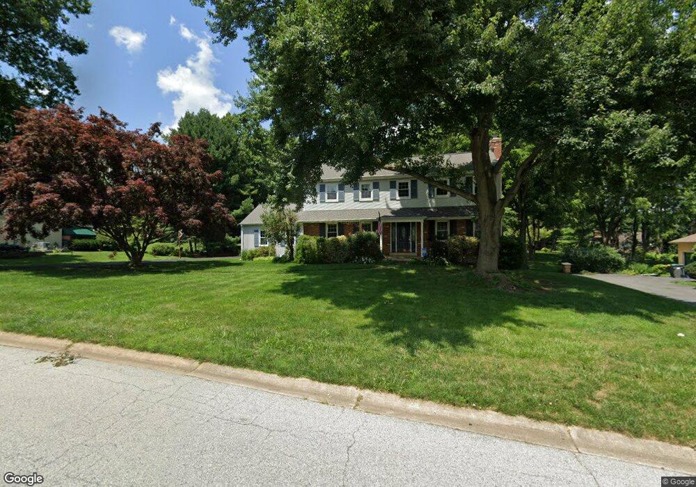
24 Kent Dr Hockessin, DE 19707
Estimated Value: $691,000 - $736,000
4
Beds
3
Baths
3,108
Sq Ft
$231/Sq Ft
Est. Value
About This Home
This home is located at 24 Kent Dr, Hockessin, DE 19707 and is currently estimated at $718,162, approximately $231 per square foot. 24 Kent Dr is a home located in New Castle County with nearby schools including Dupont (H.B.) Middle School, Alexis I. du Pont High School, and Hockessin Montessori School.
Ownership History
Date
Name
Owned For
Owner Type
Purchase Details
Closed on
Aug 29, 2005
Sold by
Reid William D
Bought by
Schmidt Jeffrey O and Schmidt Susan M
Current Estimated Value
Home Financials for this Owner
Home Financials are based on the most recent Mortgage that was taken out on this home.
Original Mortgage
$285,000
Outstanding Balance
$150,843
Interest Rate
5.68%
Mortgage Type
Fannie Mae Freddie Mac
Estimated Equity
$567,319
Purchase Details
Closed on
Nov 13, 2002
Sold by
Reid William D and Reid Stephanie D
Bought by
Reid William D
Home Financials for this Owner
Home Financials are based on the most recent Mortgage that was taken out on this home.
Original Mortgage
$160,000
Interest Rate
6.03%
Create a Home Valuation Report for This Property
The Home Valuation Report is an in-depth analysis detailing your home's value as well as a comparison with similar homes in the area
Home Values in the Area
Average Home Value in this Area
Purchase History
| Date | Buyer | Sale Price | Title Company |
|---|---|---|---|
| Schmidt Jeffrey O | $435,000 | -- | |
| Reid William D | -- | Stewart Title Guaranty Compa |
Source: Public Records
Mortgage History
| Date | Status | Borrower | Loan Amount |
|---|---|---|---|
| Open | Schmidt Jeffrey O | $285,000 | |
| Previous Owner | Reid William D | $160,000 |
Source: Public Records
Tax History
| Year | Tax Paid | Tax Assessment Tax Assessment Total Assessment is a certain percentage of the fair market value that is determined by local assessors to be the total taxable value of land and additions on the property. | Land | Improvement |
|---|---|---|---|---|
| 2024 | $6,605 | $172,400 | $33,800 | $138,600 |
| 2023 | $5,858 | $172,400 | $33,800 | $138,600 |
| 2022 | $5,890 | $172,400 | $33,800 | $138,600 |
| 2021 | $5,883 | $172,400 | $33,800 | $138,600 |
| 2020 | $5,885 | $172,400 | $33,800 | $138,600 |
| 2019 | $6,250 | $172,400 | $33,800 | $138,600 |
| 2018 | $5,783 | $172,400 | $33,800 | $138,600 |
| 2017 | $5,714 | $172,400 | $33,800 | $138,600 |
| 2016 | $5,435 | $172,400 | $33,800 | $138,600 |
| 2015 | $5,108 | $172,400 | $33,800 | $138,600 |
| 2014 | $4,745 | $172,400 | $33,800 | $138,600 |
Source: Public Records
Map
Nearby Homes
- 408 Willowbend Ct
- 105 Bellfield Ct
- 747 Morris Rd
- 112 Cameron Dr
- 304 Bartram Ln E
- 1439 Old Wilmington Rd
- 1127 Kaolin Rd
- 1075 Yorklyn Rd
- 509 Holly Knoll Rd
- 10 Yorkridge Trail
- 11 Yorkridge Trail
- 707 Pine Ridge Ln
- 531 Chandler Mill Rd
- 47 Clifton Dr
- 820 Sharpless Rd
- 988 Sharpless Rd
- 12 Larchmont Ct
- 100 Pennfield Dr
- 100 Pyles Mountain Ln
- 7 Piersons Ridge Unit RG
Your Personal Tour Guide
Ask me questions while you tour the home.