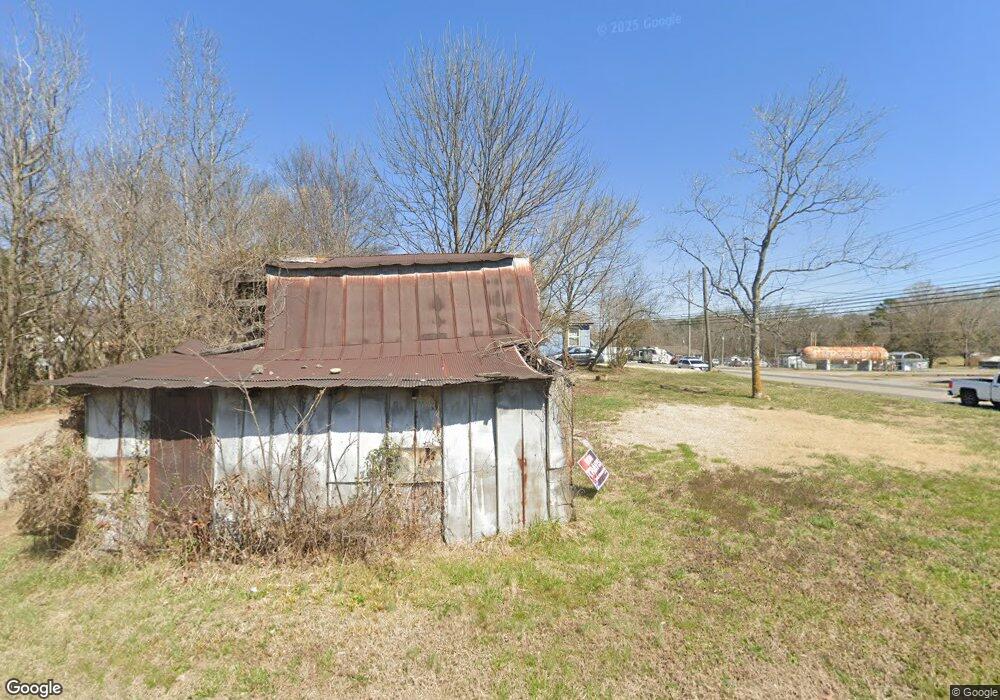
24 Land Dr Dunlap, TN 37327
Estimated Value: $116,000 - $243,000
--
Bed
1
Bath
1,041
Sq Ft
$162/Sq Ft
Est. Value
About This Home
This home is located at 24 Land Dr, Dunlap, TN 37327 and is currently estimated at $168,507, approximately $161 per square foot. 24 Land Dr is a home located in Sequatchie County with nearby schools including Griffith Elementary School, Sequatchie County Middle School, and Sequatchie County High School.
Ownership History
Date
Name
Owned For
Owner Type
Purchase Details
Closed on
May 12, 2022
Sold by
Land George D
Bought by
Wv777 Enterprises Llc
Current Estimated Value
Purchase Details
Closed on
Apr 22, 1994
Sold by
George Land and George Faye
Bought by
George Land and George Faye
Purchase Details
Closed on
Feb 11, 1994
Sold by
George Land
Bought by
Swafford Ronald H Trustee
Purchase Details
Closed on
Sep 25, 1992
Bought by
Swafford Ronald H Trustee
Create a Home Valuation Report for This Property
The Home Valuation Report is an in-depth analysis detailing your home's value as well as a comparison with similar homes in the area
Home Values in the Area
Average Home Value in this Area
Purchase History
| Date | Buyer | Sale Price | Title Company |
|---|---|---|---|
| Wv777 Enterprises Llc | $500,000 | None Listed On Document | |
| George Land | -- | -- | |
| Swafford Ronald H Trustee | $27,500 | -- | |
| Swafford Ronald H Trustee | $22,000 | -- |
Source: Public Records
Tax History Compared to Growth
Tax History
| Year | Tax Paid | Tax Assessment Tax Assessment Total Assessment is a certain percentage of the fair market value that is determined by local assessors to be the total taxable value of land and additions on the property. | Land | Improvement |
|---|---|---|---|---|
| 2025 | $651 | $26,925 | $0 | $0 |
| 2024 | $651 | $26,925 | $19,750 | $7,175 |
| 2023 | $651 | $26,925 | $19,750 | $7,175 |
| 2022 | $817 | $24,600 | $19,750 | $4,850 |
| 2021 | $804 | $24,600 | $19,750 | $4,850 |
| 2020 | $804 | $24,600 | $19,750 | $4,850 |
| 2019 | $804 | $24,600 | $19,750 | $4,850 |
| 2018 | $689 | $21,350 | $19,750 | $1,600 |
| 2017 | $682 | $21,350 | $19,750 | $1,600 |
| 2016 | $704 | $21,125 | $19,750 | $1,375 |
| 2015 | $704 | $21,125 | $19,750 | $1,375 |
| 2014 | $704 | $21,125 | $19,750 | $1,375 |
Source: Public Records
Map
Nearby Homes
- 14999 Rankin Ave
- 267 Williams Rd
- 217 A Day Dream Dr
- 103 Fredonia Rd
- 3 Fredonia Rd
- 1 Fredonia Rd
- 2 Fredonia Rd
- 134 River Ridge Dr Unit 117
- 134 River Ridge Dr
- 11342 Fredonia Rd
- 21 Fredonia Rd
- 0 Fredonia Loop
- 0 State Rt 399 Lot 13
- 0 SE US Hwy 127 Unit 1519993
- 0 SE US Hwy 127 Unit 1519990
- 0 SE US Hwy 127 Unit 1519988
- 0 SE US Hwy 127 Unit 1314389
- 0 SE US Hwy 127 Unit 1519979
- 0 SE US Hwy 127 Unit 1519991
- 0 SE US Hwy 127 Unit 1519984
- 25 Land Dr
- 16675 Rankin Ave
- 3 Hatfield Ln
- 16584 Rankin Ave
- 0 Rankin Ave Hobbs Ridge Rd Unit 199487
- 0 Rankin Ave Hobbs Ridge Unit 199527
- 0 Rankin Ave Hobbs Ridge Rd Unit 199489
- 0 Rankin Ave Hobbs Ridge Unit RTC2525620
- 0 Rankin Ave Hobbs Ridge Unit 1324345
- 0 Rankin Avenue Hobbs Ridge Rd Unit 20207266
- 0 Rankin Avenue Hobbs Ridge Rd Unit 20207231
- 16656 Rankin Ave
- 16670 Rankin Ave
- 53 Hatfield Ln
- 16686 Rankin Ave
- 541 Heard St Unit Lot 91
- 541 Heard St
- 3 Hobbs Ridge Rd
- 612 Rankin Ave
- 16696 Rankin Ave