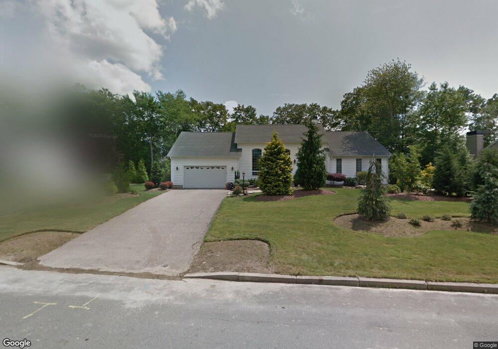
24 Lindsay Ln Cranston, RI 02921
Comstock Gardens NeighborhoodEstimated Value: $799,000 - $944,000
3
Beds
2
Baths
2,376
Sq Ft
$359/Sq Ft
Est. Value
About This Home
This home is located at 24 Lindsay Ln, Cranston, RI 02921 and is currently estimated at $853,415, approximately $359 per square foot. 24 Lindsay Ln is a home located in Providence County with nearby schools including Orchard Farms El. School, Western Hills Middle School, and Cranston High School West.
Ownership History
Date
Name
Owned For
Owner Type
Purchase Details
Closed on
Feb 3, 2023
Sold by
Bogosian David G and Bogosian Jessica L
Bought by
Jessica L Bogosian Ret
Current Estimated Value
Purchase Details
Closed on
Nov 9, 2017
Sold by
Bogosian David G
Bought by
Bogosian David G and Bogosian Jessica L
Purchase Details
Closed on
Jan 18, 2017
Sold by
Bogosian David G and Bogosian Jessica J
Bought by
Bogosian David G
Purchase Details
Closed on
Jun 2, 2014
Sold by
Bogosian David G
Bought by
Bogosian David G and Bogosian Jessica J
Purchase Details
Closed on
Nov 30, 2000
Sold by
Cranston Commons Llc
Bought by
Bogosian David G
Home Financials for this Owner
Home Financials are based on the most recent Mortgage that was taken out on this home.
Original Mortgage
$126,245
Interest Rate
7.76%
Create a Home Valuation Report for This Property
The Home Valuation Report is an in-depth analysis detailing your home's value as well as a comparison with similar homes in the area
Home Values in the Area
Average Home Value in this Area
Purchase History
| Date | Buyer | Sale Price | Title Company |
|---|---|---|---|
| Jessica L Bogosian Ret | -- | None Available | |
| Bogosian David G | -- | -- | |
| Bogosian David G | -- | -- | |
| Bogosian David G | -- | -- | |
| Bogosian David G | $78,000 | -- |
Source: Public Records
Mortgage History
| Date | Status | Borrower | Loan Amount |
|---|---|---|---|
| Previous Owner | Bogosian David G | $100,000 | |
| Previous Owner | Bogosian David G | $50,000 | |
| Previous Owner | Bogosian David G | $126,245 |
Source: Public Records
Tax History Compared to Growth
Tax History
| Year | Tax Paid | Tax Assessment Tax Assessment Total Assessment is a certain percentage of the fair market value that is determined by local assessors to be the total taxable value of land and additions on the property. | Land | Improvement |
|---|---|---|---|---|
| 2025 | $10,614 | $764,700 | $176,400 | $588,300 |
| 2024 | $10,408 | $764,700 | $176,400 | $588,300 |
| 2023 | $9,856 | $521,500 | $125,900 | $395,600 |
| 2022 | $9,653 | $521,500 | $125,900 | $395,600 |
| 2021 | $9,387 | $521,500 | $125,900 | $395,600 |
| 2020 | $9,319 | $448,700 | $147,600 | $301,100 |
| 2019 | $9,319 | $448,700 | $147,600 | $301,100 |
| 2018 | $9,104 | $448,700 | $147,600 | $301,100 |
| 2017 | $9,582 | $417,700 | $156,300 | $261,400 |
| 2016 | $9,377 | $417,700 | $156,300 | $261,400 |
| 2015 | $9,377 | $417,700 | $156,300 | $261,400 |
| 2014 | $8,624 | $377,600 | $130,200 | $247,400 |
Source: Public Records
Map
Nearby Homes
- 11 Raven Cir
- 130 Alpine Estates Dr
- 0 W Bluebird Ln
- 2073 Plainfield Pike
- 191 Pippin Orchard Rd
- 5 Braeburn Cir
- 9 Gray Coach E
- 02 Paula Ln
- 7 Taylor Rd
- 01 Paula Ln
- 121 Ashbrook Dr
- 12 Beechwood Dr
- 79 Taylor Rd
- 2202 Scituate Ave
- 53 Charcalee Dr
- 129 Valerie Ct
- 0 Peck Hill Rd
- 80 Tomahawk Trail
- 560 Seven Mile Rd
- 10 Honey Lou Ct
- 30 Lindsay Ln
- 14 Lindsay Ln
- 21 Lindsay Ln
- 15 Lindsay Ln
- 36 Lindsay Ln
- 8 Lindsay Ln
- 50 Pine Ridge Dr
- 95 Basil Crossing
- 27 Lindsay Ln
- 44 Pine Ridge Dr
- 7 Lindsay Ln
- 35 Lindsay Ln
- 38 Lindsay Ln
- 198 Marjoram Dr
- 60 Pine Ridge Dr
- 14 Sophia Dr
- 76 Basil Crossing
- 24 Sophia Dr
- 84 Basil Crossing
- 85 Basil Crossing