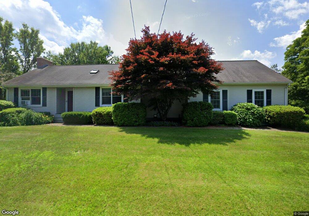
24 S County Rd Leyden, MA 01301
Leyden NeighborhoodEstimated Value: $389,141 - $540,000
2
Beds
1
Bath
1,730
Sq Ft
$255/Sq Ft
Est. Value
About This Home
This home is located at 24 S County Rd, Leyden, MA 01301 and is currently estimated at $440,785, approximately $254 per square foot. 24 S County Rd is a home located in Franklin County with nearby schools including Pioneer Valley Regional.
Ownership History
Date
Name
Owned For
Owner Type
Purchase Details
Closed on
Apr 20, 2024
Sold by
Paul W Hunter Ret and Hunter
Bought by
Paul E Hunter Ret and Hunter
Current Estimated Value
Purchase Details
Closed on
Apr 22, 2015
Sold by
Hunter Paul W
Bought by
Paul W Hunter Ret and Hunter
Purchase Details
Closed on
Sep 15, 2003
Sold by
Swanson Martha R
Bought by
Hunter Paul W
Purchase Details
Closed on
Jul 11, 2002
Sold by
Marini Lois A
Bought by
Swanson Martha R
Create a Home Valuation Report for This Property
The Home Valuation Report is an in-depth analysis detailing your home's value as well as a comparison with similar homes in the area
Home Values in the Area
Average Home Value in this Area
Purchase History
We collect this data history from publicly available records. To have your information removed, we recommend requesting removal directly through your county’s website.
| Date | Buyer | Sale Price | Title Company |
|---|---|---|---|
| Paul E Hunter Ret | -- | None Available | |
| Paul E Hunter Ret | -- | None Available | |
| Paul W Hunter Ret | -- | -- | |
| Paul W Hunter Ret | -- | -- | |
| Hunter Paul W | $176,000 | -- | |
| Hunter Paul W | $176,000 | -- | |
| Swanson Martha R | $175,000 | -- | |
| Swanson Martha R | $175,000 | -- |
Source: Public Records
Mortgage History
We collect this data history from publicly available records. To have your information removed, we recommend requesting removal directly through your county’s website.
| Date | Status | Borrower | Loan Amount |
|---|---|---|---|
| Previous Owner | Swanson Martha R | $97,500 | |
| Previous Owner | Swanson Martha R | $50,000 |
Source: Public Records
Tax History
| Year | Tax Paid | Tax Assessment Tax Assessment Total Assessment is a certain percentage of the fair market value that is determined by local assessors to be the total taxable value of land and additions on the property. | Land | Improvement |
|---|---|---|---|---|
| 2025 | $48 | $315,200 | $72,100 | $243,100 |
| 2024 | $4,736 | $317,000 | $72,100 | $244,900 |
| 2023 | $4,662 | $307,100 | $70,200 | $236,900 |
| 2022 | $4,668 | $289,200 | $63,800 | $225,400 |
| 2021 | $4,595 | $275,300 | $63,800 | $211,500 |
| 2020 | $4,486 | $263,700 | $58,100 | $205,600 |
| 2019 | $4,379 | $251,400 | $55,100 | $196,300 |
| 2018 | $3,485 | $205,100 | $55,100 | $150,000 |
| 2015 | $3,389 | $197,400 | $54,300 | $143,100 |
Source: Public Records
Map
Nearby Homes
- 79 S Schoolhouse Rd
- 0 Frizzell Hill Rd Unit 73493472
- 85 Verde Dr
- 539 Fox Hill Rd
- 151 Smead Hill Rd
- 52 Log Plain Rd
- 88 Newell Pond Rd
- 75 South St Unit 38
- 0 Fox Hill Rd Unit 73477185
- 47 Cross St
- 31 Lovers Ln
- 23 Industrial Dr
- 306 Country Side Rd
- 1 Northfield Rd
- 56 Brattleboro Rd
- 001 Adams Rd
- 108 Colrain Shelburne Rd
- 208 Silver St
- 20 Merrifield Rd
- 171 Cleveland St
- 32 S County Rd
- 32 S County Rd Unit 1
- 00034 Greenfield Rd
- 301 Greenfield Rd
- 48 S County Rd
- 333 Greenfield Rd
- 0 S County Rd
- 9 Lois Ln
- 2 S County Rd
- Lot 37 Lois Ln
- Lot 34 Lois Ln
- 72 S County Rd
- 72 Greenfield Rd
- 36 Lois Ln Unit 101
- 256 Greenfield Rd
- 4 Glen Rd
- 248 Greenfield Rd
- 55 Lois Ln
- 71 Glen Rd
- 31 Glen Rd
Your Personal Tour Guide
Ask me questions while you tour the home.