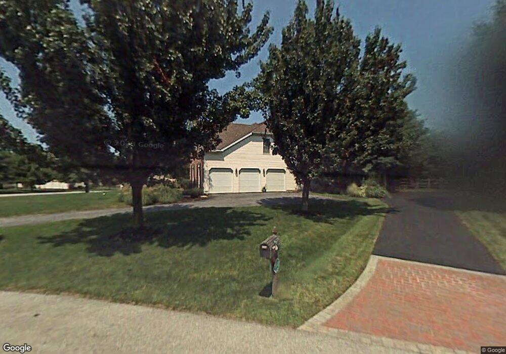
24 Springbrook Ln Newark, DE 19711
Estimated Value: $774,000 - $891,000
4
Beds
4
Baths
2,876
Sq Ft
$293/Sq Ft
Est. Value
About This Home
This home is located at 24 Springbrook Ln, Newark, DE 19711 and is currently estimated at $841,425, approximately $292 per square foot. 24 Springbrook Ln is a home located in New Castle County with nearby schools including North Star Elementary School, Dupont (H.B.) Middle School, and Alexis I. du Pont High School.
Ownership History
Date
Name
Owned For
Owner Type
Purchase Details
Closed on
Apr 29, 2016
Sold by
Acadia Brandywine Subsidiary Llc
Bought by
Smg Celebration Llc
Current Estimated Value
Purchase Details
Closed on
Aug 15, 2007
Sold by
Green Mark and Green Karen L
Bought by
Libonate Anthony and Libonate Amy
Home Financials for this Owner
Home Financials are based on the most recent Mortgage that was taken out on this home.
Original Mortgage
$525,000
Interest Rate
5.75%
Mortgage Type
Purchase Money Mortgage
Create a Home Valuation Report for This Property
The Home Valuation Report is an in-depth analysis detailing your home's value as well as a comparison with similar homes in the area
Home Values in the Area
Average Home Value in this Area
Purchase History
| Date | Buyer | Sale Price | Title Company |
|---|---|---|---|
| Smg Celebration Llc | -- | Attorney | |
| Libonate Anthony | $700,000 | None Available |
Source: Public Records
Mortgage History
| Date | Status | Borrower | Loan Amount |
|---|---|---|---|
| Previous Owner | Libonate Anthony | $525,000 |
Source: Public Records
Tax History
| Year | Tax Paid | Tax Assessment Tax Assessment Total Assessment is a certain percentage of the fair market value that is determined by local assessors to be the total taxable value of land and additions on the property. | Land | Improvement |
|---|---|---|---|---|
| 2024 | $6,482 | $168,900 | $28,700 | $140,200 |
| 2023 | $5,768 | $168,900 | $28,700 | $140,200 |
| 2022 | $5,807 | $168,900 | $28,700 | $140,200 |
| 2021 | $6,122 | $168,900 | $28,700 | $140,200 |
| 2020 | $6,122 | $168,900 | $28,700 | $140,200 |
| 2019 | $6,122 | $168,900 | $28,700 | $140,200 |
| 2018 | $5,722 | $168,900 | $28,700 | $140,200 |
| 2017 | $5,655 | $168,900 | $28,700 | $140,200 |
| 2016 | $5,372 | $168,900 | $28,700 | $140,200 |
| 2015 | $5,047 | $168,900 | $28,700 | $140,200 |
| 2014 | $4,709 | $168,900 | $28,700 | $140,200 |
Source: Public Records
Map
Nearby Homes
- 8 Bayberry Close
- 87 Chandler Ct
- 255 Grove View Dr
- 257 Grove View Dr
- 515 Massaferi Way
- 7 Piersons Ridge Unit RG
- 411 Harrison Dr
- 301 Hollins Rd Unit 97
- 28 Harris Cir
- 222 N Star Rd
- 308 Detjen Dr
- 253 Peoples Way
- 216 N Star Rd
- 567 Southwood Rd
- 1611 Brackenville Rd
- 58 Willow Creek Ln
- 832 Evanson Rd
- 3 Kings Ct
- 809 Christopher Ct
- 150 Hamilton Rd
- 28 Springbrook Ln
- 72 Springbrook Ln
- 25 Springbrook Ln
- 27 Springbrook Ln
- 73 Springbrook Ln
- 70 Springbrook Ln
- 32 Springbrook Ln
- 23 Springbrook Ln
- 21 Springbrook Ln
- 29 Springbrook Ln
- 71 Springbrook Ln
- 68 Springbrook Ln
- 36 Springbrook Ln
- 31 Springbrook Ln
- 44 Springbrook Ln
- 19 Springbrook Ln
- 18 Springbrook Ln
- 33 Springbrook Ln
- 1 Naudain Cir
- 35 Springbrook Ln
Your Personal Tour Guide
Ask me questions while you tour the home.