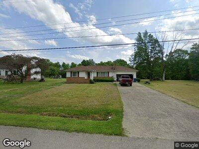
24 W Hill Dr Canfield, OH 44406
Estimated Value: $192,133 - $234,000
3
Beds
1
Bath
1,386
Sq Ft
$154/Sq Ft
Est. Value
About This Home
This home is located at 24 W Hill Dr, Canfield, OH 44406 and is currently estimated at $213,783, approximately $154 per square foot. 24 W Hill Dr is a home located in Mahoning County with nearby schools including Western Reserve Elementary School, Western Reserve Middle School, and Western Reserve High School.
Ownership History
Date
Name
Owned For
Owner Type
Purchase Details
Closed on
Jan 25, 2024
Sold by
Bogard Gregory S
Bought by
Walker Mary E
Current Estimated Value
Purchase Details
Closed on
Feb 28, 2002
Sold by
Koza Marion B and Koza Regina V
Bought by
Bogard Gregory S
Home Financials for this Owner
Home Financials are based on the most recent Mortgage that was taken out on this home.
Original Mortgage
$92,150
Interest Rate
6.92%
Purchase Details
Closed on
Aug 30, 1967
Bought by
Koza Marion B and Koza Regina
Create a Home Valuation Report for This Property
The Home Valuation Report is an in-depth analysis detailing your home's value as well as a comparison with similar homes in the area
Home Values in the Area
Average Home Value in this Area
Purchase History
| Date | Buyer | Sale Price | Title Company |
|---|---|---|---|
| Walker Mary E | $149,000 | None Listed On Document | |
| Bogard Gregory S | $97,000 | -- | |
| Koza Marion B | -- | -- |
Source: Public Records
Mortgage History
| Date | Status | Borrower | Loan Amount |
|---|---|---|---|
| Previous Owner | Bogard Gregory S | $75,746 | |
| Previous Owner | Bogard Gregory S | $92,150 |
Source: Public Records
Tax History Compared to Growth
Tax History
| Year | Tax Paid | Tax Assessment Tax Assessment Total Assessment is a certain percentage of the fair market value that is determined by local assessors to be the total taxable value of land and additions on the property. | Land | Improvement |
|---|---|---|---|---|
| 2024 | $2,266 | $48,580 | $5,190 | $43,390 |
| 2023 | $2,255 | $48,580 | $5,190 | $43,390 |
| 2022 | $1,973 | $36,770 | $4,810 | $31,960 |
| 2021 | $1,780 | $36,770 | $4,810 | $31,960 |
| 2020 | $1,799 | $36,770 | $4,810 | $31,960 |
| 2019 | $1,589 | $30,180 | $4,810 | $25,370 |
| 2018 | $1,587 | $30,180 | $4,810 | $25,370 |
| 2017 | $1,554 | $30,180 | $4,810 | $25,370 |
| 2016 | $1,524 | $28,780 | $4,810 | $23,970 |
| 2015 | $1,485 | $28,780 | $4,810 | $23,970 |
| 2014 | $1,487 | $28,780 | $4,810 | $23,970 |
| 2013 | $1,466 | $28,780 | $4,810 | $23,970 |
Source: Public Records
Map
Nearby Homes
- 10334 W Akron-Canfield Rd
- 8961 Herbert Rd
- 8195 N Palmyra Rd
- 7780 Knauf Rd
- 11276 Diehl Lake Dr
- 7923 Crory Rd
- 12043 Ellsworth Rd
- 6120 Century Blvd
- 11249 Leffingwell Rd
- 280 Lake Pointe Cir Unit 280
- 8148 Gibson Rd
- 20 Hunters Woods Blvd Unit A
- 33 Mallard Crossing
- 7509 S Palmyra Rd
- 7810 Gibson Rd
- 8670 S Salem-Warren Rd
- 0 W Western Reserve Rd Unit 4502803
- 41 Savannah Ct
- 0 W Western Reserve Rd Unit 5124598
- 0 W Western Reserve Rd Unit 5124502