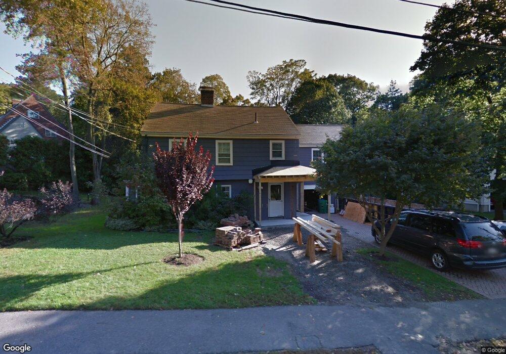
24 Wauwinet Rd West Newton, MA 02465
West Newton NeighborhoodEstimated Value: $2,232,529 - $2,760,000
5
Beds
4
Baths
2,900
Sq Ft
$841/Sq Ft
Est. Value
About This Home
This home is located at 24 Wauwinet Rd, West Newton, MA 02465 and is currently estimated at $2,438,382, approximately $840 per square foot. 24 Wauwinet Rd is a home located in Middlesex County with nearby schools including Peirce Elementary School, F.A. Day Middle School, and Newton North High School.
Ownership History
Date
Name
Owned For
Owner Type
Purchase Details
Closed on
Jan 3, 2007
Sold by
Wilson Elizabeth H
Bought by
Matthews Benjamin and Gara-Matthews Lori
Current Estimated Value
Purchase Details
Closed on
Dec 21, 1995
Sold by
Tanno Darrell J and Tanno Deborah
Bought by
Wilson Elizabeth H
Purchase Details
Closed on
Oct 24, 1994
Sold by
Mezger Richard A
Bought by
Tanno Darrell J and Tanno Deborah
Create a Home Valuation Report for This Property
The Home Valuation Report is an in-depth analysis detailing your home's value as well as a comparison with similar homes in the area
Home Values in the Area
Average Home Value in this Area
Purchase History
| Date | Buyer | Sale Price | Title Company |
|---|---|---|---|
| Matthews Benjamin | $1,000,000 | -- | |
| Wilson Elizabeth H | $470,000 | -- | |
| Tanno Darrell J | $485,000 | -- |
Source: Public Records
Mortgage History
| Date | Status | Borrower | Loan Amount |
|---|---|---|---|
| Open | Tanno Darrell J | $713,000 | |
| Closed | Tanno Darrell J | $730,000 |
Source: Public Records
Tax History Compared to Growth
Tax History
| Year | Tax Paid | Tax Assessment Tax Assessment Total Assessment is a certain percentage of the fair market value that is determined by local assessors to be the total taxable value of land and additions on the property. | Land | Improvement |
|---|---|---|---|---|
| 2025 | $18,534 | $1,891,200 | $1,236,900 | $654,300 |
| 2024 | $17,920 | $1,836,100 | $1,200,900 | $635,200 |
| 2023 | $17,230 | $1,692,500 | $928,800 | $763,700 |
| 2022 | $16,486 | $1,567,100 | $860,000 | $707,100 |
| 2021 | $15,908 | $1,478,400 | $811,300 | $667,100 |
| 2020 | $15,434 | $1,478,400 | $811,300 | $667,100 |
| 2019 | $14,999 | $1,435,300 | $787,700 | $647,600 |
| 2018 | $14,708 | $1,359,300 | $716,100 | $643,200 |
| 2017 | $13,703 | $1,232,300 | $675,600 | $556,700 |
| 2016 | $13,106 | $1,151,700 | $631,400 | $520,300 |
| 2015 | $12,497 | $1,076,400 | $590,100 | $486,300 |
Source: Public Records
Map
Nearby Homes
- 46 Ellis Rd
- 308 Prince St
- 70 Bigelow Rd
- 1230 Commonwealth Ave
- 39 Valentine Park
- 222 Prince St
- 36 Troy Ln
- 154 Beaumont Ave
- 279 Chestnut St
- 61 Lakeview Ave
- 443 Chestnut St
- 4 Hosmer Cir
- 18 Sewall St
- 479 Chestnut St
- 33 Birch Hill Rd
- 140 Mount Vernon St
- 10 Ruane Rd
- 318 Austin St Unit A
- 513 Chestnut St
- 20 Birch Hill Rd
- 18 Wauwinet Rd
- 32 Wauwinet Rd
- 167 Valentine St
- 155 Valentine St
- 25 Wauwinet Rd
- 177 Valentine St
- 17 Wauwinet Rd
- 38 Wauwinet Rd
- 151 Valentine St
- 74 Colbert Rd E
- 9 Wauwinet Rd
- 46 Wauwinet Rd
- 6 Risley Rd
- 191 Valentine St
- 3 Wauwinet Rd
- 79 Colbert Rd E
- 68 Colbert Rd E
- 150 Valentine St
- 83 Bonad Rd
- 50 Wauwinet Rd