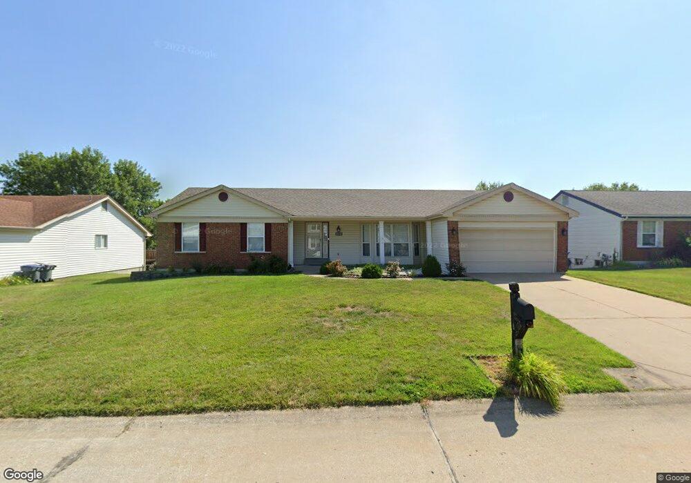
240 Brougham Dr O Fallon, MO 63368
Estimated Value: $356,000 - $383,000
3
Beds
2
Baths
1,672
Sq Ft
$223/Sq Ft
Est. Value
About This Home
This home is located at 240 Brougham Dr, O Fallon, MO 63368 and is currently estimated at $372,806, approximately $222 per square foot. 240 Brougham Dr is a home located in St. Charles County with nearby schools including John Weldon Elementary School, Francis Howell Middle School, and Francis Howell Union High School.
Ownership History
Date
Name
Owned For
Owner Type
Purchase Details
Closed on
Jul 9, 2015
Sold by
Thompson Lindell R and Thompson Margaret E
Bought by
Cicerelli Gabe
Current Estimated Value
Home Financials for this Owner
Home Financials are based on the most recent Mortgage that was taken out on this home.
Original Mortgage
$140,800
Outstanding Balance
$110,625
Interest Rate
4.08%
Mortgage Type
New Conventional
Estimated Equity
$262,181
Purchase Details
Closed on
Aug 30, 2001
Sold by
Gordon Gene B and Gordon Jody L
Bought by
Thompson Lindell R and Thompson Margaret E
Home Financials for this Owner
Home Financials are based on the most recent Mortgage that was taken out on this home.
Original Mortgage
$56,000
Interest Rate
6.98%
Create a Home Valuation Report for This Property
The Home Valuation Report is an in-depth analysis detailing your home's value as well as a comparison with similar homes in the area
Home Values in the Area
Average Home Value in this Area
Purchase History
| Date | Buyer | Sale Price | Title Company |
|---|---|---|---|
| Cicerelli Gabe | -- | Ort | |
| Thompson Lindell R | $152,900 | -- |
Source: Public Records
Mortgage History
| Date | Status | Borrower | Loan Amount |
|---|---|---|---|
| Open | Cicerelli Gabe | $140,800 | |
| Previous Owner | Thompson Lindell R | $56,000 |
Source: Public Records
Tax History
| Year | Tax Paid | Tax Assessment Tax Assessment Total Assessment is a certain percentage of the fair market value that is determined by local assessors to be the total taxable value of land and additions on the property. | Land | Improvement |
|---|---|---|---|---|
| 2025 | $3,878 | $67,528 | -- | -- |
| 2023 | $3,880 | $61,712 | $0 | $0 |
| 2022 | $3,089 | $45,546 | $0 | $0 |
| 2021 | $3,096 | $45,546 | $0 | $0 |
| 2020 | $3,181 | $44,985 | $0 | $0 |
| 2019 | $3,190 | $44,985 | $0 | $0 |
| 2018 | $3,025 | $40,624 | $0 | $0 |
| 2017 | $2,999 | $40,624 | $0 | $0 |
| 2016 | $2,734 | $35,802 | $0 | $0 |
| 2015 | $2,693 | $35,802 | $0 | $0 |
| 2014 | $2,315 | $31,304 | $0 | $0 |
Source: Public Records
Map
Nearby Homes
- 106 Rockaway Dr
- 47 Landyn Ct
- 57 Burgundy Place Dr
- 102 Riparian Dr
- 104 Haven Ridge Ct
- 157 Haven Ridge Ct
- 149 Haven Ridge Ct
- 101 Haven Ridge Ct Unit LOT 47
- 1600 Valley Hill Ct
- 7412 Cinnamon Teal Dr
- 7554 Cinnamon Teal Dr
- 517 Copper Meadows Ln
- 7053 Black Horse Dr
- 2916 Spring Blossom Dr
- 8003 Knights Crossing Dr
- 9 Dragonstone Ct
- 7 Dragonstone Ct
- 5 Dragonstone Ct
- 2756 Dunvegan Dr
- 3 Dragonstone Ct
- 236 Brougham Dr
- 244 Brougham Dr
- 149 Rockaway Dr
- 153 Rockaway Dr
- 145 Rockaway Dr
- 232 Brougham Dr
- 248 Brougham Dr
- 239 Brougham Dr
- 235 Brougham Dr
- 243 Brougham Dr
- 157 Rockaway Dr
- 141 Rockaway Dr
- 247 Brougham Dr
- 228 Brougham Dr
- 252 Brougham Dr
- 137 Rockaway Dr
- 161 Rockaway Dr
- 251 Brougham Dr
- 227 Brougham Dr
- 350 Carriage Trail Ct
Your Personal Tour Guide
Ask me questions while you tour the home.