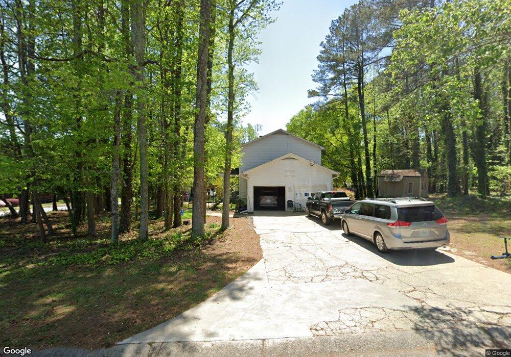
2401 Hillboro Cir SW Marietta, GA 30064
Estimated Value: $318,000 - $341,000
3
Beds
2
Baths
1,520
Sq Ft
$217/Sq Ft
Est. Value
About This Home
This home is located at 2401 Hillboro Cir SW, Marietta, GA 30064 and is currently estimated at $329,962, approximately $217 per square foot. 2401 Hillboro Cir SW is a home located in Cobb County with nearby schools including Dowell Elementary School, Smitha Middle School, and Osborne High School.
Ownership History
Date
Name
Owned For
Owner Type
Purchase Details
Closed on
Nov 16, 2012
Sold by
Tabb Connie C
Bought by
Tabb Dewberry Properties Llc
Current Estimated Value
Purchase Details
Closed on
Dec 15, 2000
Sold by
Hommond Adam T
Bought by
Tabb Connie C
Purchase Details
Closed on
May 1, 1996
Sold by
Gunchick Greggrey M Cynthia
Bought by
Hammond Adam T
Create a Home Valuation Report for This Property
The Home Valuation Report is an in-depth analysis detailing your home's value as well as a comparison with similar homes in the area
Home Values in the Area
Average Home Value in this Area
Purchase History
| Date | Buyer | Sale Price | Title Company |
|---|---|---|---|
| Tabb Dewberry Properties Llc | $125,000 | -- | |
| Tabb Connie C | $125,000 | -- | |
| Hammond Adam T | $97,500 | -- |
Source: Public Records
Mortgage History
| Date | Status | Borrower | Loan Amount |
|---|---|---|---|
| Closed | Hammond Adam T | $0 |
Source: Public Records
Tax History Compared to Growth
Tax History
| Year | Tax Paid | Tax Assessment Tax Assessment Total Assessment is a certain percentage of the fair market value that is determined by local assessors to be the total taxable value of land and additions on the property. | Land | Improvement |
|---|---|---|---|---|
| 2025 | $3,106 | $103,072 | $10,800 | $92,272 |
| 2024 | $3,108 | $103,072 | $10,800 | $92,272 |
| 2023 | $3,108 | $103,072 | $10,800 | $92,272 |
| 2022 | $2,526 | $83,244 | $10,800 | $72,444 |
| 2021 | $2,120 | $69,868 | $10,800 | $59,068 |
| 2020 | $1,956 | $64,444 | $10,800 | $53,644 |
| 2019 | $1,663 | $54,788 | $4,000 | $50,788 |
| 2018 | $1,663 | $54,788 | $4,000 | $50,788 |
| 2017 | $1,242 | $43,212 | $4,000 | $39,212 |
| 2016 | $1,242 | $43,212 | $4,000 | $39,212 |
| 2015 | $950 | $32,240 | $4,000 | $28,240 |
| 2014 | $758 | $25,504 | $0 | $0 |
Source: Public Records
Map
Nearby Homes
- 2166 Derbyshire Dr SW
- 2415 Bankstone Dr SW
- 2117 Caneridge Dr SW
- 2126 Green Dr SW
- 2409 Caneridge Point SW
- 2146 Caneridge Dr SW
- 2284 Tree Arbor Way
- 2040 Freestone Way
- 2009 Freestone Way
- Bramblewood Plan at Oak Valley Estates
- Abney Plan at Oak Valley Estates
- Sherwood Plan at Oak Valley Estates
- Hedgerow Plan at Oak Valley Estates
- Presley Plan at Oak Valley Estates
- Chatfield Plan at Oak Valley Estates
- Dunning Plan at Oak Valley Estates
- 2608 Foxwood Place SW Unit IV
- 1985 Freestone Way
- 2723 Byess Ct
- 2251 Byron Ct SW
- 2290 Bankstone Dr SW
- 2403 Hillboro Cir SW
- 2270 Bankstone Dr SW
- 2300 Bankstone Dr SW Unit A
- 2300 Bankstone Dr SW
- 2405 Hillboro Cir SW
- 2404 Hillboro Cir S W
- 2150 Derbyshire Dr
- 2142 Derbyshire Dr
- 2146 Derbyshire Dr SW Unit 98
- 2146 Derbyshire Dr SW
- 2445 Hillboro Cir S W
- 2154 Derbyshire Dr SW
- 2260 Bankstone Dr SW
- 2447 Hillboro Cir SW
- 2404 Hillboro Cir SW
- 2407 Hillboro Cir SW
- 2160 Derbyshire Dr SW
- 2445 Hillboro Cir SW