
Seller's Agent in 2025
Darin Stephens
Stone & Story RE Group, LLC
(785) 250-7278
38 in this area
1,023 Total Sales
Estimated Value: $308,000 - $337,000
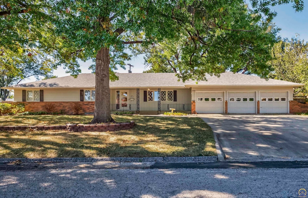
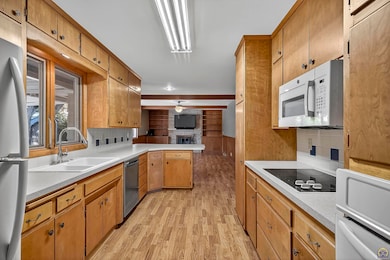
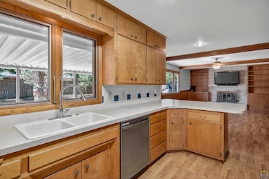
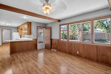
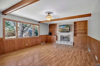
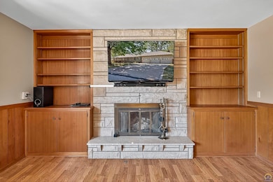
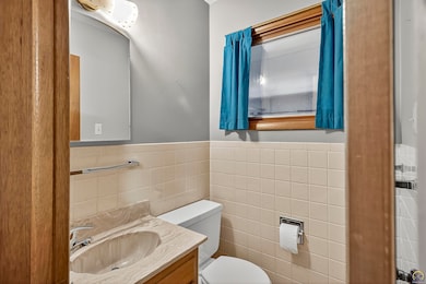
Convenience, space, charm and style, all the traits you were looking for in the middle of the city! Nice large ranch with full footprint basement and mid-century touches. Enter the foyer and find a huge living room as you pass through the dining room and into the kitchen which is open to the spacious family room with fireplace and built in shelving. 4 large bedrooms on the main floor include the ensuite primary addition to the back of the the home with jetted tub, double sinks, built in shelving, walk-in closet and sliders to the back deck. Built in storage and extra closets throughout the entire main floor. The basement is huge and open as well with plenty of space to entertain your ideas and also currently hosts the laundry and utilities. Nice fenced back yard with storage shed, covered patio and huge deck. You’ll have to be quick on your feet for this one, book a showing today!
Last Agent to Sell the Property
Stone & Story RE Group, LLC Brokerage Phone: 785-251-0717 License #00047331 Listed on: 10/24/2025
| Date | Buyer | Sale Price | Title Company |
|---|---|---|---|
| Eggleston Christopher L | -- | Security 1St Title | |
| Cafer Mitzi D | -- | None Available | |
| Cafer Mitzi | -- | None Available | |
| Cafer Mitzi D | -- | None Available |
| Date | Status | Borrower | Loan Amount |
|---|---|---|---|
| Open | Eggleston Christopher L | $256,000 |
| Date | Event | Price | List to Sale | Price per Sq Ft |
|---|---|---|---|---|
| 12/05/2025 12/05/25 | Sold | -- | -- | -- |
| 10/27/2025 10/27/25 | Pending | -- | -- | -- |
| 10/24/2025 10/24/25 | For Sale | $325,000 | -- | $79 / Sq Ft |
| Year | Tax Paid | Tax Assessment Tax Assessment Total Assessment is a certain percentage of the fair market value that is determined by local assessors to be the total taxable value of land and additions on the property. | Land | Improvement |
|---|---|---|---|---|
| 2025 | $5,048 | $35,753 | -- | -- |
| 2023 | $5,048 | $33,383 | $0 | $0 |
| 2022 | $4,517 | $29,807 | $0 | $0 |
| 2021 | $4,214 | $26,614 | $0 | $0 |
| 2020 | $3,967 | $25,347 | $0 | $0 |
| 2019 | $3,835 | $24,371 | $0 | $0 |
| 2018 | $3,726 | $23,662 | $0 | $0 |
| 2017 | $3,625 | $22,973 | $0 | $0 |
| 2014 | $3,660 | $22,973 | $0 | $0 |
Seller's Agent in 2025
Darin Stephens
Stone & Story RE Group, LLC
(785) 250-7278
38 in this area
1,023 Total Sales
Buyer's Agent in 2025
Joseph Frobisher III
Coldwell Banker American Home
(785) 580-3866
8 in this area
29 Total Sales
Source: Sunflower Association of REALTORS®
MLS Number: 241899
APN: 142-10-0-20-20-001-000
Disclaimer: Certain information contained herein is derived from information provided by parties other than Homes.com. All information provided is deemed reliable, but is not guaranteed to be accurate and should be independently verified.
![]() All data is obtained from various sources and may not have been verified by broker or MLS GRID. Supplied Open House Information is subject to change without notice. All information should be independently reviewed and verified for accuracy. Properties may or may not be listed by the office/agent presenting the information. Some IDX listings have been excluded from this website.
All data is obtained from various sources and may not have been verified by broker or MLS GRID. Supplied Open House Information is subject to change without notice. All information should be independently reviewed and verified for accuracy. Properties may or may not be listed by the office/agent presenting the information. Some IDX listings have been excluded from this website.
Based on information submitted to the MLS GRID
Listings courtesy of Sunflower Association of REALTORS® as distributed by MLS GRID.
Based on information submitted to the MLS GRID
Ask me questions while you tour the home.