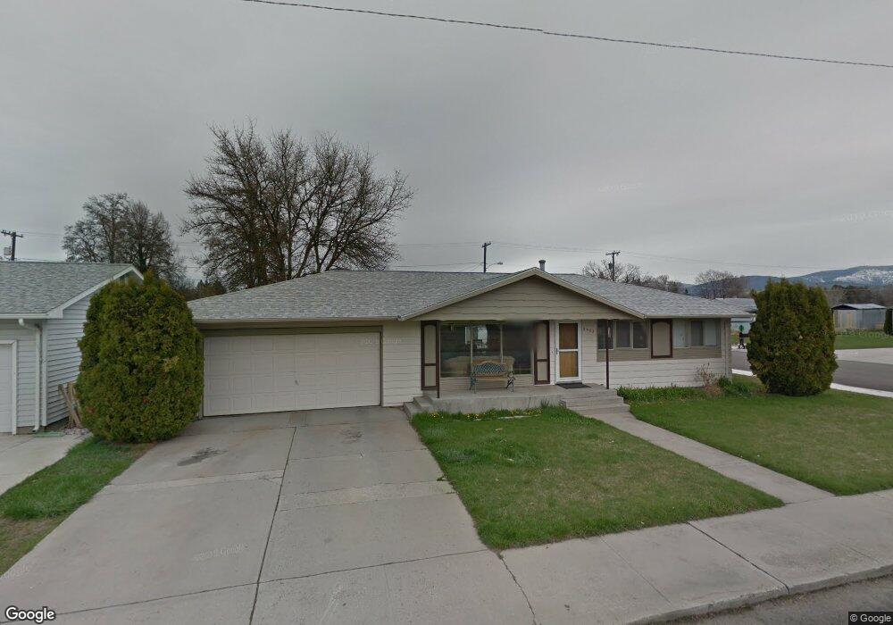
2402 S 5th St W Missoula, MT 59801
Franklin to the Fort NeighborhoodEstimated Value: $506,000 - $587,000
4
Beds
2
Baths
1,040
Sq Ft
$528/Sq Ft
Est. Value
About This Home
This home is located at 2402 S 5th St W, Missoula, MT 59801 and is currently estimated at $548,680, approximately $527 per square foot. 2402 S 5th St W is a home located in Missoula County with nearby schools including Franklin School, Porter Middle School, and Big Sky High School.
Ownership History
Date
Name
Owned For
Owner Type
Purchase Details
Closed on
Oct 5, 2020
Sold by
Andersen Mary K and Estate Of Roy L Andersen
Bought by
Thomas Chris M and Colquitt Christopher A
Current Estimated Value
Home Financials for this Owner
Home Financials are based on the most recent Mortgage that was taken out on this home.
Original Mortgage
$308,655
Outstanding Balance
$274,532
Interest Rate
2.9%
Mortgage Type
New Conventional
Estimated Equity
$274,148
Purchase Details
Closed on
Feb 19, 2001
Sold by
Christofferson Sandra Dee
Bought by
Gibson Katherine D
Create a Home Valuation Report for This Property
The Home Valuation Report is an in-depth analysis detailing your home's value as well as a comparison with similar homes in the area
Home Values in the Area
Average Home Value in this Area
Purchase History
| Date | Buyer | Sale Price | Title Company |
|---|---|---|---|
| Thomas Chris M | -- | Western Title & Escrow | |
| Gibson Katherine D | -- | -- |
Source: Public Records
Mortgage History
| Date | Status | Borrower | Loan Amount |
|---|---|---|---|
| Open | Thomas Chris M | $308,655 |
Source: Public Records
Tax History Compared to Growth
Tax History
| Year | Tax Paid | Tax Assessment Tax Assessment Total Assessment is a certain percentage of the fair market value that is determined by local assessors to be the total taxable value of land and additions on the property. | Land | Improvement |
|---|---|---|---|---|
| 2025 | $5,512 | $485,700 | $237,788 | $247,912 |
| 2024 | $5,166 | $424,500 | $173,150 | $251,350 |
| 2023 | $5,106 | $424,500 | $173,150 | $251,350 |
| 2022 | $4,311 | $309,400 | $0 | $0 |
| 2021 | $3,759 | $309,400 | $0 | $0 |
| 2020 | $3,579 | $250,400 | $0 | $0 |
| 2019 | $3,574 | $250,400 | $0 | $0 |
| 2018 | $3,272 | $220,400 | $0 | $0 |
| 2017 | $3,230 | $220,400 | $0 | $0 |
| 2016 | $2,797 | $195,700 | $0 | $0 |
| 2015 | $2,616 | $195,700 | $0 | $0 |
| 2014 | $2,670 | $112,519 | $0 | $0 |
Source: Public Records
Map
Nearby Homes
- 2406 S 5th St W
- 2337 S 3rd St W Unit 7
- 2337 S 3rd St W Unit 6
- 2337 S 3rd St W Unit 8
- 2511 and 2513 S 3rd St W
- 2511, 2513, 2515, & S 3rd St W
- 2515 and 2517 S 3rd St W
- 2514 Gleason St
- 2225 S 8th St W
- 303 S Grove St
- 940 Kemp St Unit A
- 1311 Bridgecourt Way
- 2002 S 6th St W Unit 102
- 2705 Emery Place
- 112 N Grove St
- 1310 Linnea Ln
- 920 S Johnson St
- 1936 S 7th St W
- 2214 S 12th St W
- 2216 S 12th St W
- 2410 S 5th St W
- 2401 S 4th St W
- 2405 S 4th St W
- 620 S Davis St
- 2414 S 5th St W
- 608-606 S Davis St
- 608 S Davis St
- 2409 S 4th St W
- 2413 S 4th St W
- 2418 S 5th St W
- 2335 S 3rd St W
- 2417 S 4th St W
- 2406 S 4th St W
- 2422 S 5th St W
- 2412 S 4th St W
- 2337 S 3rd St W Unit 10
- 2337 S 3rd St W
- 2337 S 3rd St W
- 2337 S 3rd St W
- 2337 S 3rd St W