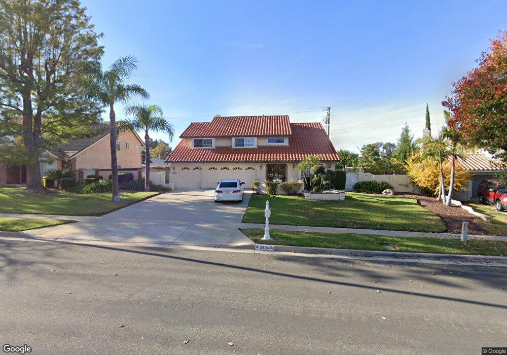
2404 Independence Cir Corona, CA 92882
South Corona NeighborhoodEstimated Value: $855,000 - $945,000
4
Beds
3
Baths
2,596
Sq Ft
$353/Sq Ft
Est. Value
About This Home
This home is located at 2404 Independence Cir, Corona, CA 92882 and is currently estimated at $915,214, approximately $352 per square foot. 2404 Independence Cir is a home located in Riverside County with nearby schools including John Adams Elementary School, Letha Raney Intermediate School, and Corona High School.
Ownership History
Date
Name
Owned For
Owner Type
Purchase Details
Closed on
Apr 14, 2025
Sold by
Pershin Shirley J
Bought by
Pershin Family Trust and Pershin
Current Estimated Value
Purchase Details
Closed on
Oct 22, 2021
Sold by
Pershin Family Trust
Bought by
Pershin Louis S and Corona Shirley J
Home Financials for this Owner
Home Financials are based on the most recent Mortgage that was taken out on this home.
Original Mortgage
$380,000
Interest Rate
6.62%
Mortgage Type
New Conventional
Purchase Details
Closed on
Nov 25, 1994
Sold by
Pershin Louis S and Pershin Shirley J
Bought by
Pershin Louis S and Pershin Shirley J
Purchase Details
Closed on
Aug 23, 1993
Sold by
Moreno Ray A and Moreno Irma Y
Bought by
Pershin Louis S and Pershin Shirley J
Home Financials for this Owner
Home Financials are based on the most recent Mortgage that was taken out on this home.
Original Mortgage
$176,000
Interest Rate
6.81%
Create a Home Valuation Report for This Property
The Home Valuation Report is an in-depth analysis detailing your home's value as well as a comparison with similar homes in the area
Home Values in the Area
Average Home Value in this Area
Purchase History
| Date | Buyer | Sale Price | Title Company |
|---|---|---|---|
| Pershin Family Trust | -- | None Listed On Document | |
| Pershin Louis S | -- | Servicelink | |
| Pershin Louis S | -- | -- | |
| Pershin Louis S | $220,000 | First American Title Insuran |
Source: Public Records
Mortgage History
| Date | Status | Borrower | Loan Amount |
|---|---|---|---|
| Previous Owner | Pershin Louis S | $380,000 | |
| Previous Owner | Pershin Louis S | $176,000 |
Source: Public Records
Tax History
| Year | Tax Paid | Tax Assessment Tax Assessment Total Assessment is a certain percentage of the fair market value that is determined by local assessors to be the total taxable value of land and additions on the property. | Land | Improvement |
|---|---|---|---|---|
| 2025 | $4,063 | $373,891 | $93,460 | $280,431 |
| 2023 | $4,063 | $359,375 | $89,832 | $269,543 |
| 2022 | $3,933 | $352,329 | $88,071 | $264,258 |
| 2021 | $3,854 | $345,422 | $86,345 | $259,077 |
| 2020 | $3,811 | $341,881 | $85,460 | $256,421 |
| 2019 | $3,722 | $335,179 | $83,787 | $251,392 |
| 2018 | $3,638 | $328,608 | $82,145 | $246,463 |
| 2017 | $3,548 | $322,166 | $80,535 | $241,631 |
| 2016 | $3,513 | $315,850 | $78,956 | $236,894 |
| 2015 | $3,435 | $311,108 | $77,771 | $233,337 |
| 2014 | $3,310 | $305,016 | $76,249 | $228,767 |
Source: Public Records
Map
Nearby Homes
- 2416 Patriot Way
- 2598 Independence Way
- 1764 Coplen Cir
- 2313 Mesquite Ln
- 2421 Mangular Ave
- 2322 Avenida Del Vista
- 1546 Tilson Cir
- 1720 Sugar Pine Dr
- 1751 Moccasin Trail Cir
- 2242 Rainbow Ridge Dr
- 1336 Old Trail Dr
- 1370 Stein Way
- 2588 Avenida Del Vista
- 1461 Deer Hollow Dr
- 2576 Avenida Del Vista Unit L204
- 2600 Avenida Del Vista Unit F203
- 2672 Condor Cir
- 2608 Avenida Del Vista
- 2612 Avenida Del Vista
- 2015 W Ontario Ave
- 2408 Independence Cir
- 2400 Independence Cir
- 2413 Mesquite Ln
- 2417 Mesquite Ln
- 2409 Mesquite Ln
- 2396 Independence Cir
- 2410 Independence Cir
- 2421 Mesquite Ln
- 2405 Mesquite Ln
- 2405 Independence Cir
- 2390 Independence Cir
- 2425 Mesquite Ln
- 2399 Mesquite Ln
- 2401 Independence Cir
- 2397 Independence Cir
- 1471 Earl St
- 2391 Independence Cir
- 1477 Earl St
- 2393 Mesquite Ln
- 2414 Mesquite Ln
Your Personal Tour Guide
Ask me questions while you tour the home.