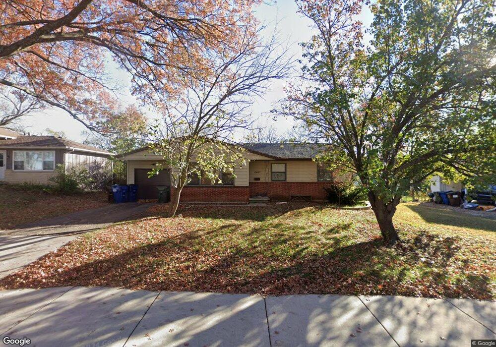
2407 Yale Rd Lawrence, KS 66049
Sunset Hills NeighborhoodEstimated Value: $250,000 - $278,000
3
Beds
1
Bath
1,336
Sq Ft
$195/Sq Ft
Est. Value
About This Home
This home is located at 2407 Yale Rd, Lawrence, KS 66049 and is currently estimated at $260,059, approximately $194 per square foot. 2407 Yale Rd is a home located in Douglas County with nearby schools including Sunset Hill Elementary School, West Middle School, and Lawrence Free State High School.
Ownership History
Date
Name
Owned For
Owner Type
Purchase Details
Closed on
Aug 27, 2025
Sold by
Black Larry G and Black Jeanne M
Bought by
Free State Properties Inc
Current Estimated Value
Purchase Details
Closed on
Dec 4, 2003
Sold by
Gosvener Michael K
Bought by
Black Larry G and Black Jeanne M
Home Financials for this Owner
Home Financials are based on the most recent Mortgage that was taken out on this home.
Original Mortgage
$82,400
Interest Rate
5.94%
Mortgage Type
Purchase Money Mortgage
Create a Home Valuation Report for This Property
The Home Valuation Report is an in-depth analysis detailing your home's value as well as a comparison with similar homes in the area
Home Values in the Area
Average Home Value in this Area
Purchase History
| Date | Buyer | Sale Price | Title Company |
|---|---|---|---|
| Free State Properties Inc | -- | Continental Title Company | |
| Black Larry G | $103,000 | Kansas Secured Title Douglas |
Source: Public Records
Mortgage History
| Date | Status | Borrower | Loan Amount |
|---|---|---|---|
| Previous Owner | Black Larry G | $82,400 |
Source: Public Records
Tax History Compared to Growth
Tax History
| Year | Tax Paid | Tax Assessment Tax Assessment Total Assessment is a certain percentage of the fair market value that is determined by local assessors to be the total taxable value of land and additions on the property. | Land | Improvement |
|---|---|---|---|---|
| 2025 | $3,060 | $26,692 | $7,475 | $19,217 |
| 2024 | $3,060 | $25,197 | $5,750 | $19,447 |
| 2023 | $2,868 | $22,609 | $5,520 | $17,089 |
| 2022 | $2,561 | $20,102 | $4,830 | $15,272 |
| 2021 | $2,341 | $17,676 | $3,795 | $13,881 |
| 2020 | $2,198 | $16,698 | $3,795 | $12,903 |
| 2019 | $2,155 | $16,399 | $3,795 | $12,604 |
| 2018 | $2,012 | $15,221 | $3,680 | $11,541 |
| 2017 | $2,021 | $15,113 | $3,680 | $11,433 |
| 2016 | $1,969 | $15,387 | $3,680 | $11,707 |
| 2015 | -- | $15,985 | $3,680 | $12,305 |
| 2014 | -- | $15,652 | $3,680 | $11,972 |
Source: Public Records
Map
Nearby Homes
- 923 Crestline Dr
- 2600 Oxford Rd
- 816 Crestline Dr
- 1214 Crestline Dr
- 800 Madeline Ln
- 1321 Raintree Place
- 2822 University Dr
- 3025 Wellington Ct
- 3016 W 7th St
- 1014 Lawrence Ave
- 1336 Spencer Dr
- 1008 Lawrence Ave
- 1319 Westbrooke St
- 1339 Westbrooke St
- 1405 Westbrooke St
- 3228 W 9th St
- 1439 Applegate Ct
- 1424 Applegate Ct Unit A
- 3404 Oxford Ct
- 817 Maine St