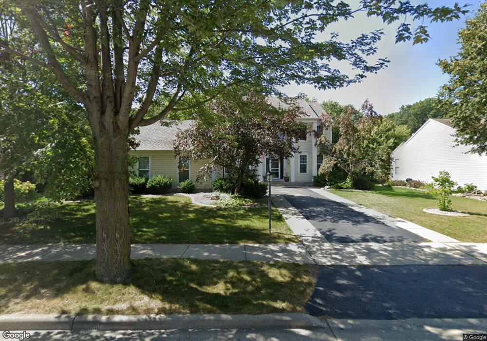
2414 Patrick Ln Waukesha, WI 53188
Estimated Value: $488,000 - $548,000
4
Beds
3
Baths
1,980
Sq Ft
$258/Sq Ft
Est. Value
About This Home
This home is located at 2414 Patrick Ln, Waukesha, WI 53188 and is currently estimated at $510,904, approximately $258 per square foot. 2414 Patrick Ln is a home located in Waukesha County with nearby schools including Meadowbrook Elementary School, Butler Middle School, and North High School.
Ownership History
Date
Name
Owned For
Owner Type
Purchase Details
Closed on
Feb 27, 2023
Sold by
Hauser Tyler M and Hauser Jennifer L
Bought by
Tyler M Hauser And Jennifer L Hauser Revocabl
Current Estimated Value
Purchase Details
Closed on
Sep 17, 1998
Sold by
Boyd Phillip M and Boyd Jo Ann
Bought by
Hauser Tyler M and Hauser Jennifer L
Home Financials for this Owner
Home Financials are based on the most recent Mortgage that was taken out on this home.
Original Mortgage
$191,600
Interest Rate
6.9%
Purchase Details
Closed on
May 31, 1996
Sold by
Pulte Home Corp
Bought by
Boyd Phillip M and Boyd Jo Ann
Home Financials for this Owner
Home Financials are based on the most recent Mortgage that was taken out on this home.
Original Mortgage
$109,600
Interest Rate
7.97%
Create a Home Valuation Report for This Property
The Home Valuation Report is an in-depth analysis detailing your home's value as well as a comparison with similar homes in the area
Home Values in the Area
Average Home Value in this Area
Purchase History
| Date | Buyer | Sale Price | Title Company |
|---|---|---|---|
| Tyler M Hauser And Jennifer L Hauser Revocabl | -- | -- | |
| Hauser Tyler M | $215,000 | -- | |
| Boyd Phillip M | $209,600 | -- |
Source: Public Records
Mortgage History
| Date | Status | Borrower | Loan Amount |
|---|---|---|---|
| Previous Owner | Hauser Tyler M | $191,600 | |
| Previous Owner | Boyd Phillip M | $109,600 |
Source: Public Records
Tax History Compared to Growth
Tax History
| Year | Tax Paid | Tax Assessment Tax Assessment Total Assessment is a certain percentage of the fair market value that is determined by local assessors to be the total taxable value of land and additions on the property. | Land | Improvement |
|---|---|---|---|---|
| 2024 | $6,528 | $417,800 | $97,400 | $320,400 |
| 2023 | $6,088 | $417,800 | $97,400 | $320,400 |
| 2022 | $5,916 | $305,600 | $92,400 | $213,200 |
| 2021 | $6,064 | $305,600 | $92,400 | $213,200 |
| 2020 | $5,845 | $305,600 | $92,400 | $213,200 |
| 2019 | $5,671 | $305,600 | $92,400 | $213,200 |
| 2018 | $5,352 | $283,000 | $79,800 | $203,200 |
| 2017 | $5,919 | $283,000 | $79,800 | $203,200 |
| 2016 | $5,310 | $264,500 | $75,600 | $188,900 |
| 2015 | $5,276 | $264,500 | $75,600 | $188,900 |
| 2014 | $5,180 | $249,500 | $75,600 | $173,900 |
| 2013 | $5,180 | $249,500 | $75,600 | $173,900 |
Source: Public Records
Map
Nearby Homes
- 2605 Emslie Dr
- 2912 Willard Ln
- 2732 Northview Rd Unit 88
- 2728 Northview Rd Unit 61
- The Adalyn Plan at Tallgrass - Villas
- 2312 Judith Ln
- 2145 Broken Hill Rd Unit 5
- 2127 Bluestem Dr Unit 101
- 2119 Bluestem Dr Unit 201
- 2125 Bluestem Dr Unit 102
- 2117 Bluestem Dr Unit 202
- 2106 Bluestem Dr Unit 1301
- 2108 Bluestem Dr Unit 1302
- 2339 Bramblewood Ct
- 2912 N University Dr Unit 305
- 2912 N University Dr Unit 208
- 3014 Plymouth Ct
- 2112 Woodburn Rd Unit E
- 2013 Woodburn Rd Unit A
- 1917 Tree Line Ct
- 2415 Patrick Ln
- 2419 Patrick Ln
- 2409 Patrick Ln
- 2418 Patrick Ln
- 2414 N University Dr
- 2418 N University Dr
- 2423 Patrick Ln
- 2410 N University Dr
- 2405 Patrick Ln
- 2406 Patrick Ln
- 2422 Patrick Ln
- 2422 N University Dr
- 2410 Patrick Ln
- 2406 N University Dr
- 2708 Keri Ct
- 2400 Patrick Ln
- 2401 Patrick Ln
- 2811 Keri Ct
- 2704 Keri Ct
- 2402 N University Dr