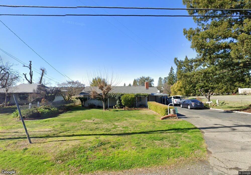
2415 Bean Rd Auburn, CA 95603
Northwest Auburn NeighborhoodEstimated Value: $478,000 - $546,000
3
Beds
2
Baths
1,297
Sq Ft
$395/Sq Ft
Est. Value
About This Home
This home is located at 2415 Bean Rd, Auburn, CA 95603 and is currently estimated at $512,295, approximately $394 per square foot. 2415 Bean Rd is a home located in Placer County with nearby schools including Auburn Elementary School, Placer High School, and Bowman Charter School.
Ownership History
Date
Name
Owned For
Owner Type
Purchase Details
Closed on
Jul 31, 2020
Sold by
Queen Lyon Panfila E and Queen Bucy Connie
Bought by
Queen Lyon Panfila E and Queen Bucy Connie
Current Estimated Value
Purchase Details
Closed on
Jul 24, 2000
Sold by
Bucy Robert D
Bought by
Queen Bucy Connie N
Home Financials for this Owner
Home Financials are based on the most recent Mortgage that was taken out on this home.
Original Mortgage
$35,000
Interest Rate
8.2%
Mortgage Type
Purchase Money Mortgage
Purchase Details
Closed on
Jun 10, 1999
Sold by
Queen Connie N
Bought by
Bucy Robert D and Queen Connie N
Create a Home Valuation Report for This Property
The Home Valuation Report is an in-depth analysis detailing your home's value as well as a comparison with similar homes in the area
Home Values in the Area
Average Home Value in this Area
Purchase History
| Date | Buyer | Sale Price | Title Company |
|---|---|---|---|
| Queen Lyon Panfila E | -- | None Available | |
| Queen Bucy Connie N | -- | Financial Title Company | |
| Bucy Robert D | -- | Financial Title Company | |
| Bucy Robert D | -- | -- |
Source: Public Records
Mortgage History
| Date | Status | Borrower | Loan Amount |
|---|---|---|---|
| Closed | Queen Bucy Connie N | $35,000 |
Source: Public Records
Tax History
| Year | Tax Paid | Tax Assessment Tax Assessment Total Assessment is a certain percentage of the fair market value that is determined by local assessors to be the total taxable value of land and additions on the property. | Land | Improvement |
|---|---|---|---|---|
| 2025 | $596 | $57,088 | $8,561 | $48,527 |
| 2023 | $596 | $54,874 | $8,230 | $46,644 |
| 2022 | $583 | $53,799 | $8,069 | $45,730 |
| 2021 | $563 | $52,745 | $7,911 | $44,834 |
| 2020 | $558 | $52,205 | $7,830 | $44,375 |
| 2019 | $547 | $51,182 | $7,677 | $43,505 |
| 2018 | $519 | $50,179 | $7,527 | $42,652 |
| 2017 | $509 | $49,196 | $7,380 | $41,816 |
| 2016 | $498 | $48,233 | $7,236 | $40,997 |
| 2015 | $486 | $47,510 | $7,128 | $40,382 |
| 2014 | $477 | $46,580 | $6,989 | $39,591 |
Source: Public Records
Map
Nearby Homes
- 11260 Scofield Way
- 11355 Spur Ln
- 2620 Vineyard Dr
- 2213 Country Villa Ct Unit 22
- 10747 Mount Vernon Rd
- 11765 Jones St
- 1605 Grass Valley Hwy Unit 70
- 1605 Grass Valley Hwy Unit 62
- 1605 Grass Valley Hwy
- 1605 Grass Valley Hwy Unit 54
- 1605 Grass Valley Hwy Unit 92
- 12265 New Airport Rd
- 2660 Commons Place
- 2650 Commons Place
- 2690 Commons Place
- 99 Marigold Ave
- 2540 Grass Valley Hwy Unit 72
- 2540 Grass Valley Hwy Unit 27
- 2540 Grass Valley Hwy Unit SP 12
- 2540 Grass Valley Hwy Unit 55
Your Personal Tour Guide
Ask me questions while you tour the home.