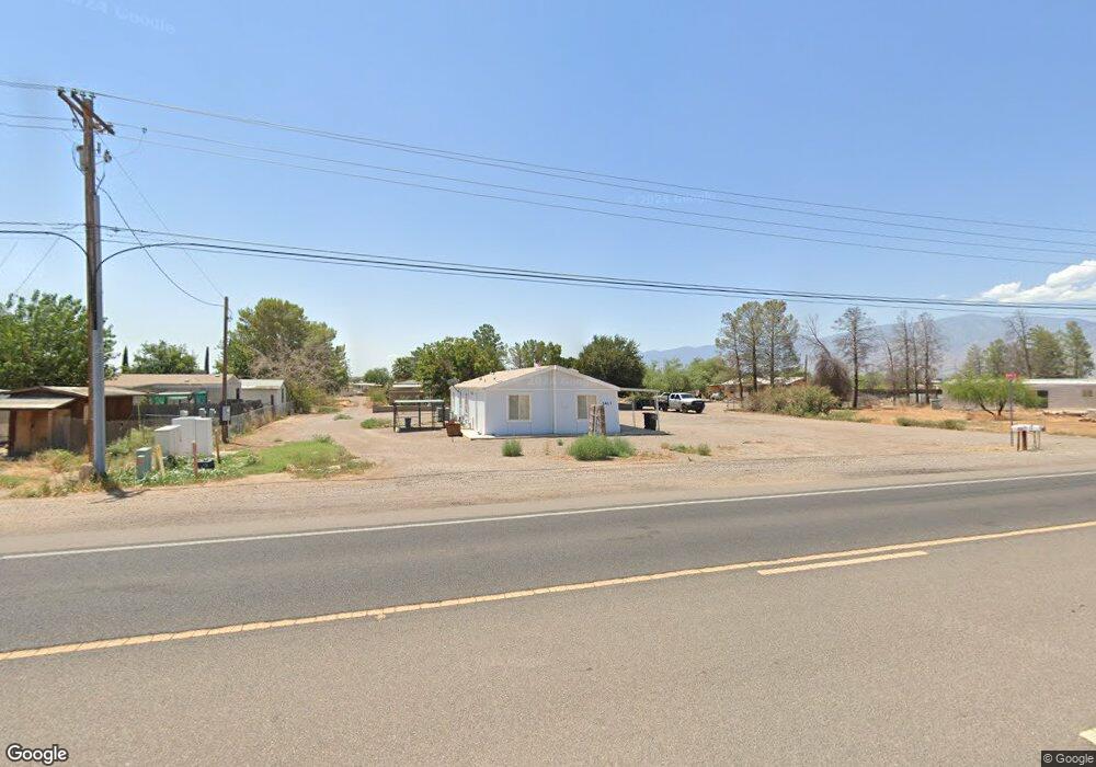
2417 E Us Highway 70 Safford, AZ 85546
Estimated Value: $57,000 - $121,683
--
Bed
--
Bath
552
Sq Ft
$152/Sq Ft
Est. Value
About This Home
This home is located at 2417 E Us Highway 70, Safford, AZ 85546 and is currently estimated at $83,921, approximately $152 per square foot. 2417 E Us Highway 70 is a home located in Graham County with nearby schools including Ruth Powell Elementary School, Dorothy Stinson School, and Lafe Nelson School.
Ownership History
Date
Name
Owned For
Owner Type
Purchase Details
Closed on
Feb 20, 2024
Sold by
Chap Corporation
Bought by
Long View Operations Llc
Current Estimated Value
Purchase Details
Closed on
Jun 12, 2006
Sold by
St Hillaire Louis
Bought by
Chap Corporation
Home Financials for this Owner
Home Financials are based on the most recent Mortgage that was taken out on this home.
Original Mortgage
$251,000
Interest Rate
6.55%
Mortgage Type
Seller Take Back
Create a Home Valuation Report for This Property
The Home Valuation Report is an in-depth analysis detailing your home's value as well as a comparison with similar homes in the area
Home Values in the Area
Average Home Value in this Area
Purchase History
| Date | Buyer | Sale Price | Title Company |
|---|---|---|---|
| Long View Operations Llc | $50,000 | Stewart Title & Trust Of Phoen | |
| Chap Corporation | $281,000 | Safford Title Agency | |
| St Hilaire Louis | -- | Safford Title Agency |
Source: Public Records
Mortgage History
| Date | Status | Borrower | Loan Amount |
|---|---|---|---|
| Previous Owner | Chap Corporation | $251,000 |
Source: Public Records
Tax History Compared to Growth
Tax History
| Year | Tax Paid | Tax Assessment Tax Assessment Total Assessment is a certain percentage of the fair market value that is determined by local assessors to be the total taxable value of land and additions on the property. | Land | Improvement |
|---|---|---|---|---|
| 2026 | $99 | -- | -- | -- |
| 2025 | $99 | $5,575 | $336 | $5,239 |
| 2024 | -- | $7,967 | $479 | $7,488 |
| 2023 | $0 | $6,680 | $479 | $6,201 |
| 2022 | $6,808 | $5,809 | $479 | $5,330 |
| 2021 | $0 | $0 | $0 | $0 |
| 2020 | $6,808 | $0 | $0 | $0 |
| 2019 | $0 | $0 | $0 | $0 |
| 2018 | $0 | $0 | $0 | $0 |
| 2017 | $0 | $0 | $0 | $0 |
| 2016 | $0 | $0 | $0 | $0 |
| 2015 | -- | $0 | $0 | $0 |
Source: Public Records
Map
Nearby Homes
- 2056 E U S Highway 70
- 2464 S Montierth Ln
- 1480 Montierth Loop
- 1697 E Kelson Place
- 1368 S Roper Ln
- 1630 Kelson Place
- 1539 E Whirlwind Way
- 1551 Hobble Creek Dr
- 1210 S Coventry Dr
- 1098 S Coventry Dr
- 1552 Katelyn Ln
- 417 E Lone Star Rd
- 400 E Observatory St
- 222 E 20th St
- 115 W 15th St
- 1105 S 1st Ave
- 1204 S 1st Ave
- APN# 103-22-018
- 120 Relation St Unit 2
- 220 W 16th St
- 2417 E Us Highway 70
- 2417 E Us Highway 70
- 2417 E U S Highway 70
- 515 E U S Highway 70
- 0 E U S Highway 70 Unit 250188
- 0 E U S Highway 70 Unit 249447
- 0 E U S Highway 70 Unit 2 2938547
- 0 E U S Highway 70
- 2389 E Us Highway 70
- 2389 E U S Highway 70
- 2488 E Us Highway 70
- 2507 E U S Highway 70
- 2135 S Lois Ln
- 2507 E Us Highway 70
- 2096 S Nelson Place
- 2333 E Us Highway 70
- 2556 E Nelson Place
- 2586 E Nelson Place
- 2096 S Nelson Dr
- 2245 E Us Highway 70