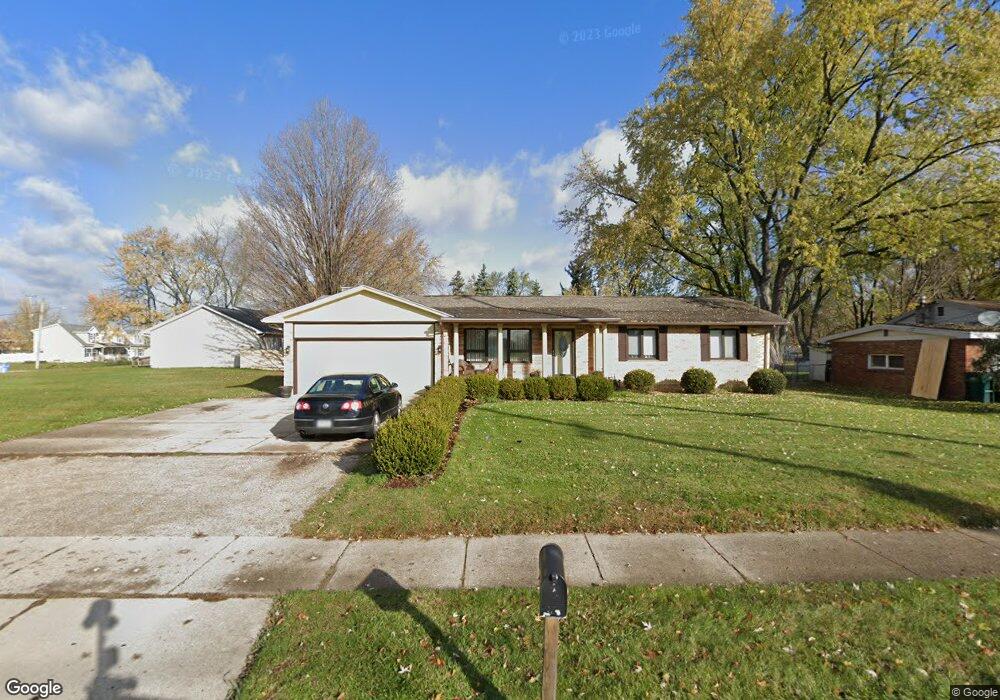
2418 W Miller Rd Lansing, MI 48911
Southern Lansing NeighborhoodEstimated Value: $183,000 - $212,515
--
Bed
1
Bath
1,452
Sq Ft
$137/Sq Ft
Est. Value
About This Home
This home is located at 2418 W Miller Rd, Lansing, MI 48911 and is currently estimated at $199,379, approximately $137 per square foot. 2418 W Miller Rd is a home located in Ingham County with nearby schools including Reo Elementary School, Attwood School, and Everett High School.
Ownership History
Date
Name
Owned For
Owner Type
Purchase Details
Closed on
Jan 15, 2010
Sold by
Mortgage Electronic Registration Systems
Bought by
Hsbc Bank Usa National Association
Current Estimated Value
Purchase Details
Closed on
Dec 3, 2009
Sold by
Xiong Soua and Xiong Mee Yang
Bought by
Mortgage Electronic Registration Systems
Create a Home Valuation Report for This Property
The Home Valuation Report is an in-depth analysis detailing your home's value as well as a comparison with similar homes in the area
Home Values in the Area
Average Home Value in this Area
Purchase History
| Date | Buyer | Sale Price | Title Company |
|---|---|---|---|
| Hsbc Bank Usa National Association | -- | None Available | |
| Mortgage Electronic Registration Systems | $140,655 | None Available |
Source: Public Records
Tax History Compared to Growth
Tax History
| Year | Tax Paid | Tax Assessment Tax Assessment Total Assessment is a certain percentage of the fair market value that is determined by local assessors to be the total taxable value of land and additions on the property. | Land | Improvement |
|---|---|---|---|---|
| 2025 | $3,364 | $110,300 | $12,000 | $98,300 |
| 2024 | $27 | $87,700 | $12,000 | $75,700 |
| 2023 | $3,154 | $74,700 | $12,000 | $62,700 |
| 2022 | $2,842 | $64,100 | $8,400 | $55,700 |
| 2021 | $2,783 | $58,700 | $7,400 | $51,300 |
| 2020 | $2,766 | $53,600 | $7,400 | $46,200 |
| 2019 | $2,652 | $47,900 | $7,400 | $40,500 |
| 2018 | $2,485 | $46,800 | $7,400 | $39,400 |
| 2017 | $2,379 | $46,800 | $7,400 | $39,400 |
| 2016 | $2,275 | $44,600 | $7,400 | $37,200 |
| 2015 | $2,275 | $43,000 | $14,887 | $28,113 |
| 2014 | $2,275 | $40,500 | $24,191 | $16,309 |
Source: Public Records
Map
Nearby Homes
- 6030 Piper Ave
- 2923 Newark Ave
- 5838 S Martin Luther King Junior Blvd
- 6037 Hughes Rd
- 2045 Moffitt St
- 5750 Ashley Dr
- 2416 Midwood St
- 3814 Coachlight Common St
- 1119 W Miller Rd
- 6050 S Waverly Rd
- 0 Midwood St
- 5830 Granary Ln
- 1020 R G Curtiss Ave
- 2626 Little Hickory Dr
- 2520 Renfrew Way
- 2616 Michigan 99
- 4828 Ingham St
- 5424 S Waverly Rd
- 1014 W Northrup St
- 5100 Wexford Rd
- 2418 W Ller
- 2410 W Miller Rd
- 6021 Picardy St
- 2400 W Miller Rd
- 2419 Bliesener St
- 2400 Ller
- 6001 Picardy St
- 2500 W Miller Rd
- 2411 Bliesner St
- 2403 Bliesener St
- 2425 W Miller Rd
- 2510 W Ller
- 2510 W Miller Rd
- 2319 Bliesener St
- 6006 Picardy St
- 2517 W Miller Rd
- 2310 W Miller Rd
- 2310 W Ller
- 6200 S Mlk
- 6058 Pheasant Ave