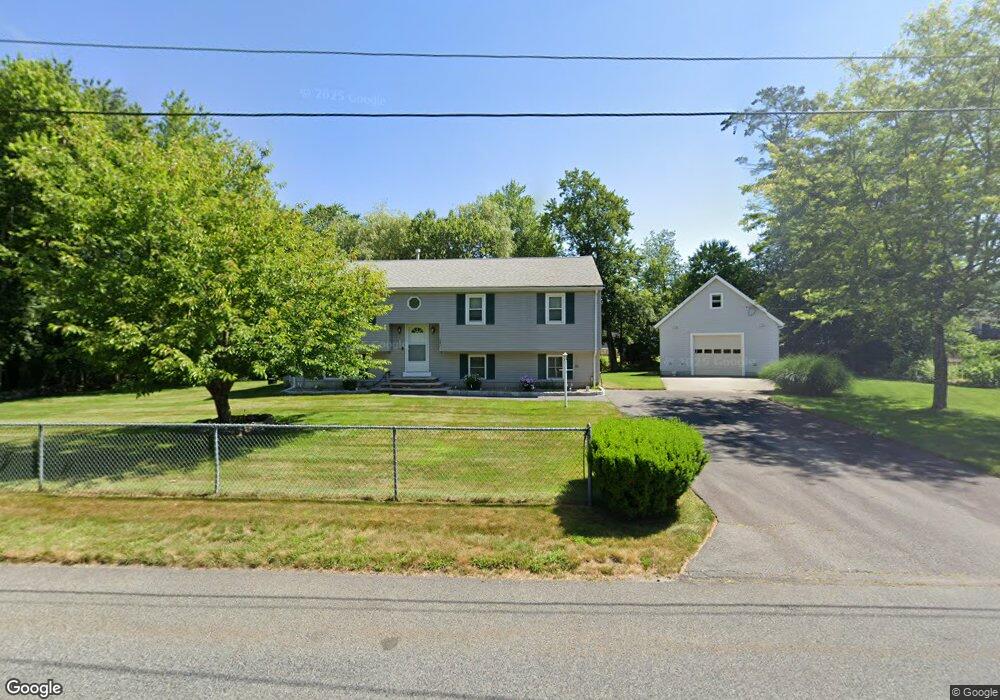
242 Temi Rd Raynham, MA 02767
Estimated Value: $496,000 - $660,000
3
Beds
2
Baths
1,300
Sq Ft
$451/Sq Ft
Est. Value
About This Home
This home is located at 242 Temi Rd, Raynham, MA 02767 and is currently estimated at $586,056, approximately $450 per square foot. 242 Temi Rd is a home located in Bristol County with nearby schools including Merrill Elementary School, LaLiberte Elementary School, and Williams Intermediate School.
Ownership History
Date
Name
Owned For
Owner Type
Purchase Details
Closed on
Sep 14, 1993
Sold by
Mahoney Temi Road T and Frank Maureen
Bought by
Chick Temi Road T and Inacio Lisa
Current Estimated Value
Purchase Details
Closed on
Sep 1, 1993
Sold by
Fischel Fred
Bought by
Ciambriello Francesco and Ciambriello Ellen M
Create a Home Valuation Report for This Property
The Home Valuation Report is an in-depth analysis detailing your home's value as well as a comparison with similar homes in the area
Home Values in the Area
Average Home Value in this Area
Purchase History
| Date | Buyer | Sale Price | Title Company |
|---|---|---|---|
| Chick Temi Road T | $45,000 | -- | |
| Ciambriello Francesco | $50,000 | -- | |
| Fischel Fred | $40,000 | -- |
Source: Public Records
Mortgage History
| Date | Status | Borrower | Loan Amount |
|---|---|---|---|
| Open | Fischel Fred | $160,000 | |
| Closed | Fischel Fred | $29,000 | |
| Closed | Fischel Fred | $117,000 |
Source: Public Records
Tax History
| Year | Tax Paid | Tax Assessment Tax Assessment Total Assessment is a certain percentage of the fair market value that is determined by local assessors to be the total taxable value of land and additions on the property. | Land | Improvement |
|---|---|---|---|---|
| 2025 | $6,734 | $556,500 | $216,200 | $340,300 |
| 2024 | $6,667 | $536,800 | $196,500 | $340,300 |
| 2023 | $6,486 | $476,900 | $176,900 | $300,000 |
| 2022 | $6,461 | $435,700 | $167,000 | $268,700 |
| 2021 | $0 | $416,900 | $157,200 | $259,700 |
| 2020 | $5,790 | $401,800 | $149,300 | $252,500 |
| 2019 | $0 | $392,000 | $139,500 | $252,500 |
| 2018 | $5,248 | $352,200 | $131,700 | $220,500 |
| 2017 | $4,954 | $329,600 | $125,800 | $203,800 |
| 2016 | $4,877 | $325,600 | $121,800 | $203,800 |
| 2015 | $4,302 | $282,300 | $126,400 | $155,900 |
Source: Public Records
Map
Nearby Homes
- 30 Edward Rd
- 21 Sully Rd
- 53 Queens Cir
- 26 Nottingham Dr
- 935 King St
- 33 White St
- 201 Buck Knoll Rd
- 75 Warren St W Unit 16
- 224 Whippoorwill Dr
- 162 Bayberry Rd
- 84 Diniz Dr
- 152 Forgeriver
- 0 Cape Highway Route 44 Unit 73474847
- 5 Parcels Cape Highway Route 44
- 35 Spruce St
- 208 S Main St
- 115 Forge River Pkwy
- 4-B High Ridge Dr
- 2 Maplewood Ln Unit 21-1
- 0 Maplewood Unit 21.3 73426136
Your Personal Tour Guide
Ask me questions while you tour the home.