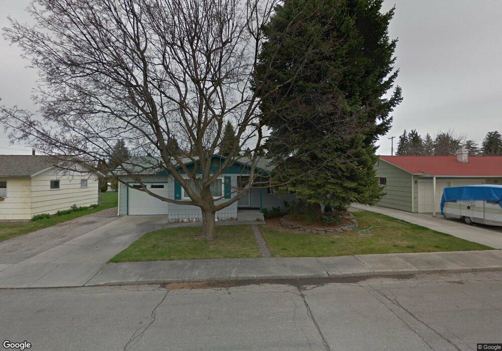
2420 S 4th St W Missoula, MT 59801
Franklin to the Fort NeighborhoodEstimated Value: $533,000 - $558,794
4
Beds
2
Baths
1,472
Sq Ft
$372/Sq Ft
Est. Value
About This Home
This home is located at 2420 S 4th St W, Missoula, MT 59801 and is currently estimated at $547,598, approximately $372 per square foot. 2420 S 4th St W is a home located in Missoula County with nearby schools including Franklin School, Porter Middle School, and Big Sky High School.
Ownership History
Date
Name
Owned For
Owner Type
Purchase Details
Closed on
May 24, 2022
Sold by
Brosious Patricia K
Bought by
Patricia K Brosious Testamentary Trust
Current Estimated Value
Purchase Details
Closed on
Mar 26, 2021
Sold by
Brosious Patricia K
Bought by
Brosious Patricia K and Brosious Michael A
Purchase Details
Closed on
Jul 31, 2013
Sold by
Brosious Michael A and Brosious Patricia K
Bought by
Brosious Patricia K
Purchase Details
Closed on
Apr 16, 2003
Sold by
Brosious Patricia K
Bought by
Brosious Patricia K and Brosious Michael A
Create a Home Valuation Report for This Property
The Home Valuation Report is an in-depth analysis detailing your home's value as well as a comparison with similar homes in the area
Home Values in the Area
Average Home Value in this Area
Purchase History
| Date | Buyer | Sale Price | Title Company |
|---|---|---|---|
| Patricia K Brosious Testamentary Trust | -- | Jones & Associates Pllc | |
| Brosious Patricia K | -- | None Available | |
| Brosious Patricia K | -- | None Available | |
| Brosious Patricia K | -- | -- | |
| Brosious Patricia K | -- | -- |
Source: Public Records
Tax History Compared to Growth
Tax History
| Year | Tax Paid | Tax Assessment Tax Assessment Total Assessment is a certain percentage of the fair market value that is determined by local assessors to be the total taxable value of land and additions on the property. | Land | Improvement |
|---|---|---|---|---|
| 2025 | $5,839 | $532,200 | $234,162 | $298,038 |
| 2024 | $5,566 | $457,400 | $171,582 | $285,818 |
| 2023 | $5,401 | $457,400 | $171,582 | $285,818 |
| 2022 | $4,626 | $339,400 | $0 | $0 |
| 2021 | $4,394 | $339,400 | $0 | $0 |
| 2020 | $4,007 | $290,300 | $0 | $0 |
| 2019 | $4,002 | $290,300 | $0 | $0 |
| 2018 | $3,573 | $249,700 | $0 | $0 |
| 2017 | $2,992 | $249,700 | $0 | $0 |
| 2016 | $3,251 | $238,900 | $0 | $0 |
| 2015 | $3,034 | $238,900 | $0 | $0 |
| 2014 | $2,987 | $132,023 | $0 | $0 |
Source: Public Records
Map
Nearby Homes
- 2406 S 5th St W
- 2337 S 3rd St W Unit 7
- 2337 S 3rd St W Unit 8
- 2511 and 2513 S 3rd St W
- 2511, 2513, 2515, & S 3rd St W
- 2515 and 2517 S 3rd St W
- 2514 Gleason St
- 303 S Grove St
- 2225 S 8th St W
- 2705 Emery Place
- 112 N Grove St
- 940 Kemp St Unit A
- 2719 Juneau Ct
- 1311 Bridgecourt Way
- 2783 Renae Ct
- 2002 S 6th St W Unit 102
- 2816 S 3rd St W
- 1310 Linnea Ln
- 1936 S 7th St W
- 920 S Johnson St
- 2416 S 4th St W
- 2424 S 4th St W
- 2417 S 4th St W
- 2412 S 4th St W
- 2428 S 4th St W
- 2413 S 4th St W
- 2421 S 4th St W
- 2423 S 3rd St W
- 2409 S 4th St W
- 2415 S 3rd St W
- 2425 S 4th St W
- 2434 S 4th St W
- 2411 S 3rd St W
- 2405 S 4th St W
- 2406 S 4th St W
- 2429 S 4th St W
- 2418 S 5th St W
- 2401 S 4th St W
- 2422 S 5th St W
- 2401 S 3rd St W