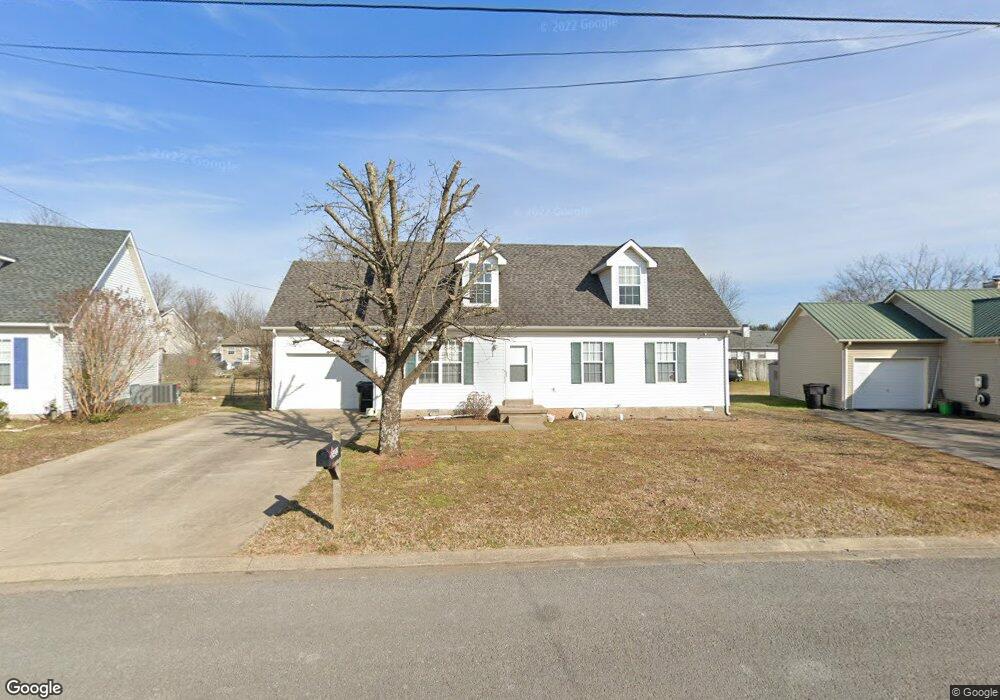
2422 Planter Ct Murfreesboro, TN 37128
Estimated Value: $340,000 - $476,000
Studio
2
Baths
1,838
Sq Ft
$209/Sq Ft
Est. Value
About This Home
This home is located at 2422 Planter Ct, Murfreesboro, TN 37128 and is currently estimated at $383,337, approximately $208 per square foot. 2422 Planter Ct is a home located in Rutherford County with nearby schools including Barfield Elementary School, Cason Lane Academy, and Rockvale Middle School.
Ownership History
Date
Name
Owned For
Owner Type
Purchase Details
Closed on
Feb 4, 1997
Bought by
Amanda Shaw
Current Estimated Value
Home Financials for this Owner
Home Financials are based on the most recent Mortgage that was taken out on this home.
Original Mortgage
$78,937
Outstanding Balance
$7,513
Interest Rate
7.7%
Mortgage Type
Purchase Money Mortgage
Estimated Equity
$375,825
Purchase Details
Closed on
Aug 2, 1994
Sold by
River Birch Estates Ventur
Bought by
Smeal Britton M
Create a Home Valuation Report for This Property
The Home Valuation Report is an in-depth analysis detailing your home's value as well as a comparison with similar homes in the area
Home Values in the Area
Average Home Value in this Area
Purchase History
| Date | Buyer | Sale Price | Title Company |
|---|---|---|---|
| Amanda Shaw | $79,000 | -- | |
| Smeal Britton M | -- | -- |
Source: Public Records
Mortgage History
| Date | Status | Borrower | Loan Amount |
|---|---|---|---|
| Open | Smeal Britton M | $78,937 |
Source: Public Records
Tax History
| Year | Tax Paid | Tax Assessment Tax Assessment Total Assessment is a certain percentage of the fair market value that is determined by local assessors to be the total taxable value of land and additions on the property. | Land | Improvement |
|---|---|---|---|---|
| 2025 | $1,968 | $72,075 | $13,750 | $58,325 |
| 2024 | $2,039 | $72,075 | $13,750 | $58,325 |
| 2023 | $1,352 | $72,075 | $13,750 | $58,325 |
| 2022 | $1,165 | $72,075 | $13,750 | $58,325 |
| 2021 | $1,089 | $49,075 | $10,625 | $38,450 |
| 2020 | $1,089 | $49,075 | $10,625 | $38,450 |
| 2019 | $1,089 | $49,075 | $10,625 | $38,450 |
| 2018 | $1,496 | $49,075 | $0 | $0 |
| 2017 | $1,297 | $33,375 | $0 | $0 |
| 2016 | $1,297 | $33,375 | $0 | $0 |
| 2015 | $1,297 | $33,375 | $0 | $0 |
| 2014 | $830 | $33,375 | $0 | $0 |
| 2013 | -- | $32,050 | $0 | $0 |
Source: Public Records
Map
Nearby Homes
- 465 Warrior Dr Unit 2
- 711 Warrior Dr
- 1611 Magnolia Dr
- 510 Iris Ave
- 2417 New Holland Cir
- 2413 New Holland Cir
- 416 Kubota Dr
- 411 Kubota Dr
- 2638 Merchants Walk
- 2346 New Holland Cir
- 304 Arapaho Dr
- 306 Arapaho Dr
- 210 Seminole St
- 245 Shoshone Place
- 520 Forest Glen Cir
- 2704 Painted Pony Dr
- 953 Warrior Dr
- 443 Forest Glen Cir
- 2638 Big Eagle Trail
- 327 Forest Glen Cir
- 2418 Planter Ct
- 2426 Planter Ct
- 427 Westgate Blvd
- 429 Westgate Blvd
- 429 Westgate Blvd Unit 429
- 423 Westgate Blvd
- 433 Westgate Blvd
- 421 Westgate Blvd
- 2414 Planter Ct
- 435 Westgate Blvd
- 2430 Planter Ct
- 2423 Planter Ct
- 417 Westgate Blvd
- 2417 Planter Ct
- 439 Westgate Blvd
- 415 Westgate Blvd
- 441 Westgate Blvd
- 2410 Planter Ct
- 411 Westgate Blvd
- 2411 Planter Ct
Your Personal Tour Guide
Ask me questions while you tour the home.