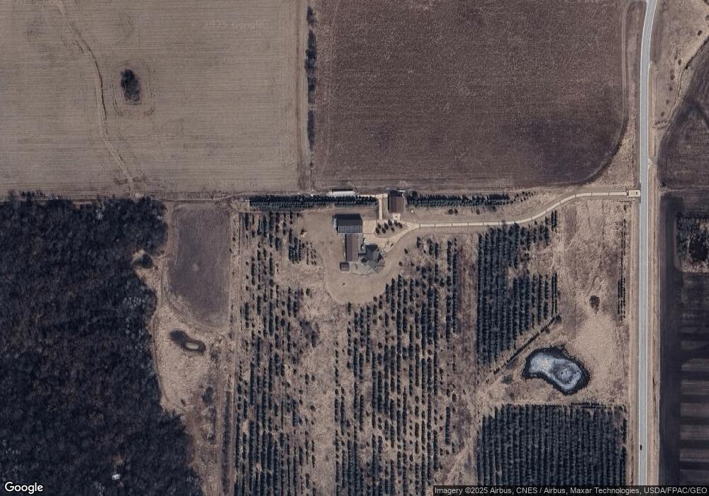
24235 111th Ave Spring Valley, MN 55975
Estimated Value: $820,000 - $2,412,000
1
Bed
1
Bath
4,320
Sq Ft
$374/Sq Ft
Est. Value
About This Home
This home is located at 24235 111th Ave, Spring Valley, MN 55975 and is currently estimated at $1,616,000, approximately $374 per square foot. 24235 111th Ave is a home with nearby schools including Kingsland Elementary School, Kingsland Middle School, and Kingsland Junior/Senior High School.
Ownership History
Date
Name
Owned For
Owner Type
Purchase Details
Closed on
Jun 19, 2025
Sold by
Toni M Kolling Revocable Trust and Kolling Toni M
Bought by
Kolling Aaron R
Current Estimated Value
Purchase Details
Closed on
Oct 16, 2014
Sold by
Kolling Aaron R and Kolling Toni M
Bought by
Kolling Toni M and Toni M Kolling Revocable Trust
Purchase Details
Closed on
Mar 25, 2011
Sold by
Citizens 1St Corporation
Bought by
Kolling Aaron and Kolling Toni
Create a Home Valuation Report for This Property
The Home Valuation Report is an in-depth analysis detailing your home's value as well as a comparison with similar homes in the area
Home Values in the Area
Average Home Value in this Area
Purchase History
| Date | Buyer | Sale Price | Title Company |
|---|---|---|---|
| Kolling Aaron R | $500 | None Listed On Document | |
| Kolling Toni M | -- | None Available | |
| Kolling Aaron | -- | None Available | |
| Kolling Aaron | $164,000 | None Available |
Source: Public Records
Tax History Compared to Growth
Tax History
| Year | Tax Paid | Tax Assessment Tax Assessment Total Assessment is a certain percentage of the fair market value that is determined by local assessors to be the total taxable value of land and additions on the property. | Land | Improvement |
|---|---|---|---|---|
| 2025 | $8,094 | $2,301,000 | $679,400 | $1,621,600 |
| 2024 | $8,094 | $1,894,400 | $560,700 | $1,333,700 |
| 2023 | $5,734 | $1,894,400 | $560,700 | $1,333,700 |
| 2022 | $5,734 | $1,504,200 | $429,700 | $1,074,500 |
| 2021 | $5,734 | $1,249,000 | $422,300 | $826,700 |
| 2020 | $5,820 | $1,249,000 | $422,300 | $826,700 |
| 2019 | $5,434 | $1,277,700 | $405,100 | $872,600 |
| 2018 | $3,880 | $1,277,700 | $405,100 | $872,600 |
| 2017 | -- | $981,100 | $395,800 | $585,300 |
| 2016 | $5,752 | $959,100 | $373,800 | $585,300 |
| 2015 | $2,016 | $868,100 | $448,700 | $419,400 |
| 2014 | $2,016 | $435,100 | $385,300 | $49,800 |
| 2013 | $2,016 | $289,200 | $289,200 | $0 |
Source: Public Records
Map
Nearby Homes
- XXX Sata Dr
- XXX 256th St
- 712 Memorial Dr
- 528 N Broadway St
- 709 Mlinar Ave
- 113 E Fairview St
- 517 Warren Ave
- 313 N Hudson Ave
- 321 N Section Ave
- 409 Center Ave
- 505 E Farmer St
- 213 W Fremont St
- 700 S Section Ave
- xxx 265th St
- 79275 267th St
- xxx Highway 63
- 12 Pine Ave SE
- TBD Harrison Ave NE
- 204 Lincoln Dr NE
- 26269 Old Shady Wood Dr
- TBD Hwy 16 63
- 10894 State Highway 16
- 10894 State Highway 16
- 10894 State Highway 16
- 10894 State Highway 16
- 10442 State Highway 16
- 10442 State Highway 16
- 10442 State Highway 16
- 10442 State Highway 16
- 10442 State Highway 16
- 10442 State Highway 16
- 10442 State Highway 16
- 10442 State Highway 16
- 10442 State Highway 16
- 10442 State Highway 16
- 10437 State Highway 16
- 10455 State Highway 16
- 10340 State Highway 16
- 11019 236th St
- 10267 State Highway 16