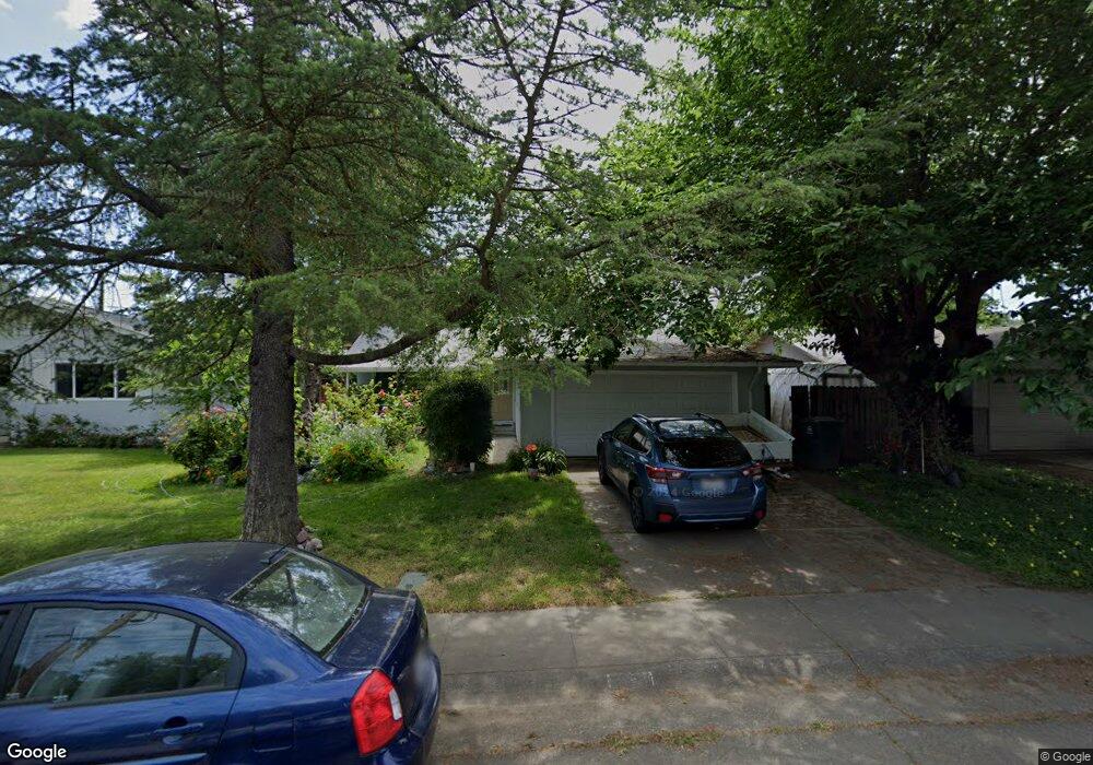
2424 Denison Dr Davis, CA 95618
East Davis NeighborhoodEstimated Value: $514,000 - $652,000
3
Beds
1
Bath
1,000
Sq Ft
$579/Sq Ft
Est. Value
About This Home
This home is located at 2424 Denison Dr, Davis, CA 95618 and is currently estimated at $579,397, approximately $579 per square foot. 2424 Denison Dr is a home located in Yolo County with nearby schools including Birch Lane Elementary School, Oliver Wendell Holmes Junior High School, and Davis Senior High School.
Ownership History
Date
Name
Owned For
Owner Type
Purchase Details
Closed on
Apr 5, 2010
Sold by
Murphy Brook C and Brook C Murphy Revocable Trust
Bought by
Murphy Brook C
Current Estimated Value
Purchase Details
Closed on
Apr 8, 2003
Sold by
Murphy Brook C
Bought by
Murphy Brook C and Brook C Murphy Revocable Trust
Purchase Details
Closed on
Feb 25, 2002
Sold by
Chu Peter T H and Chu Yusen Yin
Bought by
Murphy Brook C
Home Financials for this Owner
Home Financials are based on the most recent Mortgage that was taken out on this home.
Original Mortgage
$191,200
Outstanding Balance
$79,757
Interest Rate
7.04%
Estimated Equity
$499,640
Create a Home Valuation Report for This Property
The Home Valuation Report is an in-depth analysis detailing your home's value as well as a comparison with similar homes in the area
Home Values in the Area
Average Home Value in this Area
Purchase History
| Date | Buyer | Sale Price | Title Company |
|---|---|---|---|
| Murphy Brook C | -- | None Available | |
| Murphy Brook C | -- | -- | |
| Murphy Brook C | $239,000 | First American Title Ins Co |
Source: Public Records
Mortgage History
| Date | Status | Borrower | Loan Amount |
|---|---|---|---|
| Open | Murphy Brook C | $191,200 | |
| Closed | Murphy Brook C | $35,850 |
Source: Public Records
Tax History
| Year | Tax Paid | Tax Assessment Tax Assessment Total Assessment is a certain percentage of the fair market value that is determined by local assessors to be the total taxable value of land and additions on the property. | Land | Improvement |
|---|---|---|---|---|
| 2025 | $6,995 | $356,815 | $125,557 | $231,258 |
| 2023 | $6,995 | $342,962 | $120,683 | $222,279 |
| 2022 | $6,752 | $336,238 | $118,317 | $217,921 |
| 2021 | $6,623 | $329,647 | $115,998 | $213,649 |
| 2020 | $6,539 | $326,268 | $114,809 | $211,459 |
| 2019 | $6,258 | $319,871 | $112,558 | $207,313 |
| 2018 | $5,962 | $313,600 | $110,351 | $203,249 |
| 2017 | $5,869 | $307,452 | $108,188 | $199,264 |
| 2016 | $5,715 | $301,424 | $106,067 | $195,357 |
| 2015 | $3,831 | $296,897 | $104,474 | $192,423 |
| 2014 | $3,831 | $291,082 | $102,428 | $188,654 |
Source: Public Records
Map
Nearby Homes
- 2309 O'Keeffe Place
- 1619 Monarch Ln
- 2385 Roualt St
- 2011 Regis Dr
- 2806 Audubon Cir
- 2807 Layton Dr
- 2803 Bidwell St Unit 2
- 2708 Pole Line Rd Unit 4
- 2317 E 8th St
- 2307 E 8th St
- 1513 Cypress Ln
- 2900 Pole Line Rd Unit 2
- 218 Full Cir
- 1224 Spruce Ln
- 1416 Drexel Dr
- 131 Full Cir
- 103 Full Cir
- 3423 Verona Terrace
- 739 M St
- 1000 Berryessa Ln Unit 211
