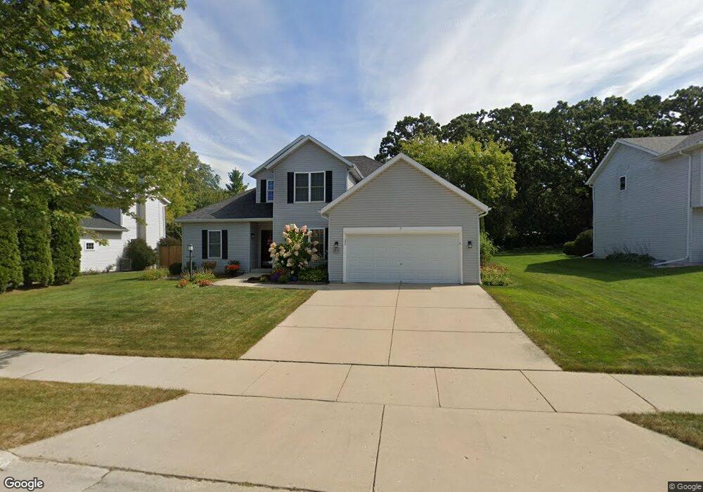
2435 Emslie Dr Waukesha, WI 53188
Estimated Value: $446,000 - $500,000
3
Beds
3
Baths
1,773
Sq Ft
$264/Sq Ft
Est. Value
About This Home
This home is located at 2435 Emslie Dr, Waukesha, WI 53188 and is currently estimated at $468,477, approximately $264 per square foot. 2435 Emslie Dr is a home located in Waukesha County with nearby schools including Summit View Elementary School, Butler Middle School, and North High School.
Ownership History
Date
Name
Owned For
Owner Type
Purchase Details
Closed on
Oct 23, 2008
Sold by
Kimball Lee A and Kimball Julie A
Bought by
Feuling Robert R and Feuling Mary Beth
Current Estimated Value
Home Financials for this Owner
Home Financials are based on the most recent Mortgage that was taken out on this home.
Original Mortgage
$209,822
Outstanding Balance
$137,229
Interest Rate
6.09%
Mortgage Type
Purchase Money Mortgage
Estimated Equity
$331,248
Purchase Details
Closed on
Mar 20, 2003
Sold by
Brookstone Homes Inc
Bought by
Kimball Lee A and Kimball Julie A
Home Financials for this Owner
Home Financials are based on the most recent Mortgage that was taken out on this home.
Original Mortgage
$176,308
Interest Rate
5.95%
Mortgage Type
Purchase Money Mortgage
Create a Home Valuation Report for This Property
The Home Valuation Report is an in-depth analysis detailing your home's value as well as a comparison with similar homes in the area
Home Values in the Area
Average Home Value in this Area
Purchase History
| Date | Buyer | Sale Price | Title Company |
|---|---|---|---|
| Feuling Robert R | $262,300 | None Available | |
| Kimball Lee A | $220,500 | Fidelity |
Source: Public Records
Mortgage History
| Date | Status | Borrower | Loan Amount |
|---|---|---|---|
| Open | Feuling Robert R | $209,822 | |
| Previous Owner | Kimball Lee A | $176,308 |
Source: Public Records
Tax History Compared to Growth
Tax History
| Year | Tax Paid | Tax Assessment Tax Assessment Total Assessment is a certain percentage of the fair market value that is determined by local assessors to be the total taxable value of land and additions on the property. | Land | Improvement |
|---|---|---|---|---|
| 2024 | $5,589 | $375,000 | $84,000 | $291,000 |
| 2023 | $5,440 | $375,000 | $84,000 | $291,000 |
| 2022 | $5,717 | $295,700 | $85,800 | $209,900 |
| 2021 | $5,859 | $295,700 | $85,800 | $209,900 |
| 2020 | $5,650 | $295,700 | $85,800 | $209,900 |
| 2019 | $5,481 | $295,700 | $85,800 | $209,900 |
| 2018 | $5,172 | $273,800 | $74,100 | $199,700 |
| 2017 | $5,150 | $273,800 | $74,100 | $199,700 |
| 2016 | $5,132 | $255,900 | $70,200 | $185,700 |
| 2015 | $5,099 | $255,900 | $70,200 | $185,700 |
| 2014 | $5,007 | $241,400 | $70,200 | $171,200 |
| 2013 | $5,007 | $241,400 | $70,200 | $171,200 |
Source: Public Records
Map
Nearby Homes
- 2339 Bramblewood Ct
- 2145 Broken Hill Rd Unit 5
- 2605 Emslie Dr
- 2013 Woodburn Rd Unit A
- 2732 Northview Rd Unit 88
- 1825 Woodburn Rd Unit C
- 2112 Woodburn Rd Unit E
- 2728 Northview Rd Unit 61
- 2012 Sunkist Ave
- The Adalyn Plan at Tallgrass - Villas
- 1606 Pleasant View Ave
- 1516 Pleasant View Ave
- 2127 Bluestem Dr Unit 101
- 2125 Bluestem Dr Unit 102
- 2119 Bluestem Dr Unit 201
- 2117 Bluestem Dr Unit 202
- 2106 Bluestem Dr Unit 1301
- 2108 Bluestem Dr Unit 1302
- 1917 Tree Line Ct
- 1513 N Bel Ayr Dr
- 2431 Emslie Dr
- 2439 Emslie Dr
- 2320 Broken Hill Rd
- 2427 Emslie Dr
- 2443 Emslie Dr
- 2436 Emslie Dr
- 2432 Emslie Dr
- 2440 Emslie Dr
- 2324 Broken Hill Rd
- 2447 Emslie Dr
- 2423 Emslie Dr
- 2424 Emslie Dr
- 2428 Emslie Dr
- 2316 Broken Hill Rd
- 2444 Emslie Dr
- 2400 Broken Hill Rd
- 2312 Oxbridge Ct
- 2419 Emslie Dr
- 2451 Emslie Dr
- 2349 Ramshead Ct