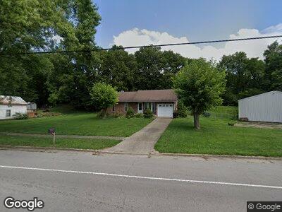
244 S Main St Somerville, OH 45064
Milford Township NeighborhoodEstimated Value: $171,030 - $216,000
3
Beds
1
Bath
986
Sq Ft
$193/Sq Ft
Est. Value
About This Home
This home is located at 244 S Main St, Somerville, OH 45064 and is currently estimated at $190,758, approximately $193 per square foot. 244 S Main St is a home located in Butler County with nearby schools including Talawanda Middle School and Talawanda High School.
Ownership History
Date
Name
Owned For
Owner Type
Purchase Details
Closed on
Nov 1, 2019
Sold by
Bond Dallas N
Bought by
Smith Tanya S
Current Estimated Value
Purchase Details
Closed on
Apr 11, 1997
Sold by
Kerns Larry
Bought by
Menke Steve and Menke Noreda
Home Financials for this Owner
Home Financials are based on the most recent Mortgage that was taken out on this home.
Original Mortgage
$53,200
Interest Rate
7.74%
Mortgage Type
New Conventional
Purchase Details
Closed on
Apr 4, 1995
Sold by
Johnson George
Bought by
Kerns Larry and Kerns Lililan
Create a Home Valuation Report for This Property
The Home Valuation Report is an in-depth analysis detailing your home's value as well as a comparison with similar homes in the area
Home Values in the Area
Average Home Value in this Area
Purchase History
| Date | Buyer | Sale Price | Title Company |
|---|---|---|---|
| Smith Tanya S | -- | None Available | |
| Menke Steve | $76,000 | -- | |
| Kerns Larry | $64,000 | -- |
Source: Public Records
Mortgage History
| Date | Status | Borrower | Loan Amount |
|---|---|---|---|
| Previous Owner | Bond Tanya S | $10,358 | |
| Previous Owner | Bond Dallas N | $83,353 | |
| Previous Owner | Bond Dallas N | $87,000 | |
| Previous Owner | Menke Steve | $53,200 |
Source: Public Records
Tax History Compared to Growth
Tax History
| Year | Tax Paid | Tax Assessment Tax Assessment Total Assessment is a certain percentage of the fair market value that is determined by local assessors to be the total taxable value of land and additions on the property. | Land | Improvement |
|---|---|---|---|---|
| 2024 | $1,624 | $45,450 | $3,040 | $42,410 |
| 2023 | $1,615 | $45,450 | $3,040 | $42,410 |
| 2022 | $1,312 | $33,150 | $3,040 | $30,110 |
| 2021 | $1,256 | $33,150 | $3,040 | $30,110 |
| 2020 | $1,312 | $33,150 | $3,040 | $30,110 |
| 2019 | $2,079 | $26,600 | $3,050 | $23,550 |
| 2018 | $1,109 | $26,600 | $3,050 | $23,550 |
| 2017 | $1,032 | $26,600 | $3,050 | $23,550 |
| 2016 | $1,067 | $26,600 | $3,050 | $23,550 |
| 2015 | $1,133 | $26,600 | $3,050 | $23,550 |
| 2014 | $1,473 | $26,600 | $3,050 | $23,550 |
| 2013 | $1,473 | $34,010 | $3,050 | $30,960 |
Source: Public Records
Map
Nearby Homes
- 0 State Rt 127
- .831 acres Stare Route 127
- 3550 Oxford-Middletown
- 2645 Oxford Middletown Rd
- 1246 Oxford Germantown Rd
- 3355 Somerville Rd
- 11038 State Route 227
- 2280 Harris Rd
- 5595 Hamilton Richmond Rd
- 0 Harris Rd Unit 1829575
- 5123 Hamilton Eaton Rd
- 5115 & 5123 Hamilton Eaton Rd
- 5115 Hamilton Eaton Rd
- 0 Oxford Milford Rd Unit 1838683
- 0 Trenton Oxford Rd Unit 1845432
- 2574 Oxford Trenton Rd
- 46 ac Depot Rd
- 4975 Hamilton Eaton Rd
- 0 Depot Rd Unit 20733766
- 2062 Oxford Trenton Rd
- 244 S Main St
- 256 S Main St
- 228 S Main St
- 253 S Main St
- 210 S Main St
- 332 S Main St
- 233 Church St
- 235 S Main St
- 253 Church St
- 0 S Main St Unit 1418018
- 0 S Main St Unit 1520904
- 219 S Main St
- 234 Church St
- 215 Main St
- 242 Church St
- 184 S Main St
- 250 Church St
- 123 E Church St
- 265 Church St
- 265 Church St