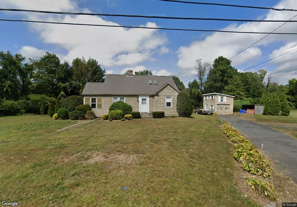
244 Stanley St Amherst, MA 01002
Estimated Value: $541,000 - $701,000
4
Beds
2
Baths
1,982
Sq Ft
$304/Sq Ft
Est. Value
About This Home
This home is located at 244 Stanley St, Amherst, MA 01002 and is currently estimated at $602,341, approximately $303 per square foot. 244 Stanley St is a home located in Hampshire County with nearby schools including Fort River Elementary School, Amherst Regional Middle School, and Amherst Regional High School.
Ownership History
Date
Name
Owned For
Owner Type
Purchase Details
Closed on
Dec 15, 2004
Sold by
David Jacqueline A
Bought by
David James F
Current Estimated Value
Purchase Details
Closed on
Jul 28, 1998
Sold by
Nerbonne Rt and Patrick Nerbonne
Bought by
David Jacqueline A and Davis James F
Home Financials for this Owner
Home Financials are based on the most recent Mortgage that was taken out on this home.
Original Mortgage
$115,200
Interest Rate
6.99%
Mortgage Type
Purchase Money Mortgage
Create a Home Valuation Report for This Property
The Home Valuation Report is an in-depth analysis detailing your home's value as well as a comparison with similar homes in the area
Home Values in the Area
Average Home Value in this Area
Purchase History
| Date | Buyer | Sale Price | Title Company |
|---|---|---|---|
| David James F | -- | -- | |
| David Jacqueline A | $144,000 | -- |
Source: Public Records
Mortgage History
| Date | Status | Borrower | Loan Amount |
|---|---|---|---|
| Previous Owner | David Jacqueline A | $115,200 | |
| Previous Owner | David Jacqueline A | $50,000 |
Source: Public Records
Tax History Compared to Growth
Tax History
| Year | Tax Paid | Tax Assessment Tax Assessment Total Assessment is a certain percentage of the fair market value that is determined by local assessors to be the total taxable value of land and additions on the property. | Land | Improvement |
|---|---|---|---|---|
| 2025 | $88 | $491,300 | $188,500 | $302,800 |
| 2024 | $8,350 | $451,100 | $177,900 | $273,200 |
| 2023 | $7,998 | $397,900 | $161,900 | $236,000 |
| 2022 | $7,706 | $362,300 | $147,200 | $215,100 |
| 2021 | $7,670 | $351,500 | $136,400 | $215,100 |
| 2020 | $7,494 | $351,500 | $136,400 | $215,100 |
| 2019 | $10,795 | $332,400 | $136,400 | $196,000 |
| 2018 | $7,027 | $332,400 | $136,400 | $196,000 |
| 2017 | $6,850 | $313,800 | $130,000 | $183,800 |
| 2016 | $6,659 | $313,800 | $130,000 | $183,800 |
| 2015 | $6,445 | $313,800 | $130,000 | $183,800 |
Source: Public Records
Map
Nearby Homes
- 12 Chadwick Ct
- 53 Pine Grove Unit 53
- 785 Main St
- 14 Pebble Ridge Rd
- 57 Tanglewood Rd
- 61 S Valley Rd
- 74 N Whitney St
- 11 Dayton Ln
- 148 Wildflower Dr
- 17 Palley Village Place
- 63 Larkspur Dr
- 0 Red Gate Ln Unit 73348273
- 6 Evening Star Dr
- 60 Red Gate Ln
- 305 Strong St
- 130 Linden Ridge Rd
- 18 N Prospect St
- 967 S East St
- 20 Station Rd
- 24 S Sunset Ave
- 266 Stanley St
- 265 Stanley St
- 280 Stanley St
- 239 Stanley St
- 233 Stanley St
- 261 Belchertown Rd
- 0 Belchertown Rd Stanley Unit 30171121
- 285 Stanley St
- 260 Belchertown Rd
- 201 Stanley St Unit 203
- 293 Belchertown Rd
- 234 Belchertown Rd
- 311 Belchertown Rd
- 286 Belchertown Rd Unit 288
- 270 Belchertown Rd
- 200 Stanley St
- 222 Belchertown Rd
- 310 Belchertown Rd
- 298 Belchertown Rd Unit 302
- 180 Stanley St