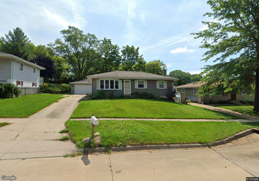
2441 Lori Dr SW Cedar Rapids, IA 52404
Estimated Value: $218,000 - $237,000
3
Beds
2
Baths
1,920
Sq Ft
$118/Sq Ft
Est. Value
About This Home
This home is located at 2441 Lori Dr SW, Cedar Rapids, IA 52404 and is currently estimated at $225,809, approximately $117 per square foot. 2441 Lori Dr SW is a home located in Linn County with nearby schools including Junction City Elementary School, Perryville Elementary School, and Van Buren Elementary School.
Ownership History
Date
Name
Owned For
Owner Type
Purchase Details
Closed on
May 18, 2009
Sold by
Goodall Karrie A and Goodall Lance A
Bought by
Leonard Michael W and Leonnard Jessica R
Current Estimated Value
Home Financials for this Owner
Home Financials are based on the most recent Mortgage that was taken out on this home.
Original Mortgage
$142,864
Outstanding Balance
$90,507
Interest Rate
4.9%
Mortgage Type
FHA
Estimated Equity
$135,302
Purchase Details
Closed on
Feb 28, 2003
Sold by
Klotzbach Larry L and Klotzbach Carol A
Bought by
Goodall Karrie A and Goodall Lance A
Home Financials for this Owner
Home Financials are based on the most recent Mortgage that was taken out on this home.
Original Mortgage
$92,000
Interest Rate
6%
Create a Home Valuation Report for This Property
The Home Valuation Report is an in-depth analysis detailing your home's value as well as a comparison with similar homes in the area
Home Values in the Area
Average Home Value in this Area
Purchase History
| Date | Buyer | Sale Price | Title Company |
|---|---|---|---|
| Leonard Michael W | $145,000 | Security First Title Co | |
| Goodall Karrie A | $126,500 | -- |
Source: Public Records
Mortgage History
| Date | Status | Borrower | Loan Amount |
|---|---|---|---|
| Open | Leonard Michael W | $142,864 | |
| Previous Owner | Goodall Karrie A | $92,000 |
Source: Public Records
Tax History Compared to Growth
Tax History
| Year | Tax Paid | Tax Assessment Tax Assessment Total Assessment is a certain percentage of the fair market value that is determined by local assessors to be the total taxable value of land and additions on the property. | Land | Improvement |
|---|---|---|---|---|
| 2025 | $3,152 | $212,500 | $42,000 | $170,500 |
| 2024 | $3,370 | $200,200 | $35,600 | $164,600 |
| 2023 | $3,370 | $188,600 | $33,900 | $154,700 |
| 2022 | $3,124 | $168,700 | $33,900 | $134,800 |
| 2021 | $3,216 | $159,800 | $30,700 | $129,100 |
| 2020 | $3,216 | $154,400 | $25,900 | $128,500 |
| 2019 | $2,882 | $142,200 | $25,900 | $116,300 |
| 2018 | $2,798 | $142,200 | $25,900 | $116,300 |
| 2017 | $2,785 | $131,000 | $25,900 | $105,100 |
| 2016 | $2,785 | $131,000 | $25,900 | $105,100 |
| 2015 | $2,891 | $135,886 | $25,856 | $110,030 |
| 2014 | $2,706 | $135,886 | $25,856 | $110,030 |
| 2013 | $2,644 | $135,886 | $25,856 | $110,030 |
Source: Public Records
Map
Nearby Homes
- 2126 Snapdragon Cir SW
- 2020 25th St SW
- 2404 25th St SW
- 2105 Milligan Ct SW
- 3000 Wilson Ave SW Unit A11
- 3000 Wilson Ave SW
- 2207 Shady Grove Rd SW
- 2812 29th Ave SW
- 2150 Rockford Rd SW
- 2025 18th St SW
- 3140 Wilson Ave SW Unit 6
- 2825 18th St SW
- Remington - Cedar Rapids Plan at Whispering Pines
- Copeland Plan at Whispering Pines
- Meadowbrook - Cedar Rapids Plan at Stags Leap Estates
- Caldwell Plan at Stags Leap Estates
- Concord - Cedar Rapids Plan at Stags Leap Estates
- Yuma Expanded Plan at Whispering Pines
- Becker II Plan at Kirkwood Village - Kirk Wood Village
- Meadowbrook - Cedar Rapids Plan at Whispering Pines
- 2501 Lori Dr SW
- 2433 Lori Dr SW
- 2509 Lori Dr SW
- 2425 Lori Dr SW
- 2421 Lori Dr SW
- 2517 Lori Dr SW
- 2440 Lori Dr SW
- 2500 Lori Dr SW
- 2432 Lori Dr SW
- 2508 Lori Dr SW
- 2424 Lori Dr SW
- 2415 Lori Dr SW
- 2525 Lori Dr SW
- 2516 Lori Dr SW
- 2127 Wilson Ave SW
- 2409 Lori Dr SW
- 2533 Lori Dr SW
- 2524 Lori Dr SW
- 2414 Lori Dr SW
- 2405 25th St SW