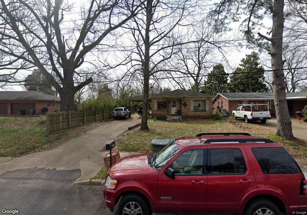
2443 Manchester Rd Memphis, TN 38114
Southeast Memphis NeighborhoodEstimated Value: $91,358 - $161,000
3
Beds
2
Baths
1,312
Sq Ft
$86/Sq Ft
Est. Value
About This Home
This home is located at 2443 Manchester Rd, Memphis, TN 38114 and is currently estimated at $113,340, approximately $86 per square foot. 2443 Manchester Rd is a home located in Shelby County with nearby schools including Hamilton High School, Believe Memphis Academy Charter School, and Memphis College Preparatory.
Ownership History
Date
Name
Owned For
Owner Type
Purchase Details
Closed on
May 23, 2007
Sold by
Citimortgage Inc
Bought by
Shaw Sammie
Current Estimated Value
Purchase Details
Closed on
Feb 2, 2007
Sold by
Small Ruth and Small Latrell D
Bought by
Citimortgage Inc
Purchase Details
Closed on
Jun 23, 1997
Sold by
Small Ruth
Bought by
Small Latrell D and Small Ruth
Home Financials for this Owner
Home Financials are based on the most recent Mortgage that was taken out on this home.
Original Mortgage
$55,052
Interest Rate
7.65%
Create a Home Valuation Report for This Property
The Home Valuation Report is an in-depth analysis detailing your home's value as well as a comparison with similar homes in the area
Home Values in the Area
Average Home Value in this Area
Purchase History
| Date | Buyer | Sale Price | Title Company |
|---|---|---|---|
| Shaw Sammie | $29,000 | Associates Closing & Title H | |
| Citimortgage Inc | $45,105 | None Available | |
| Small Latrell D | -- | First Title Corporation |
Source: Public Records
Mortgage History
| Date | Status | Borrower | Loan Amount |
|---|---|---|---|
| Previous Owner | Small Latrell D | $55,052 |
Source: Public Records
Tax History Compared to Growth
Tax History
| Year | Tax Paid | Tax Assessment Tax Assessment Total Assessment is a certain percentage of the fair market value that is determined by local assessors to be the total taxable value of land and additions on the property. | Land | Improvement |
|---|---|---|---|---|
| 2025 | $383 | $17,575 | $2,100 | $15,475 |
| 2024 | $383 | $11,300 | $1,200 | $10,100 |
| 2023 | $688 | $11,300 | $1,200 | $10,100 |
| 2022 | $688 | $11,300 | $1,200 | $10,100 |
| 2021 | $696 | $11,300 | $1,200 | $10,100 |
| 2020 | $768 | $10,600 | $1,200 | $9,400 |
| 2019 | $768 | $10,600 | $1,200 | $9,400 |
| 2018 | $768 | $10,600 | $1,200 | $9,400 |
| 2017 | $436 | $10,600 | $1,200 | $9,400 |
| 2016 | $456 | $10,425 | $0 | $0 |
| 2014 | $456 | $10,425 | $0 | $0 |
Source: Public Records
Map
Nearby Homes
- 2428 Rozelle St
- 2386 Bridgeport Dr
- 2416 Verdun St
- 1490 Lockhaven Ave
- 1473 Carlton Rd
- 2601 Darlene St
- 2377 Warren St
- 0 Carlton Rd
- 2944 Millbranch Rd
- 1408 Eloise Rd
- 1560 Cane Rd
- 1385 Eloise Rd
- 2180 Elvis Presley Blvd
- 2067 Corry Rd
- 2196 Ketchum Rd
- 2410 W Hollyford Rd
- 1832 Rozelle St
- 1824 Rozelle St
- 1431 Ledger Rd
- 1078 N Ball Rd
- 2437 Manchester Rd
- 2435 Manchester Rd
- 2463 Manchester Rd
- 2442 Rozelle St
- 1690 E Alcy Rd
- 2438 Rozelle St
- 2450 Manchester Rd
- 2423 Manchester Rd
- 2434 Rozelle St
- 1682 E Alcy Rd
- 2442 Manchester Rd
- 1718 E Alcy Rd
- 2434 Manchester Rd
- 2422 Rozelle St
- 2413 Manchester Rd
- 2422 Manchester Rd
- 2416 Rozelle St
- 1679 E Alcy Rd
- 2412 Manchester Rd
- 2482 Manchester Rd