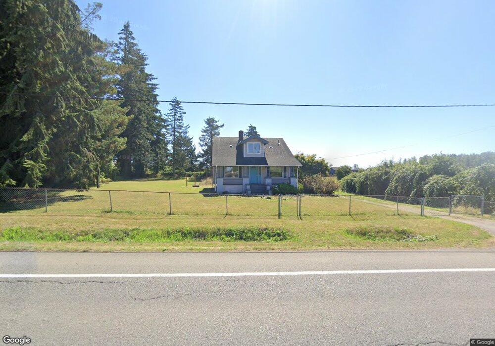
24631 SE 440th St Enumclaw, WA 98022
Estimated Value: $624,950 - $668,000
3
Beds
1
Bath
1,180
Sq Ft
$545/Sq Ft
Est. Value
About This Home
This home is located at 24631 SE 440th St, Enumclaw, WA 98022 and is currently estimated at $643,238, approximately $545 per square foot. 24631 SE 440th St is a home located in King County with nearby schools including Sunrise Elementary School, Enumclaw Middle School, and Enumclaw Senior High School.
Ownership History
Date
Name
Owned For
Owner Type
Purchase Details
Closed on
Jun 8, 1999
Sold by
Goff David C and Goff Lisa M
Bought by
Trinity Lutheran Church
Current Estimated Value
Purchase Details
Closed on
Dec 13, 1994
Sold by
Parks Calvin W and Parks Christine J
Bought by
Goff David C and Goff Lisa M
Home Financials for this Owner
Home Financials are based on the most recent Mortgage that was taken out on this home.
Original Mortgage
$145,600
Interest Rate
8.25%
Create a Home Valuation Report for This Property
The Home Valuation Report is an in-depth analysis detailing your home's value as well as a comparison with similar homes in the area
Home Values in the Area
Average Home Value in this Area
Purchase History
| Date | Buyer | Sale Price | Title Company |
|---|---|---|---|
| Trinity Lutheran Church | $250,000 | -- | |
| Goff David C | $182,000 | Chicago Title Insurance Co |
Source: Public Records
Mortgage History
| Date | Status | Borrower | Loan Amount |
|---|---|---|---|
| Previous Owner | Goff David C | $145,600 |
Source: Public Records
Tax History
| Year | Tax Paid | Tax Assessment Tax Assessment Total Assessment is a certain percentage of the fair market value that is determined by local assessors to be the total taxable value of land and additions on the property. | Land | Improvement |
|---|---|---|---|---|
| 2024 | $5,204 | $542,000 | $263,000 | $279,000 |
| 2023 | $4,829 | $465,000 | $226,000 | $239,000 |
| 2022 | $4,326 | $531,000 | $259,000 | $272,000 |
| 2021 | $4,011 | $431,000 | $224,000 | $207,000 |
| 2020 | $3,656 | $364,000 | $195,000 | $169,000 |
| 2018 | $3,667 | $329,000 | $179,000 | $150,000 |
| 2017 | $3,257 | $298,000 | $163,000 | $135,000 |
| 2016 | $3,115 | $273,000 | $150,000 | $123,000 |
| 2015 | $3,342 | $257,000 | $142,000 | $115,000 |
| 2014 | -- | $264,000 | $142,000 | $122,000 |
| 2013 | -- | $203,000 | $114,000 | $89,000 |
Source: Public Records
Map
Nearby Homes
- 3555 Elmont Ave
- 2881 Initial Ave
- 1471 Florence St
- 3183 Roosevelt Ave
- 3189 Roosevelt Ave
- 1720 Garfield St Unit 4
- 3359 Terry Ln
- 1722 Harding St
- 23724 SE 436th St
- 23420 SE 448th St
- 3436 Wetherbee Ln
- 1705 Marshall Ave
- 522 Harmony Ln
- 2054 Roosevelt Ave
- 1234 Lincoln Ave Unit A
- 1234 Lincoln Ave Unit B
- 1101 Wells St
- 43128 260th Ave SE
- 2921 Frederickson St
- 1107 Griffin Ave
- 24711 SE 440th St
- 3255 Griffin Ave
- 3211 Griffin Ave
- 3270 Lois Ln
- 3250 Lois Ln
- 1790 Lois Ln
- 1770 Highpoint St
- 24515 SE 440th St
- 1820 Lois Ln
- 3249 Lois Ln
- 1822 Highpoint St
- 24530 SE 436th Way
- 1870 Lois Ln
- 3339 Fisk Ave Unit 2-2
- 1863 Lois Ln
- 3373 Fisk Ave Unit 1-2
- 24729 SE 440th St
- 3285 Fisk Ave Unit 4-2
- 3311 Fisk Ave Unit 3-2
- 3405 Fisk Ave Unit 61
Your Personal Tour Guide
Ask me questions while you tour the home.