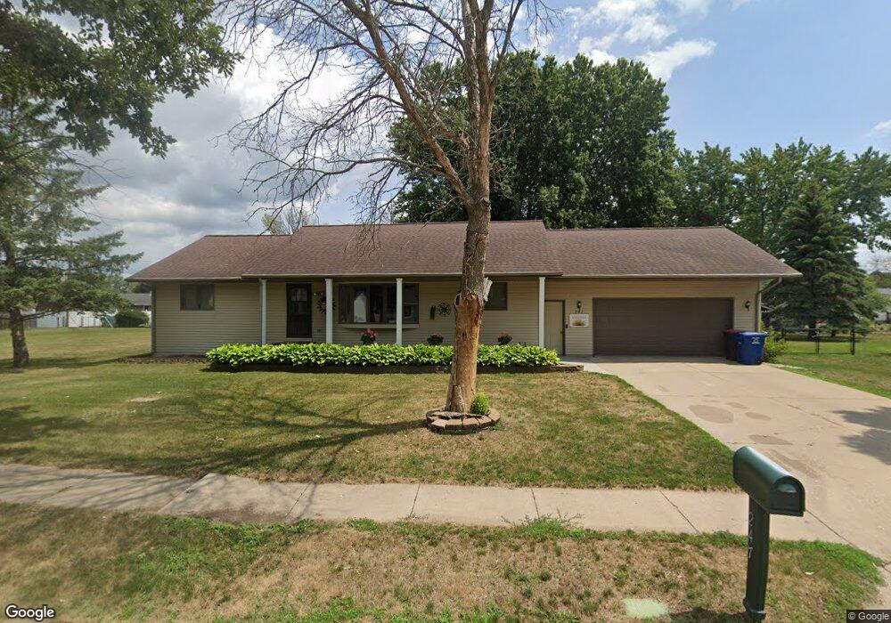
247 Fern Ave Red Wing, MN 55066
Estimated Value: $404,000 - $449,000
3
Beds
3
Baths
3,664
Sq Ft
$116/Sq Ft
Est. Value
About This Home
This home is located at 247 Fern Ave, Red Wing, MN 55066 and is currently estimated at $424,360, approximately $115 per square foot. 247 Fern Ave is a home located in Goodhue County with nearby schools including Burnside Elementary School, Sunnyside Elementary School, and Twin Bluff Middle School.
Ownership History
Date
Name
Owned For
Owner Type
Purchase Details
Closed on
Apr 9, 2021
Sold by
Anderson David A and Anderson Joann I
Bought by
Wangen Tom K and Wangen Barb T
Current Estimated Value
Home Financials for this Owner
Home Financials are based on the most recent Mortgage that was taken out on this home.
Original Mortgage
$175,000
Outstanding Balance
$131,110
Interest Rate
2.9%
Mortgage Type
New Conventional
Estimated Equity
$293,250
Purchase Details
Closed on
Jun 29, 2016
Sold by
Collett Ronald G
Bought by
Anderson David A and Anderson Joann I
Purchase Details
Closed on
Apr 30, 1998
Sold by
Issendorf Dallas A and Issendorf Hazel P
Bought by
Collett Ronald G and Collett Nora J
Create a Home Valuation Report for This Property
The Home Valuation Report is an in-depth analysis detailing your home's value as well as a comparison with similar homes in the area
Home Values in the Area
Average Home Value in this Area
Purchase History
| Date | Buyer | Sale Price | Title Company |
|---|---|---|---|
| Wangen Tom K | $350,000 | Knight Barry Ttl United Llc | |
| Anderson David A | $234,000 | Goodhue County Abstract | |
| Collett Ronald G | $152,000 | -- | |
| Wangen Tom Tom | $350,000 | -- |
Source: Public Records
Mortgage History
| Date | Status | Borrower | Loan Amount |
|---|---|---|---|
| Open | Wangen Tom K | $175,000 | |
| Closed | Wangen Tom Tom | $175,000 |
Source: Public Records
Tax History
| Year | Tax Paid | Tax Assessment Tax Assessment Total Assessment is a certain percentage of the fair market value that is determined by local assessors to be the total taxable value of land and additions on the property. | Land | Improvement |
|---|---|---|---|---|
| 2025 | $5,540 | $429,500 | $54,300 | $375,200 |
| 2024 | $5,540 | $416,800 | $54,300 | $362,500 |
| 2023 | $5,460 | $392,000 | $54,300 | $337,700 |
| 2022 | $4,352 | $389,400 | $54,300 | $335,100 |
| 2021 | $4,030 | $299,700 | $54,300 | $245,400 |
| 2020 | $3,976 | $282,800 | $54,300 | $228,500 |
| 2019 | $3,956 | $262,300 | $54,300 | $208,000 |
| 2018 | $3,184 | $264,000 | $52,400 | $211,600 |
| 2017 | $3,112 | $230,300 | $52,400 | $177,900 |
| 2016 | $2,866 | $228,100 | $52,400 | $175,700 |
| 2015 | $2,746 | $221,100 | $52,400 | $168,700 |
| 2014 | -- | $218,500 | $52,400 | $166,100 |
Source: Public Records
Map
Nearby Homes
- 135 Kingswood Dr
- 980 Aurora Cir
- 853 Aurora Cir
- 912 Aurora Cir
- 4739 Big Sky Ct
- 4786 Mount Hood Ln
- 921 Snowbird Dr
- 1056 Birch Ave
- 910 Snowbird Dr
- 914 Snowbird Dr
- 3557 Skyline Dr
- 3560 Graves Dr
- 3429 Helen Ln
- 4958 Chalet Ct
- 131 Rose Ave
- 186 Sargent Dr
- 128 Charles Ave
- 5542 Cannon Dale Ct
- 113 Burnside Ave S
- 1125 Hewitt Blvd
Your Personal Tour Guide
Ask me questions while you tour the home.