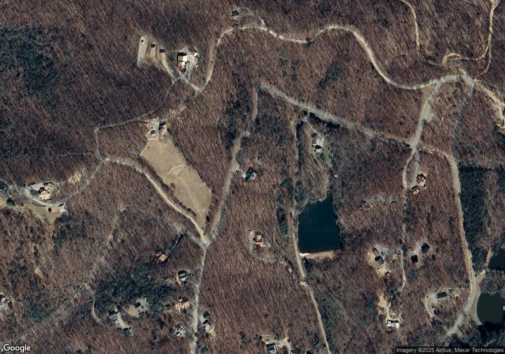
2470 Squirrel Hunting Rd Morganton, GA 30560
Estimated Value: $100,000 - $629,000
--
Bed
1
Bath
1,428
Sq Ft
$263/Sq Ft
Est. Value
About This Home
This home is located at 2470 Squirrel Hunting Rd, Morganton, GA 30560 and is currently estimated at $375,209, approximately $262 per square foot. 2470 Squirrel Hunting Rd is a home with nearby schools including Fannin County High School.
Ownership History
Date
Name
Owned For
Owner Type
Purchase Details
Closed on
Jan 27, 2014
Sold by
Lieberman Mark Ronald
Bought by
Thompson John K and Thompson Frances A
Current Estimated Value
Purchase Details
Closed on
Aug 8, 2003
Sold by
Lieberman Mark Ronald
Bought by
Lieberman Mark Ronald
Purchase Details
Closed on
Aug 27, 2001
Sold by
Covered Bridge Llc
Bought by
Thompson John K
Purchase Details
Closed on
Jun 8, 2001
Sold by
Covered Bridge Llc
Bought by
Lieberman Mark Ronald
Create a Home Valuation Report for This Property
The Home Valuation Report is an in-depth analysis detailing your home's value as well as a comparison with similar homes in the area
Home Values in the Area
Average Home Value in this Area
Purchase History
| Date | Buyer | Sale Price | Title Company |
|---|---|---|---|
| Thompson John K | $28,000 | -- | |
| Lieberman Mark Ronald | $20,000 | -- | |
| Thompson John K | $29,500 | -- | |
| Lieberman Mark Ronald | $30,500 | -- |
Source: Public Records
Tax History Compared to Growth
Tax History
| Year | Tax Paid | Tax Assessment Tax Assessment Total Assessment is a certain percentage of the fair market value that is determined by local assessors to be the total taxable value of land and additions on the property. | Land | Improvement |
|---|---|---|---|---|
| 2025 | $1,450 | $189,803 | $33,313 | $156,490 |
| 2024 | $1,450 | $189,803 | $33,313 | $156,490 |
| 2023 | $1,421 | $164,140 | $33,313 | $130,827 |
| 2022 | $1,431 | $165,567 | $33,313 | $132,254 |
| 2021 | $1,475 | $117,466 | $33,313 | $84,153 |
| 2020 | $1,445 | $111,979 | $27,826 | $84,153 |
| 2019 | $1,438 | $109,042 | $27,826 | $81,216 |
| 2018 | $1,524 | $109,042 | $27,826 | $81,216 |
| 2017 | $2,009 | $113,543 | $27,826 | $85,717 |
| 2016 | $1,604 | $102,885 | $27,826 | $75,059 |
| 2013 | -- | $0 | $0 | $0 |
Source: Public Records
Map
Nearby Homes
- 332 Mattie Mitchell Rd
- 35 Wunder Bear Ridge
- 0 Squirrel Hunting Rd Unit 10496884
- 24 Rabbit Ridge Rd
- 97 Deer Ridge Rd
- 168 Rabbit Ridge Rd
- 693 Goldmine Rd
- LOT 118 Croft Mountain Rd
- 119 Croft Mountain Rd
- LOT 119 Croft Mountain Rd
- 311 Chicory Dr W
- 217 Goldmine Rd
- 221 Goldmine Rd
- 5 Gold Mine Rd
- 5 Gold Mine Rd Unit LOT 5
- LT120 Croft Mountain Rd
- 691 Mitchell Branch Rd
- 225 Goldmine Rd
- 458 Blue Berry Ridge
- 184 High Meadows Dr
- 3600 Squirrel Hunting Rd
- 218 Mattie Mitchell Rd
- 11 Mattie Mitchell Rd
- LOT 7 Coon Gap Views
- 6 Coon Gap Rd
- 6 Thomas Ridge Rd
- 507 Mattie Mitchell Rd
- 256 Woodland Ridge Dr
- 44 Coon Gap Rd
- 400 Woodland Ridge Dr
- 130 Thomas Ridge Rd
- 2350 Squirrel Hunting Rd
- LOT 9 Thomas Ridge Rd
- 424 Woodland Ridge Dr
- 400 Woodland Ridge Dr
- 334 Mattie Mitchell Rd
- 80 Dial Ridge Dr
- 35 Thomas Ridge Rd
- 84 Coon Gap Rd
- 180 Thomas Ridge Rd
