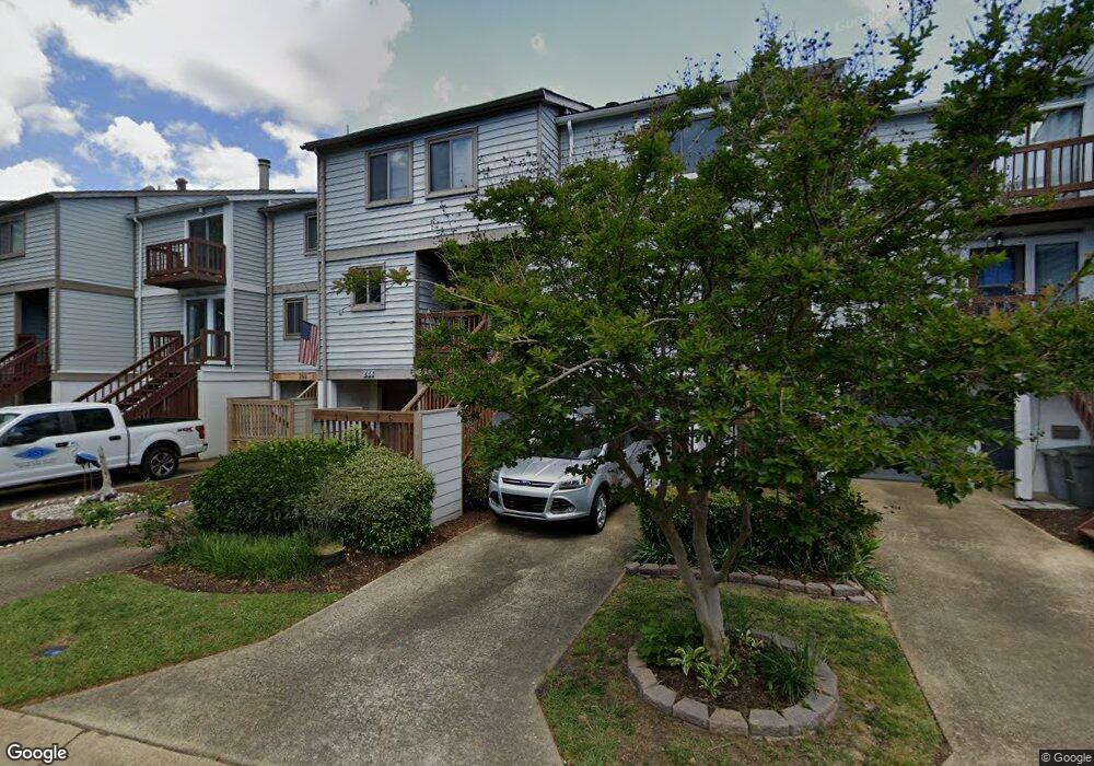
248 Mill Point Dr Hampton, VA 23669
Downtown Hampton NeighborhoodEstimated Value: $270,000 - $335,000
3
Beds
3
Baths
1,468
Sq Ft
$209/Sq Ft
Est. Value
About This Home
This home is located at 248 Mill Point Dr, Hampton, VA 23669 and is currently estimated at $306,898, approximately $209 per square foot. 248 Mill Point Dr is a home located in Hampton City with nearby schools including Capt. John Smith Elementary School, C. Alton Lindsay Middle School, and Phoebus High School.
Ownership History
Date
Name
Owned For
Owner Type
Purchase Details
Closed on
Apr 15, 2024
Sold by
Janczewski Adam J
Bought by
Jacobs Randy Eugene and Jacobs Courtney Lynn
Current Estimated Value
Home Financials for this Owner
Home Financials are based on the most recent Mortgage that was taken out on this home.
Original Mortgage
$214,500
Outstanding Balance
$211,331
Interest Rate
6.94%
Mortgage Type
New Conventional
Estimated Equity
$95,567
Create a Home Valuation Report for This Property
The Home Valuation Report is an in-depth analysis detailing your home's value as well as a comparison with similar homes in the area
Home Values in the Area
Average Home Value in this Area
Purchase History
| Date | Buyer | Sale Price | Title Company |
|---|---|---|---|
| Jacobs Randy Eugene | $289,000 | Closing Edge Title |
Source: Public Records
Mortgage History
| Date | Status | Borrower | Loan Amount |
|---|---|---|---|
| Open | Jacobs Randy Eugene | $214,500 |
Source: Public Records
Tax History Compared to Growth
Tax History
| Year | Tax Paid | Tax Assessment Tax Assessment Total Assessment is a certain percentage of the fair market value that is determined by local assessors to be the total taxable value of land and additions on the property. | Land | Improvement |
|---|---|---|---|---|
| 2025 | $3,245 | $281,600 | $80,600 | $201,000 |
| 2024 | $2,983 | $259,400 | $68,200 | $191,200 |
| 2023 | $2,856 | $246,200 | $68,200 | $178,000 |
| 2022 | $2,585 | $219,100 | $68,200 | $150,900 |
| 2021 | $2,605 | $199,600 | $68,200 | $131,400 |
| 2020 | $2,368 | $191,000 | $68,200 | $122,800 |
| 2019 | $2,380 | $191,900 | $68,200 | $123,700 |
| 2018 | $2,454 | $190,300 | $68,200 | $122,100 |
| 2017 | $2,454 | $0 | $0 | $0 |
| 2016 | $2,454 | $190,300 | $0 | $0 |
| 2015 | $2,454 | $0 | $0 | $0 |
| 2014 | $2,444 | $190,300 | $68,200 | $122,100 |
Source: Public Records
Map
Nearby Homes
- 35 Miles Cary Mews
- 156 Mill Point Dr
- 115 E Pembroke Ave
- 418 Wine St
- 542 River St
- 497 Bridge St
- 433 Cooper St
- 439 Cooper St
- 130 Meredith St
- 144 Meredith St
- 217 S Armistead Ave
- 116 Linden Ave
- 14 Myrtle St
- 227 Lee St
- 840 Quash St
- 256 Lee St
- 904 E Pembroke Ave
- 138 Eberly Terrace
- 4408 Victoria Blvd
- 210 Dockside Dr Unit A
- 250 Mill Point Dr
- 246 Mill Point Dr
- 252 Mill Point Dr
- 244 Mill Point Dr
- 254 Mill Point Dr
- 242 Mill Point Dr
- 240 Mill Point Dr
- 256 Mill Point Dr
- 238 Mill Point Dr
- 241 Mill Point Dr
- 236 Mill Point Dr
- 239 Mill Point Dr
- 234 Mill Point Dr
- 237 Mill Point Dr
- 235 Mill Point Dr
- 233 Mill Point Dr
- 230 Mill Point Dr
- 245 Mill Point Dr
- 217 Washington St
- 231 Mill Point Dr