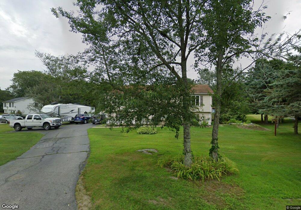
248 Squaw Rock Rd Moosup, CT 06354
Estimated Value: $362,000 - $377,000
3
Beds
2
Baths
1,242
Sq Ft
$295/Sq Ft
Est. Value
About This Home
This home is located at 248 Squaw Rock Rd, Moosup, CT 06354 and is currently estimated at $365,849, approximately $294 per square foot. 248 Squaw Rock Rd is a home located in Windham County with nearby schools including Plainfield Memorial School, Plainfield Central Middle School, and Plainfield High School.
Ownership History
Date
Name
Owned For
Owner Type
Purchase Details
Closed on
Nov 5, 1997
Sold by
Rapp Douglas A
Bought by
Beausoleil Thomas J
Current Estimated Value
Purchase Details
Closed on
Jul 31, 1995
Sold by
Marquis Richard F and Marquis Betty A
Bought by
First Union Mtg Corp
Purchase Details
Closed on
May 4, 1989
Sold by
Turn Key Housing
Bought by
Marquis Richard
Create a Home Valuation Report for This Property
The Home Valuation Report is an in-depth analysis detailing your home's value as well as a comparison with similar homes in the area
Home Values in the Area
Average Home Value in this Area
Purchase History
| Date | Buyer | Sale Price | Title Company |
|---|---|---|---|
| Beausoleil Thomas J | $112,854 | -- | |
| Beausoleil Thomas J | $112,854 | -- | |
| First Union Mtg Corp | $134,000 | -- | |
| First Union Mtg Corp | $134,000 | -- | |
| Marquis Richard | $121,000 | -- |
Source: Public Records
Mortgage History
| Date | Status | Borrower | Loan Amount |
|---|---|---|---|
| Open | Marquis Richard | $123,000 | |
| Closed | Marquis Richard | $50,000 |
Source: Public Records
Tax History
| Year | Tax Paid | Tax Assessment Tax Assessment Total Assessment is a certain percentage of the fair market value that is determined by local assessors to be the total taxable value of land and additions on the property. | Land | Improvement |
|---|---|---|---|---|
| 2025 | $4,705 | $199,300 | $35,930 | $163,370 |
| 2024 | $4,594 | $199,300 | $35,930 | $163,370 |
| 2023 | $4,572 | $199,300 | $35,930 | $163,370 |
| 2022 | $5,810 | $129,160 | $31,080 | $98,080 |
| 2021 | $3,969 | $129,160 | $31,080 | $98,080 |
| 2020 | $3,943 | $129,160 | $31,080 | $98,080 |
| 2019 | $3,943 | $129,160 | $31,080 | $98,080 |
| 2018 | $3,883 | $129,160 | $31,080 | $98,080 |
| 2017 | $3,734 | $116,630 | $31,080 | $85,550 |
| 2016 | $3,610 | $116,630 | $31,080 | $85,550 |
| 2015 | $3,518 | $116,630 | $31,080 | $85,550 |
| 2014 | $3,518 | $116,630 | $31,080 | $85,550 |
Source: Public Records
Map
Nearby Homes
- 277 Moosup Pond Rd
- 13 Henry Dr
- 100 Squaw Rock Rd
- 58 Milner Ave
- 23 High St
- 25 Snake Meadow Rd
- 6 Grace Ln
- 12 Mechanic St
- 29 Union St
- 30 Main St
- 0 Putnam Rd Unit 24147722
- 181 Snake Meadow Rd
- 45 Main St
- 25 Torrey Ln
- 143 Goshen Rd
- 365 Putnam Rd Unit 367
- 77 Charlotte Dr
- 44-46 S Chestnut St
- 133 Sachem Dr
- 30 S Walnut St
- 254 Squaw Rock Rd
- 251 Squaw Rock Rd
- 242 Squaw Rock Rd
- 258 Squaw Rock Rd
- 243 Squaw Rock Rd
- 239 Squaw Rock Rd
- 236 Squaw Rock Rd
- 226 Squaw Rock Rd
- 263 Squaw Rock Rd
- 227 Squaw Rock Rd
- 219 Squaw Rock Rd
- 214 Squaw Rock Rd
- 286 Squaw Rock Rd
- 356 Moosup Pond Rd
- 201 Squaw Rock Rd
- 365 Moosup Pond Rd
- 368 Moosup Pond Rd
- 297 Squaw Rock Rd
- 383 Moosup Pond Rd
- 381 Moosup Pond Rd
Your Personal Tour Guide
Ask me questions while you tour the home.