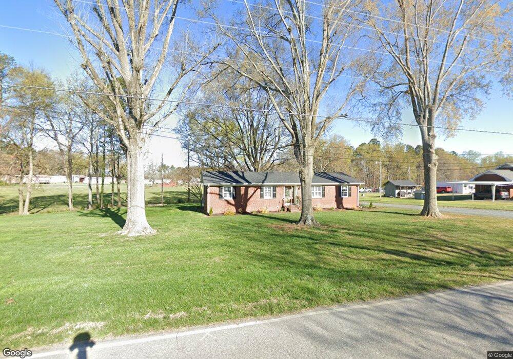
24857 Millingport Rd Locust, NC 28097
Estimated Value: $256,000 - $308,000
3
Beds
2
Baths
1,260
Sq Ft
$223/Sq Ft
Est. Value
About This Home
This home is located at 24857 Millingport Rd, Locust, NC 28097 and is currently estimated at $281,487, approximately $223 per square foot. 24857 Millingport Rd is a home located in Stanly County with nearby schools including Locust Elementary School, West Stanly Middle School, and West Stanly High School.
Ownership History
Date
Name
Owned For
Owner Type
Purchase Details
Closed on
Oct 26, 2016
Sold by
Nancy L Tenhengel
Bought by
Griffin Daniel and Griffin Kathryn
Current Estimated Value
Home Financials for this Owner
Home Financials are based on the most recent Mortgage that was taken out on this home.
Original Mortgage
$198,850
Outstanding Balance
$160,144
Interest Rate
3.52%
Estimated Equity
$121,343
Create a Home Valuation Report for This Property
The Home Valuation Report is an in-depth analysis detailing your home's value as well as a comparison with similar homes in the area
Home Values in the Area
Average Home Value in this Area
Purchase History
| Date | Buyer | Sale Price | Title Company |
|---|---|---|---|
| Griffin Daniel | -- | -- |
Source: Public Records
Mortgage History
| Date | Status | Borrower | Loan Amount |
|---|---|---|---|
| Open | Griffin Daniel | $198,850 | |
| Closed | Griffin Daniel | -- |
Source: Public Records
Tax History Compared to Growth
Tax History
| Year | Tax Paid | Tax Assessment Tax Assessment Total Assessment is a certain percentage of the fair market value that is determined by local assessors to be the total taxable value of land and additions on the property. | Land | Improvement |
|---|---|---|---|---|
| 2025 | $1,136 | $172,121 | $33,040 | $139,081 |
| 2024 | $116 | $107,105 | $21,240 | $85,865 |
| 2023 | $42 | $107,105 | $21,240 | $85,865 |
| 2022 | $771 | $107,105 | $21,240 | $85,865 |
| 2021 | $771 | $107,105 | $21,240 | $85,865 |
| 2020 | $727 | $94,183 | $18,880 | $75,303 |
| 2019 | $735 | $94,183 | $18,880 | $75,303 |
| 2018 | $41 | $94,183 | $18,880 | $75,303 |
| 2017 | $735 | $94,183 | $18,880 | $75,303 |
| 2016 | $700 | $92,144 | $16,992 | $75,152 |
| 2015 | $784 | $92,144 | $16,992 | $75,152 |
| 2014 | $820 | $92,144 | $16,992 | $75,152 |
Source: Public Records
Map
Nearby Homes
- 17427 Purser Dr
- 24910 Birdhouse Ln Unit 1
- 27040 Crepts Branch Rd
- 00 Millingport Rd Unit 1
- 00 Millingport Rd Unit 3
- 21080 Running Creek Dr
- 21072 Running Creek Dr
- 21064 Running Creek Dr
- 21056 Running Creek Dr
- 21048 Running Creek Dr
- 21040 Running Creek Dr
- 21039 Running Creek Dr
- 21032 Running Creek Dr
- 20313 Running Creek Church Rd
- 20420 Ridgecrest Rd
- 20289 Running Creek Church Rd
- Lot 1B Mallory Ln Unit 1B
- 21035 Old Mill Rd
- 20956 Old Mill Rd
- Red Cedar Plan at Running Creek
- 24858 Millingport Rd
- 24566 Ridgecrest Rd
- 24846 Millingport Rd
- 24880 Millingport Rd
- 24885 Millingport Rd
- 24890 Millingport Rd
- 24905 Millingport Rd
- 24530 Ridgecrest Rd
- 24908 Millingport Rd
- 24913 Millingport Rd
- 24866 Millingport Rd
- 24921 Millingport Rd
- 24671 Ridgecrest Rd
- 24633 Ridgecrest Rd
- 24520 Ridgecrest Rd
- 24926 Millingport Rd
- 24935 Millingport Rd
- 24718 Millingport Rd
- 24953 Millingport Rd
- 24493 Ridgecrest Rd