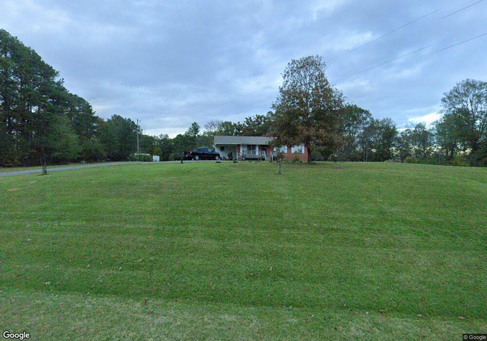
24871 Highway 315 Sardis, MS 38666
Estimated Value: $118,000 - $226,000
3
Beds
2
Baths
1,800
Sq Ft
$105/Sq Ft
Est. Value
About This Home
This home is located at 24871 Highway 315, Sardis, MS 38666 and is currently estimated at $188,338, approximately $104 per square foot. 24871 Highway 315 is a home located in Panola County with nearby schools including Greenhill Elementary School, North Panola Junior High School, and North Panola High School.
Ownership History
Date
Name
Owned For
Owner Type
Purchase Details
Closed on
Feb 14, 2014
Sold by
Williams Wilkerson Albert and Williams Wilkerson
Bought by
Williams Sammy Lee and Williams Mary G
Current Estimated Value
Home Financials for this Owner
Home Financials are based on the most recent Mortgage that was taken out on this home.
Original Mortgage
$122,000
Outstanding Balance
$92,481
Interest Rate
4.42%
Mortgage Type
New Conventional
Estimated Equity
$95,857
Create a Home Valuation Report for This Property
The Home Valuation Report is an in-depth analysis detailing your home's value as well as a comparison with similar homes in the area
Home Values in the Area
Average Home Value in this Area
Purchase History
| Date | Buyer | Sale Price | Title Company |
|---|---|---|---|
| Williams Sammy Lee | -- | First Natl Title Services |
Source: Public Records
Mortgage History
| Date | Status | Borrower | Loan Amount |
|---|---|---|---|
| Open | Williams Sammy Lee | $122,000 |
Source: Public Records
Tax History Compared to Growth
Tax History
| Year | Tax Paid | Tax Assessment Tax Assessment Total Assessment is a certain percentage of the fair market value that is determined by local assessors to be the total taxable value of land and additions on the property. | Land | Improvement |
|---|---|---|---|---|
| 2024 | -- | $6,769 | $2,042 | $4,727 |
| 2023 | $0 | $6,772 | $2,045 | $4,727 |
| 2022 | $0 | $6,776 | $2,049 | $4,727 |
| 2021 | $0 | $6,781 | $2,054 | $4,727 |
| 2020 | -- | $6,786 | $2,059 | $4,727 |
| 2019 | -- | $7,613 | $2,064 | $5,549 |
| 2018 | -- | $7,661 | $2,112 | $5,549 |
| 2017 | -- | $7,653 | $2,104 | $5,549 |
| 2016 | -- | $7,477 | $2,088 | $5,389 |
| 2015 | -- | $7,459 | $2,070 | $5,389 |
| 2014 | -- | $11,088 | $3,005 | $8,083 |
| 2013 | -- | $11,079 | $2,996 | $8,083 |
Source: Public Records
Map
Nearby Homes
- 240 Kimes Cove
- 180 Hummingbird
- 22757 Mississippi 315
- 1275 Edwards Rd
- 22115 Mississippi 315
- 3684 Union Rd
- 2617 Belmont Rd
- 102 E Hospital Rd
- 115 Collins Rd
- 16945 Mississippi 315
- 0 Ballentine Unit 19694199
- 106 Childress St
- 509 Franklin St
- 3012 Cold Springs Rd
- 3038 Cold Springs Rd
- 109 Hightower St
- 104 Hightower St
- 212 N Main St
- 304 N Main St
- 533 Hudson Rd
- 24871 Highway 315
- 24871 Highway 315
- 24886 Highway 315
- 25336 E Hwy Unit 315
- 24769 Highway 315
- 24737 Highway 315
- 24659 Highway 315
- 24659 Mississippi 315
- 1726 King Rd
- 1876 King Rd
- 1675 King Rd
- 22538 Highway 315
- 111 Forrest Dr N
- 1932 King Rd
- 149 Forrest Dr N
- 179 Forrest Dr N
- 168 Forrest Dr N
- 108 Norris Cove
- 68 Forrest Dr S
- 1948 King Rd