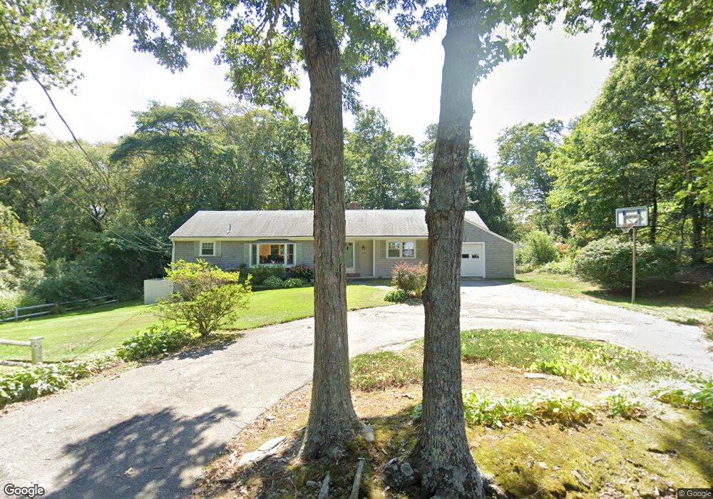
249 Holly Point Rd Centerville, MA 02632
Centerville NeighborhoodEstimated Value: $763,039 - $996,000
3
Beds
2
Baths
1,720
Sq Ft
$512/Sq Ft
Est. Value
About This Home
This home is located at 249 Holly Point Rd, Centerville, MA 02632 and is currently estimated at $880,260, approximately $511 per square foot. 249 Holly Point Rd is a home located in Barnstable County with nearby schools including Centerville Elementary School, Barnstable United Elementary School, and Barnstable Intermediate School.
Ownership History
Date
Name
Owned For
Owner Type
Purchase Details
Closed on
Dec 11, 2024
Sold by
Nellis William J and Nellis Carole A
Bought by
Nellis Ft and Sader
Current Estimated Value
Purchase Details
Closed on
Feb 4, 2010
Sold by
Francis Keith A and Francis Susan J
Bought by
Nellis William J and Nellis Carole Anne
Purchase Details
Closed on
Aug 31, 1988
Sold by
Capen David A
Bought by
Francis Keith A
Home Financials for this Owner
Home Financials are based on the most recent Mortgage that was taken out on this home.
Original Mortgage
$193,000
Interest Rate
10.38%
Mortgage Type
Purchase Money Mortgage
Create a Home Valuation Report for This Property
The Home Valuation Report is an in-depth analysis detailing your home's value as well as a comparison with similar homes in the area
Home Values in the Area
Average Home Value in this Area
Purchase History
| Date | Buyer | Sale Price | Title Company |
|---|---|---|---|
| Nellis Ft | -- | None Available | |
| Nellis Ft | -- | None Available | |
| Nellis William J | -- | None Available | |
| Nellis William J | $407,000 | -- | |
| Nellis William J | $407,000 | -- | |
| Francis Keith A | $177,000 | -- |
Source: Public Records
Mortgage History
| Date | Status | Borrower | Loan Amount |
|---|---|---|---|
| Previous Owner | Francis Keith A | $193,000 |
Source: Public Records
Tax History Compared to Growth
Tax History
| Year | Tax Paid | Tax Assessment Tax Assessment Total Assessment is a certain percentage of the fair market value that is determined by local assessors to be the total taxable value of land and additions on the property. | Land | Improvement |
|---|---|---|---|---|
| 2025 | $5,578 | $689,500 | $261,600 | $427,900 |
| 2024 | $5,358 | $686,000 | $261,600 | $424,400 |
| 2023 | $5,266 | $631,400 | $258,800 | $372,600 |
| 2022 | $4,726 | $490,200 | $165,800 | $324,400 |
| 2021 | $1,565 | $446,800 | $176,200 | $270,600 |
| 2020 | $1,532 | $446,300 | $186,500 | $259,800 |
| 2019 | $1,470 | $430,600 | $196,900 | $233,700 |
| 2018 | $4,423 | $394,200 | $196,300 | $197,900 |
| 2017 | $911 | $391,400 | $201,800 | $189,600 |
| 2016 | $4,285 | $393,100 | $203,500 | $189,600 |
| 2015 | $4,160 | $383,400 | $198,000 | $185,400 |
Source: Public Records
Map
Nearby Homes
- 233 Holly Point Rd
- 307 Holly Point Rd
- 319 Holly Point Rd
- 246 Holly Point Rd
- 256 Holly Point Rd
- 345 Holly Point Rd
- 236 Holly Point Rd
- 305 Holly Point Rd
- 266 Holly Point Rd
- 219 Holly Point Rd
- 312 Holly Point Rd
- 226 Holly Point Rd
- 326 Holly Point Rd
- 300 Holly Point Rd
- 212 Holly Point Rd
- 336 Holly Point Rd
- 346 Holly Point Rd
- 276 Holly Point Rd
- 213 Lakeside Dr W
- 125 Lakeside Dr W