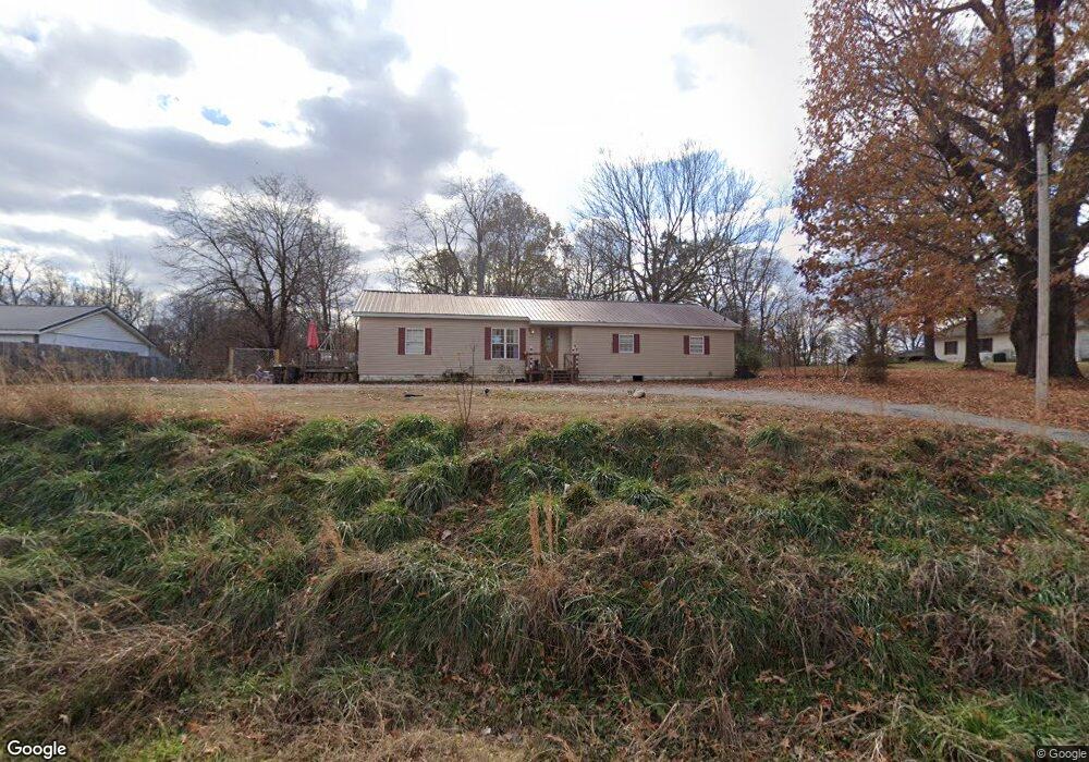
2490 S 11th St Poplar Bluff, MO 63901
Estimated Value: $89,075 - $161,000
--
Bed
--
Bath
1,247
Sq Ft
$102/Sq Ft
Est. Value
About This Home
This home is located at 2490 S 11th St, Poplar Bluff, MO 63901 and is currently estimated at $126,769, approximately $101 per square foot. 2490 S 11th St is a home with nearby schools including Eugene Field Elementary School, Poplar Bluff Fifth & Sixth Grade Center, and Poplar Bluff Junior High School.
Ownership History
Date
Name
Owned For
Owner Type
Purchase Details
Closed on
Feb 17, 2023
Sold by
Reynolds Gary Wade and Reynolds Mary Ann
Bought by
Reynolds Michael D
Current Estimated Value
Purchase Details
Closed on
Nov 17, 2020
Sold by
Reynolds Gary Wade and Reynolds Mary Ann
Bought by
Mccauley Investments Llc
Home Financials for this Owner
Home Financials are based on the most recent Mortgage that was taken out on this home.
Original Mortgage
$155,000
Interest Rate
2.8%
Mortgage Type
Future Advance Clause Open End Mortgage
Create a Home Valuation Report for This Property
The Home Valuation Report is an in-depth analysis detailing your home's value as well as a comparison with similar homes in the area
Home Values in the Area
Average Home Value in this Area
Purchase History
| Date | Buyer | Sale Price | Title Company |
|---|---|---|---|
| Reynolds Michael D | -- | -- | |
| Reynolds Michael D | -- | None Listed On Document | |
| Mccauley Investments Llc | -- | None Available |
Source: Public Records
Mortgage History
| Date | Status | Borrower | Loan Amount |
|---|---|---|---|
| Previous Owner | Mccauley Investments Llc | $155,000 |
Source: Public Records
Tax History Compared to Growth
Tax History
| Year | Tax Paid | Tax Assessment Tax Assessment Total Assessment is a certain percentage of the fair market value that is determined by local assessors to be the total taxable value of land and additions on the property. | Land | Improvement |
|---|---|---|---|---|
| 2024 | $493 | $10,200 | $0 | $0 |
| 2023 | $493 | $10,200 | $0 | $0 |
| 2022 | $470 | $9,740 | $0 | $0 |
| 2021 | $470 | $9,740 | $0 | $0 |
| 2020 | $1,527 | $30,290 | $0 | $0 |
| 2019 | $1,526 | $30,290 | $0 | $0 |
| 2018 | $1,526 | $11,540 | $0 | $0 |
| 2017 | -- | $11,540 | $0 | $0 |
| 2016 | -- | $11,540 | $0 | $0 |
| 2015 | -- | $11,230 | $0 | $0 |
| 2014 | -- | $10,530 | $0 | $0 |
| 2012 | $449 | $10,530 | $0 | $0 |
Source: Public Records
Map
Nearby Homes
- 2024 Glendale Rd
- 2801 Bedoll Ave
- 1110 Commerce St
- 2925 Wayne Ave
- 2121 Pike St
- 1039 Franklin St
- 1025 Delano St
- 1315 S 11th St
- 2335 Cheshire Blvd
- 1000 W Victor St
- 712 Nickey St
- 622 Nickey St
- 912 Adam St
- 1905 Kentucky Ave
- 1708 Kentucky Ave
- 813 Kendall Dr
- 2011 Arkansas Ave
- 1910 Arkansas Ave
- 163 Fairway Dr
- 107 W Victor St
- 2489 S 11th St
- 2500 S 11th St
- 2441 S 11th St
- 2439 S 11th St
- 2421 S 11th St
- 2480 S 11th St
- 2512 National Ave
- 2501 S 11th St
- 2518 National Ave
- 2507 National Ave
- 0 E of National Unit 9935804
- 2513 National Ave
- 2600 National Ave
- 2419 National Ave
- 1908 Brentwood Rd
- 2606 National Ave
- 1907 Brentwood Rd
- 2413 National Ave
- 1905 Glendale Rd
- 1906 Glendale Rd