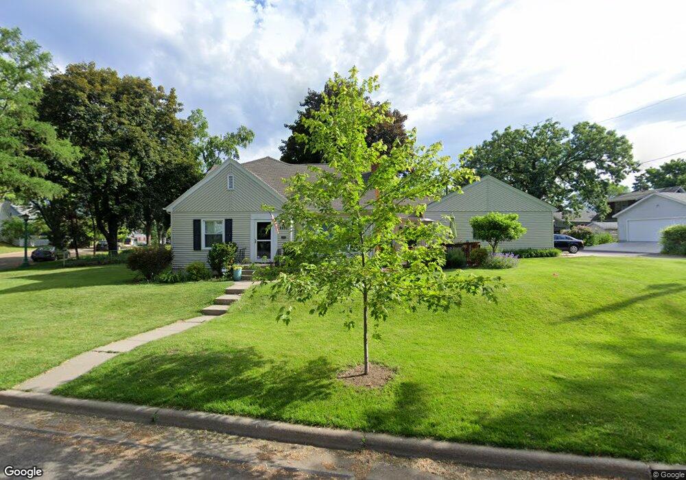
2495 Beverly Rd Saint Paul, MN 55104
Union Park NeighborhoodEstimated Value: $399,000 - $515,000
3
Beds
3
Baths
2,003
Sq Ft
$233/Sq Ft
Est. Value
About This Home
This home is located at 2495 Beverly Rd, Saint Paul, MN 55104 and is currently estimated at $467,350, approximately $233 per square foot. 2495 Beverly Rd is a home located in Ramsey County with nearby schools including Groveland Park Elementary School, Hidden River Middle School, and Central Senior High School.
Ownership History
Date
Name
Owned For
Owner Type
Purchase Details
Closed on
Jul 18, 2014
Sold by
Sheridan Robert and Sheridan Keshar
Bought by
Thuente Mark P and Thuente Kathryn
Current Estimated Value
Home Financials for this Owner
Home Financials are based on the most recent Mortgage that was taken out on this home.
Original Mortgage
$215,200
Outstanding Balance
$163,857
Interest Rate
4.15%
Mortgage Type
New Conventional
Estimated Equity
$303,493
Purchase Details
Closed on
Jul 25, 1997
Sold by
Burns Kevin J and Burns Jo Ann M
Bought by
Mcenerney Ryan
Create a Home Valuation Report for This Property
The Home Valuation Report is an in-depth analysis detailing your home's value as well as a comparison with similar homes in the area
Home Values in the Area
Average Home Value in this Area
Purchase History
| Date | Buyer | Sale Price | Title Company |
|---|---|---|---|
| Thuente Mark P | $277,151 | Burnet Title | |
| Mcenerney Ryan | $111,850 | -- |
Source: Public Records
Mortgage History
| Date | Status | Borrower | Loan Amount |
|---|---|---|---|
| Open | Thuente Mark P | $215,200 |
Source: Public Records
Tax History Compared to Growth
Tax History
| Year | Tax Paid | Tax Assessment Tax Assessment Total Assessment is a certain percentage of the fair market value that is determined by local assessors to be the total taxable value of land and additions on the property. | Land | Improvement |
|---|---|---|---|---|
| 2025 | $6,592 | $488,800 | $112,700 | $376,100 |
| 2023 | $6,592 | $426,800 | $112,700 | $314,100 |
| 2022 | $5,998 | $437,300 | $112,700 | $324,600 |
| 2021 | $5,904 | $373,200 | $112,700 | $260,500 |
| 2020 | $6,114 | $367,900 | $112,700 | $255,200 |
| 2019 | $5,696 | $355,100 | $112,700 | $242,400 |
| 2018 | $5,188 | $328,600 | $112,700 | $215,900 |
| 2017 | $4,500 | $311,600 | $112,700 | $198,900 |
| 2016 | $5,002 | $0 | $0 | $0 |
| 2015 | $4,632 | $289,200 | $112,700 | $176,500 |
| 2014 | $4,098 | $0 | $0 | $0 |
Source: Public Records
Map
Nearby Homes
- 563 Eustis St
- 583 Cromwell Ave
- 572 Desnoyer Ave
- 606 Cromwell Ave
- 515 Raymond Ave
- 215 Warwick St SE
- 2565 Franklin Ave Unit 313
- 2565 Franklin Ave Unit 207
- 820 Emerald St Unit 402
- 820 Emerald St Unit 110
- 1909 E River Pkwy
- 820 Emerald St SE Unit 314
- 2566 Ellis Ave Unit 303
- 2566 Ellis Ave Unit 116
- 2566 Ellis Ave Unit 103
- 2616 40th Ave S
- 2156 Saint Anthony Ave
- 2650 University Ave W Unit 1
- 838 Seal St
- 2508 37th Ave S
- 576 Clifford St
- 580 Clifford St
- 557 Eustis St
- 2490 Beverly Rd
- 547 Eustis St
- 567 Eustis St
- 2480 Beverly Rd
- 2498 Beverly Rd
- 588 Clifford St
- 579 Eustis St
- 573 Eustis St
- 2502 Beverly Rd
- 2507 Beverly Rd
- 2470 Beverly Rd
- 2506 Beverly Rd
- 585 Eustis St
- 2511 Beverly Rd
- 591 Clifford St
- 2510 Beverly Rd
- 598 Clifford St