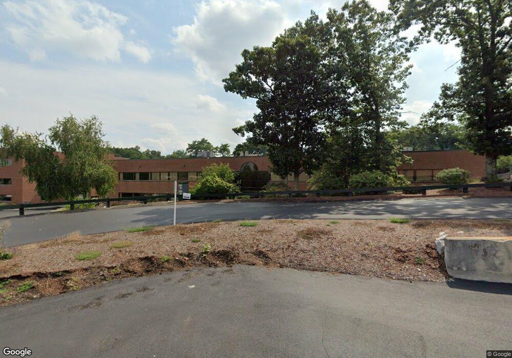
25 Birch St Milford, MA 01757
--
Bed
--
Bath
--
Sq Ft
11
Acres
About This Home
This home is located at 25 Birch St, Milford, MA 01757. 25 Birch St is a home located in Worcester County with nearby schools including Milford High School and Bethany Christian Academy.
Ownership History
Date
Name
Owned For
Owner Type
Purchase Details
Closed on
Jul 26, 2020
Sold by
Spvef Birchwood Fortune
Bought by
Rand Road Holdings Llc
Home Financials for this Owner
Home Financials are based on the most recent Mortgage that was taken out on this home.
Original Mortgage
$6,150,000
Outstanding Balance
$5,465,555
Interest Rate
3.1%
Mortgage Type
Purchase Money Mortgage
Purchase Details
Closed on
Jun 28, 1996
Sold by
Ontrainc
Bought by
Neotech Dev Co Llc
Home Financials for this Owner
Home Financials are based on the most recent Mortgage that was taken out on this home.
Original Mortgage
$2,640,000
Interest Rate
8.05%
Mortgage Type
Commercial
Create a Home Valuation Report for This Property
The Home Valuation Report is an in-depth analysis detailing your home's value as well as a comparison with similar homes in the area
Home Values in the Area
Average Home Value in this Area
Purchase History
| Date | Buyer | Sale Price | Title Company |
|---|---|---|---|
| Rand Road Holdings Llc | $14,300,000 | None Available | |
| Neotech Dev Co Llc | $3,100,000 | -- |
Source: Public Records
Mortgage History
| Date | Status | Borrower | Loan Amount |
|---|---|---|---|
| Open | Rand Road Holdings Llc | $6,150,000 | |
| Previous Owner | Neotech Dev Co Llc | $4,800,000 | |
| Previous Owner | Neotech Dev Co Llc | $2,640,000 | |
| Previous Owner | Neotech Dev Co Llc | $700,000 |
Source: Public Records
Tax History Compared to Growth
Tax History
| Year | Tax Paid | Tax Assessment Tax Assessment Total Assessment is a certain percentage of the fair market value that is determined by local assessors to be the total taxable value of land and additions on the property. | Land | Improvement |
|---|---|---|---|---|
| 2025 | $0 | $14,523,600 | $1,117,100 | $13,406,500 |
| 2024 | $315,165 | $13,637,700 | $1,068,100 | $12,569,600 |
| 2023 | $0 | $12,865,500 | $970,100 | $11,895,400 |
| 2022 | $0 | $11,816,600 | $872,100 | $10,944,500 |
| 2021 | $324,963 | $10,989,600 | $872,100 | $10,117,500 |
| 2020 | $315,165 | $10,633,100 | $872,100 | $9,761,000 |
| 2019 | $311,076 | $10,073,700 | $872,100 | $9,201,600 |
| 2018 | $350,152 | $11,273,400 | $872,100 | $10,401,300 |
| 2017 | $342,012 | $11,243,000 | $872,100 | $10,370,900 |
| 2016 | $323,150 | $10,928,300 | $872,100 | $10,056,200 |
| 2015 | $233,438 | $7,714,400 | $872,100 | $6,842,300 |
Source: Public Records
Map
Nearby Homes
- 11 Black Bear Unit 11
- 33 Brown Bear Ln Unit 33
- 9 Black Bear Cir Unit 9
- 10 Black Bear Unit 10
- 7 Black Bear Unit 7
- 43 Black Bear Cir Unit 43
- 3 Black Bear Cir Unit 3
- 48 Black Bear Cir Unit 48
- 35 Woodland Ave Unit 35A
- 9 Hillside Ave
- 3 S Central St
- 23 Christina Rd
- 17 Middleton St
- 97 E Street Extension
- 15 Free St
- 57 Beach St
- Lot 1 Florence St
- 4 E Charles St
- 6 Rainbow Dr
- 22 Granite St
- 33 Beaver St
- 48 Beaver St Unit 48
- 48 Beaver St Unit 48
- 13 Commercial Way
- 43 Beaver St Unit 43
- 1 Maple St Unit Suite 1A
- 1 Maple St
- 1 Maple St Unit 3rd Floor
- 1 Maple St Unit 1A
- 1 Maple St Unit 1B
- 4 Industrial Rd Unit 4
- 4 Industrial Rd Unit 6+7
- 4 Industrial Rd Unit 5
- 4 Industrial Rd
- 6 Industrial Rd Unit 4
- 6 Industrial Rd Unit 1
- 6 Industrial Rd
- 41 Beaver St
- 23 Birch St
- 28 Beaver St