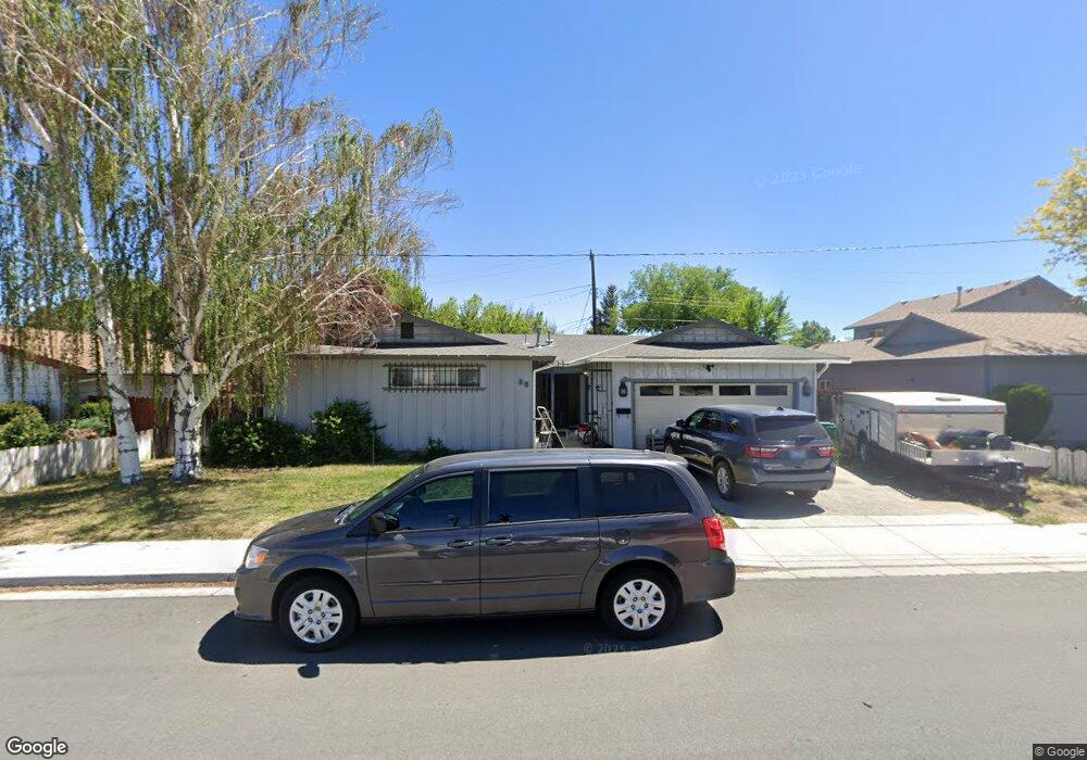
25 E Richards Way Sparks, NV 89431
McCarran Boulevard-Probasco NeighborhoodEstimated Value: $327,000 - $441,000
2
Beds
2
Baths
1,585
Sq Ft
$259/Sq Ft
Est. Value
About This Home
This home is located at 25 E Richards Way, Sparks, NV 89431 and is currently estimated at $410,270, approximately $258 per square foot. 25 E Richards Way is a home located in Washoe County with nearby schools including Greenbrae Elementary School, George L Dilworth Middle School, and Sparks High School.
Ownership History
Date
Name
Owned For
Owner Type
Purchase Details
Closed on
Sep 9, 2022
Sold by
Carolyn Paszek
Bought by
Paszek Carolyn and Goicoechea Elias D
Current Estimated Value
Purchase Details
Closed on
Dec 12, 2017
Sold by
Paszek Carolyn and Beaslex Rasalie C
Bought by
Paszek Carolyn
Purchase Details
Closed on
Sep 13, 2005
Sold by
Walther Kenneth E
Bought by
Paszek Carolyn
Purchase Details
Closed on
Aug 27, 2004
Sold by
Walther Kenneth E
Bought by
Paszek Carolyn
Create a Home Valuation Report for This Property
The Home Valuation Report is an in-depth analysis detailing your home's value as well as a comparison with similar homes in the area
Home Values in the Area
Average Home Value in this Area
Purchase History
| Date | Buyer | Sale Price | Title Company |
|---|---|---|---|
| Paszek Carolyn | $131,000 | -- | |
| Paszek Carolyn | -- | None Available | |
| Paszek Carolyn | -- | -- | |
| Paszek Carolyn | -- | -- |
Source: Public Records
Tax History Compared to Growth
Tax History
| Year | Tax Paid | Tax Assessment Tax Assessment Total Assessment is a certain percentage of the fair market value that is determined by local assessors to be the total taxable value of land and additions on the property. | Land | Improvement |
|---|---|---|---|---|
| 2025 | $2,368 | $60,038 | $36,715 | $23,323 |
| 2024 | $2,298 | $57,700 | $34,755 | $22,945 |
| 2023 | $2,298 | $56,202 | $34,930 | $21,272 |
| 2022 | $2,732 | $45,787 | $28,455 | $17,332 |
| 2021 | $1,166 | $36,550 | $19,635 | $16,915 |
| 2020 | $1,094 | $34,447 | $17,850 | $16,597 |
| 2019 | $1,043 | $34,447 | $18,725 | $15,722 |
| 2018 | $996 | $29,529 | $13,545 | $15,984 |
| 2017 | $956 | $28,656 | $12,075 | $16,581 |
| 2016 | $933 | $29,016 | $11,550 | $17,466 |
| 2015 | $932 | $27,427 | $9,415 | $18,012 |
| 2014 | $902 | $25,819 | $7,980 | $17,839 |
| 2013 | -- | $24,044 | $5,985 | $18,059 |
Source: Public Records
Map
Nearby Homes
- 8 E O St
- 1703 1st St
- 10 Sheridan Way
- 1940 4th St Unit 20
- 1940 4th St Unit 51
- 1945 4th St Unit 32
- 1945 4th St Unit 33
- 1945 4th St Unit 10
- 119 Devere Way
- 370 O'Brien Way
- 2865 Patrice Dr
- 300 I St
- 120 E Lenwood Dr
- 385 Gleeson Way
- 3071 Meadowlands Dr
- 707 Glen Meadow Dr
- 465 Lenwood Dr
- 345 H St
- 745 Glen Vista Dr
- 3104 Sandy St
- 17 E Richards Way
- 1940 Kim Way
- 30 E Quail St
- 65 E Richards Way
- 1920 Kim Way
- 10 E Richards Way
- 40 E Quail St
- 50 E Richards Way
- 20 E Quail St
- 60 E Richards Way
- 1985 Kim Way
- 18 E Quail St
- 70 E Richards Way
- 75 E Richards Way
- 75 E Richards Way Unit E Richards
- 2001 Kim Way
- 2020 Kim Way
- 50 E Quail St
- 9 E Richards Way
- 49 Arndell Way