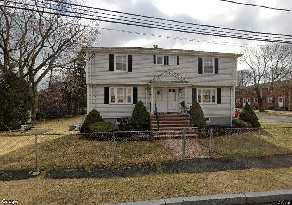
25 Heath Rd Unit 27 Arlington, MA 02474
East Arlington NeighborhoodEstimated Value: $962,000 - $1,073,000
4
Beds
2
Baths
1,800
Sq Ft
$560/Sq Ft
Est. Value
About This Home
This home is located at 25 Heath Rd Unit 27, Arlington, MA 02474 and is currently estimated at $1,007,330, approximately $559 per square foot. 25 Heath Rd Unit 27 is a home located in Middlesex County with nearby schools including Thompson School, Ottoson Middle School, and Arlington High School.
Ownership History
Date
Name
Owned For
Owner Type
Purchase Details
Closed on
Sep 22, 2016
Sold by
Berlinhieri Mario A and Berlinghieri Judith A
Bought by
Mjb Health T and Berlinhieri
Current Estimated Value
Purchase Details
Closed on
Aug 3, 1999
Sold by
Holman Josephine Est and Hurley
Bought by
Berlinghieri Mario A and Berlinghieri Judith A
Home Financials for this Owner
Home Financials are based on the most recent Mortgage that was taken out on this home.
Original Mortgage
$216,000
Interest Rate
7.61%
Mortgage Type
Purchase Money Mortgage
Create a Home Valuation Report for This Property
The Home Valuation Report is an in-depth analysis detailing your home's value as well as a comparison with similar homes in the area
Home Values in the Area
Average Home Value in this Area
Purchase History
| Date | Buyer | Sale Price | Title Company |
|---|---|---|---|
| Mjb Health T | -- | -- | |
| Berlinghieri Mario A | $270,000 | -- |
Source: Public Records
Mortgage History
| Date | Status | Borrower | Loan Amount |
|---|---|---|---|
| Previous Owner | Berlinghieri Mario A | $216,000 |
Source: Public Records
Tax History Compared to Growth
Tax History
| Year | Tax Paid | Tax Assessment Tax Assessment Total Assessment is a certain percentage of the fair market value that is determined by local assessors to be the total taxable value of land and additions on the property. | Land | Improvement |
|---|---|---|---|---|
| 2025 | $9,282 | $861,800 | $490,800 | $371,000 |
| 2024 | $8,466 | $799,400 | $466,300 | $333,100 |
| 2023 | $8,220 | $733,300 | $417,200 | $316,100 |
| 2022 | $8,094 | $708,800 | $392,700 | $316,100 |
| 2021 | $7,856 | $692,800 | $392,700 | $300,100 |
| 2020 | $7,665 | $693,000 | $392,700 | $300,300 |
| 2019 | $7,063 | $627,300 | $355,800 | $271,500 |
| 2018 | $7,386 | $608,900 | $337,400 | $271,500 |
| 2017 | $6,902 | $549,500 | $294,500 | $255,000 |
| 2016 | $6,483 | $506,500 | $251,500 | $255,000 |
| 2015 | $6,057 | $447,000 | $233,100 | $213,900 |
Source: Public Records
Map
Nearby Homes
- 23 Yale Rd
- 6 Gordon Rd
- 12 Arizona Terrace Unit 2
- 42-44 Warren St Unit 42
- 215 Massachusetts Ave Unit 19 (34)
- 29 Dartmouth St Unit 29
- 327 Alewife Brook Pkwy Unit A
- 230 Massachusetts Ave Unit 6
- 69 Sterling St
- 94 Rawson Rd Unit 94
- 16 High St Unit 2
- 21 High St
- 6 Hamilton Rd Unit 6
- 132 Rawson Rd Unit 132
- 25-27 Adams St
- 44 Woods Ave Unit 44
- 395 Alewife Brook Pkwy Unit 2C
- 395 Alewife Brook Pkwy Unit PH E
- 31 Fairfax St
- 166 Arlington St
- 27 Heath Rd Unit 8
- 25 Heath Rd Unit 1
- 32 Hilton St Unit 34
- 36 Hilton St Unit 38
- 11 Heath Rd
- 26 Heath Rd Unit 7
- 26 Heath Rd Unit 3
- 42 Hilton St Unit 42
- 7 Harris Cir
- 9 Heath Rd
- 40 Hilton St Unit 42
- 35 Hilton St Unit 37
- 35 Hilton St
- 37 Hilton St Unit 1
- 35 Hilton St Unit 2
- 35 Hilton St Unit 35
- 44 Hilton St Unit 46
- 39 Hilton St Unit 41
- 6 Harris Cir Unit 3
- 6 Harris Cir Unit 9