Estimated Value: $545,000 - $658,000
3
Beds
3
Baths
2,576
Sq Ft
$230/Sq Ft
Est. Value
About This Home
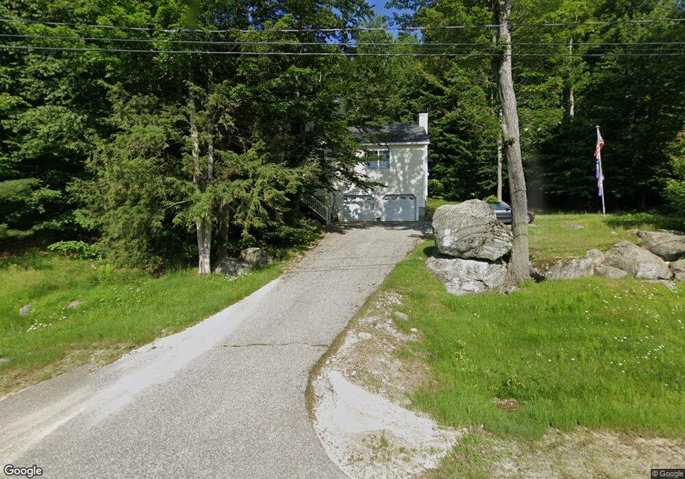
This home is located at 25 Tracie Ln, Weare, NH 03281 and is currently estimated at $592,203, approximately $229 per square foot. 25 Tracie Ln is a home located in Hillsborough County with nearby schools including Center Woods Elementary School, Weare Middle School, and John Stark Regional High School.
Ownership History
Date
Name
Owned For
Owner Type
Purchase Details
Closed on
Nov 21, 2011
Sold by
Fnma
Bought by
Lombard Carl A
Current Estimated Value
Home Financials for this Owner
Home Financials are based on the most recent Mortgage that was taken out on this home.
Original Mortgage
$73,000
Outstanding Balance
$49,538
Interest Rate
3.92%
Mortgage Type
Purchase Money Mortgage
Estimated Equity
$542,665
Purchase Details
Closed on
Apr 15, 2011
Sold by
Mandrino Caleb P and Fnma
Bought by
Federal National Mortgage Association
Purchase Details
Closed on
May 10, 2005
Sold by
High Rock Dev Llc
Bought by
Mandrino Caleb P and Mandrino Beverly G
Home Financials for this Owner
Home Financials are based on the most recent Mortgage that was taken out on this home.
Original Mortgage
$251,100
Interest Rate
6.01%
Mortgage Type
Purchase Money Mortgage
Create a Home Valuation Report for This Property
The Home Valuation Report is an in-depth analysis detailing your home's value as well as a comparison with similar homes in the area
Home Values in the Area
Average Home Value in this Area
Purchase History
| Date | Buyer | Sale Price | Title Company |
|---|---|---|---|
| Lombard Carl A | $195,100 | -- | |
| Federal National Mortgage Association | $292,900 | -- | |
| Mandrino Caleb P | $313,900 | -- |
Source: Public Records
Mortgage History
| Date | Status | Borrower | Loan Amount |
|---|---|---|---|
| Open | Mandrino Caleb P | $73,000 | |
| Previous Owner | Mandrino Caleb P | $266,400 | |
| Previous Owner | Mandrino Caleb P | $46,600 | |
| Previous Owner | Mandrino Caleb P | $251,100 |
Source: Public Records
Tax History Compared to Growth
Tax History
| Year | Tax Paid | Tax Assessment Tax Assessment Total Assessment is a certain percentage of the fair market value that is determined by local assessors to be the total taxable value of land and additions on the property. | Land | Improvement |
|---|---|---|---|---|
| 2024 | $8,360 | $410,000 | $122,800 | $287,200 |
| 2023 | $7,724 | $410,000 | $122,800 | $287,200 |
| 2022 | $7,134 | $410,000 | $122,800 | $287,200 |
| 2021 | $7,052 | $410,000 | $122,800 | $287,200 |
| 2020 | $7,183 | $299,900 | $88,100 | $211,800 |
| 2019 | $7,106 | $299,700 | $88,100 | $211,600 |
| 2018 | $6,902 | $299,700 | $88,100 | $211,600 |
| 2016 | $6,704 | $299,700 | $88,100 | $211,600 |
| 2015 | $6,268 | $279,700 | $88,100 | $191,600 |
| 2014 | $6,212 | $279,700 | $88,100 | $191,600 |
| 2013 | $6,083 | $279,700 | $88,100 | $191,600 |
Source: Public Records
Map
Nearby Homes
- 849 River Rd
- 3 Stephanie Rd
- 0 Huntington Hill Rd Unit 69
- 174 S Stark Hwy Unit 13
- 174 S Stark Hwy Unit 1
- 174 S Stark Hwy Unit 23
- 624 S Stark Hwy
- 103 Renshaw Rd
- 93 Daniels Rd
- 77 Gould Rd
- 22 Fairway Dr
- 0 Fairway Dr Unit 11
- 15 Robert Rogers Rd
- 1003 School St
- 88 Saunders Rd
- 10 Sap House Rd
- 49 Stark Hwy N
- 95 Wright Dr
- 196 Deering Center Rd
- 179 Oak Hill Rd
- 21 Tracie Ln
- 37 Tracie Ln
- 22 Tracie Ln
- 7 Tracie Ln
- 12 Tracie Ln
- 50 Tracie Ln
- 125 High Rock Rd
- 0 High Rock Rd
- 623B River Rd Unit A
- 611 River Rd
- 152 High Rock Rd
- 67 Highrock Rd
- 67 High Rock Rd Unit 67
- 651 River Rd Unit A
- 163 Highrock Rd
- 163 A Highrock Rd
- 150 Highrock Rd
- 150 High Rock Rd
- 60 Highrock Rd
- 101 Chuck St S