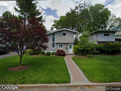
25 Walnut Dr Tenafly, NJ 07670
Estimated Value: $1,089,086 - $1,589,000
--
Bed
--
Bath
2,726
Sq Ft
$479/Sq Ft
Est. Value
About This Home
This home is located at 25 Walnut Dr, Tenafly, NJ 07670 and is currently estimated at $1,305,522, approximately $478 per square foot. 25 Walnut Dr is a home located in Bergen County with nearby schools including Tenafly Middle School, Tenafly High School, and Englewood on the Palisades Charter School.
Ownership History
Date
Name
Owned For
Owner Type
Purchase Details
Closed on
Jan 24, 2017
Sold by
Roditi Elizabeth
Bought by
Roditi Jack and Roditi Elizabeth
Current Estimated Value
Home Financials for this Owner
Home Financials are based on the most recent Mortgage that was taken out on this home.
Original Mortgage
$350,000
Interest Rate
4.09%
Mortgage Type
New Conventional
Purchase Details
Closed on
Jun 22, 2004
Create a Home Valuation Report for This Property
The Home Valuation Report is an in-depth analysis detailing your home's value as well as a comparison with similar homes in the area
Home Values in the Area
Average Home Value in this Area
Purchase History
| Date | Buyer | Sale Price | Title Company |
|---|---|---|---|
| Roditi Jack | -- | None Available | |
| -- | -- | -- |
Source: Public Records
Mortgage History
| Date | Status | Borrower | Loan Amount |
|---|---|---|---|
| Open | Roditi Jack | $326,450 | |
| Closed | Roditi Jack | $89,500 | |
| Closed | Roditi Jack | $350,000 | |
| Previous Owner | Roditi Elizabeth | $175,744 | |
| Previous Owner | Roditi Jack | $200,000 |
Source: Public Records
Tax History Compared to Growth
Tax History
| Year | Tax Paid | Tax Assessment Tax Assessment Total Assessment is a certain percentage of the fair market value that is determined by local assessors to be the total taxable value of land and additions on the property. | Land | Improvement |
|---|---|---|---|---|
| 2024 | $18,406 | $664,000 | $358,000 | $306,000 |
| 2023 | $17,961 | $664,000 | $358,000 | $306,000 |
| 2022 | $17,961 | $664,000 | $358,000 | $306,000 |
| 2021 | $17,642 | $664,000 | $358,000 | $306,000 |
| 2020 | $17,384 | $664,000 | $358,000 | $306,000 |
| 2019 | $17,078 | $664,000 | $358,000 | $306,000 |
| 2018 | $16,812 | $664,000 | $358,000 | $306,000 |
| 2017 | $16,753 | $664,000 | $358,000 | $306,000 |
| 2016 | $16,421 | $664,000 | $358,000 | $306,000 |
| 2015 | $16,056 | $664,000 | $358,000 | $306,000 |
| 2014 | $15,757 | $664,000 | $358,000 | $306,000 |
Source: Public Records
Map
Nearby Homes
- 26 Clover St
- 60 Demott St
- 66 Dean Dr
- 63 W Hudson Ave Unit A24
- 135 Pleasant Ave
- 68 Franklin St Unit B
- 78 Franklin St Unit D
- 51 W Hudson Ave Unit 4
- 51 W Hudson Ave Unit 1
- 51 W Hudson Ave Unit 16
- 12 Louise Ln
- 97 Palmer Ave
- 60 Elm St
- 119 W Hudson Ave
- 10 Kensington Ct
- 29 Engle St Unit 8
- 7 S Park Dr
- 167 Everett Place
- 41 Cambridge Ave
- 20 Norman Place