25021 State Highway 27 W Hoffman, MN 56339
Estimated Value: $300,000 - $387,000
--
Bed
--
Bath
1,948
Sq Ft
$178/Sq Ft
Est. Value
About This Home
This home is located at 25021 State Highway 27 W, Hoffman, MN 56339 and is currently estimated at $345,852, approximately $177 per square foot. 25021 State Highway 27 W is a home with nearby schools including West Central Area Secondary School.
Ownership History
Date
Name
Owned For
Owner Type
Purchase Details
Closed on
Jun 10, 2019
Sold by
Johnson Hedner Gail C
Bought by
Stark Erick and Stark Adrianne
Current Estimated Value
Home Financials for this Owner
Home Financials are based on the most recent Mortgage that was taken out on this home.
Original Mortgage
$135,000
Interest Rate
5%
Mortgage Type
Land Contract Argmt. Of Sale
Create a Home Valuation Report for This Property
The Home Valuation Report is an in-depth analysis detailing your home's value as well as a comparison with similar homes in the area
Home Values in the Area
Average Home Value in this Area
Purchase History
| Date | Buyer | Sale Price | Title Company |
|---|---|---|---|
| Stark Erick | $175,000 | None Available |
Source: Public Records
Mortgage History
| Date | Status | Borrower | Loan Amount |
|---|---|---|---|
| Closed | Stark Erick | $135,000 |
Source: Public Records
Tax History Compared to Growth
Tax History
| Year | Tax Paid | Tax Assessment Tax Assessment Total Assessment is a certain percentage of the fair market value that is determined by local assessors to be the total taxable value of land and additions on the property. | Land | Improvement |
|---|---|---|---|---|
| 2025 | $2,710 | $326,800 | $55,700 | $271,100 |
| 2024 | $2,710 | $312,200 | $55,700 | $256,500 |
| 2023 | $2,654 | $295,300 | $46,400 | $248,900 |
| 2022 | $2,046 | $263,900 | $37,900 | $226,000 |
| 2021 | $2,144 | $197,500 | $35,500 | $162,000 |
| 2020 | $1,638 | $191,100 | $33,700 | $157,400 |
| 2019 | $1,594 | $185,100 | $27,500 | $157,600 |
| 2018 | $1,364 | $183,500 | $27,500 | $156,000 |
| 2017 | $1,422 | $168,900 | $23,300 | $145,600 |
| 2016 | $1,376 | $158,789 | $22,601 | $136,188 |
| 2015 | $1,406 | $0 | $0 | $0 |
| 2014 | -- | $153,700 | $23,300 | $130,400 |
Source: Public Records
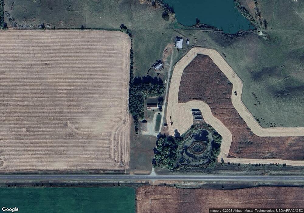
Map
Nearby Homes
- 6580 Tower Rd SW
- 114 8th St S
- 64.4 acres Westridge Ln SW
- 108 4th St N
- 302 Dakota Ave
- 104 3rd St N
- 406 1st St S
- 103 Arkansas Ave
- 113 Iowa Ave
- TBD 1st St N
- 4291 County Road 1 SW
- 000 Red Rock Shores Dr SW
- 27 Central Ave N Unit SW
- 16 Tower St
- TBD Solem Lake Rd SW
- 2134 County Road 15 SW
- 21377 County Road 5
- 13638 183rd St
- 14976 County Road 107 SW
- XXX Loon Point Dr
- 5810 County Road 25 SW
- 6160 County Road 25 SW
- 5680 County Road 25 SW
- 7460 Unity Dr SW
- 5726 Zachs Ln SW
- XXXXX Sandy Hill Rd
- Lt 1, Blk Zachs Ln
- Lt 1, Blk 2 Zachs Ln
- 5652 Zachs Ln SW
- 10362 State Highway 27
- Lt 5, Blk 1 Zachs Ln
- Lt 5, Blk Zachs Ln
- Lt 1,Blk 3 Zachs Ln
- Lt 2,Blk 3 Zachs Ln
- 10366 State Highway 27
- Lt 1,Blk 3 Red Rock Addition
- Lt 3, Blk 3 Zachs Ln
- Lt 3, Blk 3 Red Rock Addition
- Lt 3, Blk Red Rock Addition
- Lt 3, Blk Zachs Ln