Estimated Value: $166,000 - $271,000
Studio
2
Baths
1,700
Sq Ft
$134/Sq Ft
Est. Value
About This Home
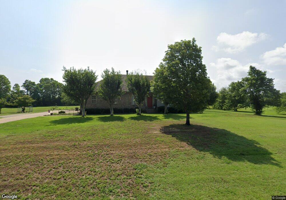
This home is located at 251 Sfc 3635, Colt, AR 72326 and is currently estimated at $227,869, approximately $134 per square foot. 251 Sfc 3635 is a home located in St. Francis County with nearby schools including Central Elementary School, Stewart Elementary School, and Forrest City Junior High School.
Ownership History
Date
Name
Owned For
Owner Type
Purchase Details
Closed on
May 6, 2013
Sold by
Puckett Sandra Kay
Bought by
Semonds Billy and Semonds Amanda C
Current Estimated Value
Home Financials for this Owner
Home Financials are based on the most recent Mortgage that was taken out on this home.
Original Mortgage
$142,500
Outstanding Balance
$100,995
Interest Rate
3.56%
Mortgage Type
New Conventional
Estimated Equity
$126,874
Purchase Details
Closed on
Oct 20, 2000
Sold by
Mgmt Roberts
Bought by
Puckett Sandra K
Create a Home Valuation Report for This Property
The Home Valuation Report is an in-depth analysis detailing your home's value as well as a comparison with similar homes in the area
Purchase History
| Date | Buyer | Sale Price | Title Company |
|---|---|---|---|
| Semonds Billy | $150,000 | None Available | |
| Puckett Sandra K | $20,000 | -- |
Source: Public Records
Mortgage History
| Date | Status | Borrower | Loan Amount |
|---|---|---|---|
| Open | Semonds Billy | $142,500 |
Source: Public Records
Tax History
| Year | Tax Paid | Tax Assessment Tax Assessment Total Assessment is a certain percentage of the fair market value that is determined by local assessors to be the total taxable value of land and additions on the property. | Land | Improvement |
|---|---|---|---|---|
| 2025 | $1,272 | $34,330 | $4,770 | $29,560 |
| 2024 | $1,305 | $34,330 | $4,770 | $29,560 |
| 2023 | $1,192 | $34,330 | $4,770 | $29,560 |
| 2022 | $788 | $34,330 | $4,770 | $29,560 |
| 2021 | $718 | $28,150 | $3,710 | $24,440 |
| 2020 | $718 | $28,150 | $3,710 | $24,440 |
| 2019 | $746 | $28,150 | $3,710 | $24,440 |
| 2018 | $771 | $28,150 | $3,710 | $24,440 |
| 2017 | $1,120 | $28,150 | $3,710 | $24,440 |
| 2016 | $1,134 | $28,490 | $4,300 | $24,190 |
| 2015 | $1,134 | $28,490 | $4,300 | $24,190 |
| 2014 | $1,134 | $28,490 | $4,300 | $24,190 |
Source: Public Records
Map
Nearby Homes
- 207 Sfc 1003
- 2073 Arkansas 306
- 8697 Highway 284
- 4339 Highway 284
- 347 Old Military Rd E
- 0 Sfc 355
- 2458 Sfc 311
- 481 Sfc 333
- 90 County Road 7415
- 137 County Road 789
- 0 Good Hope Rd
- 109 Sonny Ln
- 192 Sfc 322
- County Rd 415
- 00 cr 415 Sfc 359
- 54 County Road 766
- 128 County Road 725
- 308 E Eleanor Ave
- 398 Barry St E
- 371 Barry St E
- 323 Sfc 3635
- 153 Sfc 3635
- 286 Sfc 3635
- 134 Sfc 3633
- 91 Sfc 3635
- 451 Sfc 3635
- 106 Sfc 3634
- 452 Sfc 3635
- 452 Sfc 3635
- 269 Sfc 3633
- 135 Sfc 3634
- 3800 Highway 306 E
- 137 Sfc 3634
- 3451 Highway 306 E
- 3551 Highway 306 E
- 3641 Highway 306 E
- 3841 Highway 306 E
- 3793 Highway 306 E
- 712 Sfc 3635
- 3209 Highway 306 E
Your Personal Tour Guide
Ask me questions while you tour the home.