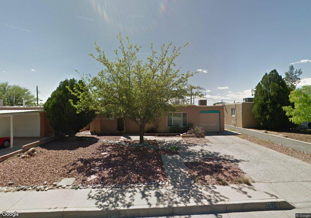
2511 Carol St NE Albuquerque, NM 87112
Northeast Heights NeighborhoodEstimated Value: $267,000 - $280,412
3
Beds
1
Bath
1,248
Sq Ft
$220/Sq Ft
Est. Value
About This Home
This home is located at 2511 Carol St NE, Albuquerque, NM 87112 and is currently estimated at $274,603, approximately $220 per square foot. 2511 Carol St NE is a home located in Bernalillo County with nearby schools including Eldorado High School, Matheson Park Elementary School, and Hoover Middle School.
Ownership History
Date
Name
Owned For
Owner Type
Purchase Details
Closed on
Mar 13, 2005
Sold by
Slingerland Jeffery Dale and Ward Karolyn Kaye
Bought by
Gregory Rachel L
Current Estimated Value
Home Financials for this Owner
Home Financials are based on the most recent Mortgage that was taken out on this home.
Original Mortgage
$104,000
Outstanding Balance
$52,722
Interest Rate
5.71%
Mortgage Type
Purchase Money Mortgage
Estimated Equity
$221,881
Create a Home Valuation Report for This Property
The Home Valuation Report is an in-depth analysis detailing your home's value as well as a comparison with similar homes in the area
Home Values in the Area
Average Home Value in this Area
Purchase History
| Date | Buyer | Sale Price | Title Company |
|---|---|---|---|
| Gregory Rachel L | -- | First American Title Ins Co |
Source: Public Records
Mortgage History
| Date | Status | Borrower | Loan Amount |
|---|---|---|---|
| Open | Gregory Rachel L | $104,000 | |
| Closed | Gregory Rachel L | $19,500 |
Source: Public Records
Tax History Compared to Growth
Tax History
| Year | Tax Paid | Tax Assessment Tax Assessment Total Assessment is a certain percentage of the fair market value that is determined by local assessors to be the total taxable value of land and additions on the property. | Land | Improvement |
|---|---|---|---|---|
| 2025 | $1,971 | $50,165 | $14,019 | $36,146 |
| 2024 | $1,971 | $48,704 | $13,611 | $35,093 |
| 2023 | $1,935 | $47,285 | $13,214 | $34,071 |
| 2022 | $1,868 | $45,909 | $12,830 | $33,079 |
| 2021 | $1,802 | $44,572 | $12,456 | $32,116 |
| 2020 | $1,770 | $43,274 | $12,093 | $31,181 |
| 2019 | $1,716 | $42,014 | $11,741 | $30,273 |
| 2018 | $1,652 | $42,014 | $11,741 | $30,273 |
| 2017 | $1,599 | $40,791 | $11,400 | $29,391 |
| 2016 | $1,551 | $38,449 | $10,745 | $27,704 |
| 2015 | $37,329 | $37,329 | $10,432 | $26,897 |
| 2014 | $1,480 | $36,856 | $10,609 | $26,247 |
| 2013 | -- | $35,783 | $10,300 | $25,483 |
Source: Public Records
Map
Nearby Homes
- 2700 Eubank Blvd NE
- 2805 Christine St NE
- 9521 Salem Rd NE
- 2329 Britt St NE
- 2417 Britt St NE
- 3110 Betts Dr NE
- 10410 Towner Ave NE
- 9916 Toltec Rd NE
- 2904 June St NE
- 2905 Dorothy St NE
- 9521 Snow Heights Blvd NE
- 10708 Lexington Ave NE
- 3125 Lori Place NE
- 9206 Aztec Rd NE
- 3509 Glorieta St NE
- 8922 Claremont Ave NE
- 3612 Pitt St NE
- 9004 Shoshone Rd NE
- 9616 Morrow Ave NE
- 1812 Mary Ellen St NE
- 2515 Carol St NE
- 2507 Carol St NE
- 2601 Carol St NE
- 2510 Mary Ellen St NE
- 2506 Mary Ellen St NE
- 2514 Mary Ellen St NE
- 9809 Claremont Ave NE
- 2514 Carol St NE
- 2506 Carol St NE
- 2510 Carol St NE
- 9803 Claremont Ave NE
- 2605 Carol St NE
- 2600 Carol St NE
- 2604 Mary Ellen St NE
- 2604 Carol St NE
- 9901 Claremont Ave NE
- 2609 Carol St NE
- 2511 Mary Ellen St NE
- 9905 Claremont Ave NE
- 2515 Mary Ellen St NE