Estimated Value: $231,000 - $255,000
3
Beds
2
Baths
2,133
Sq Ft
$114/Sq Ft
Est. Value
About This Home
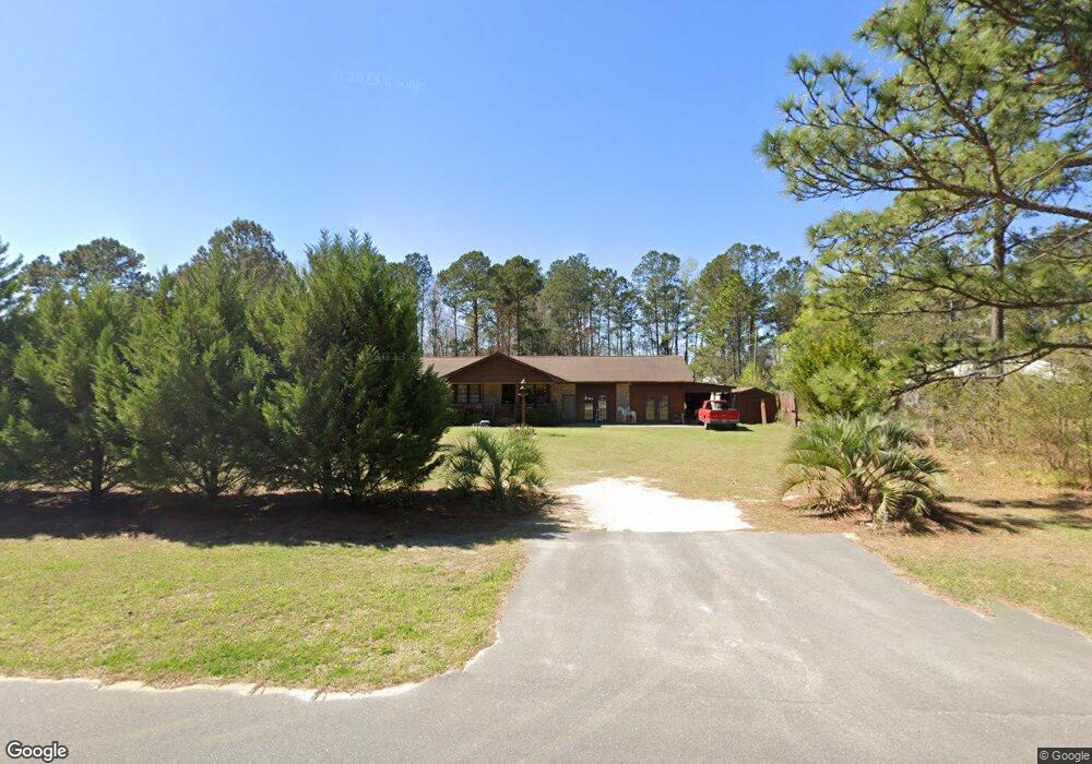
This home is located at 2511 Harvey Rd, Loris, SC 29569 and is currently estimated at $243,234, approximately $114 per square foot. 2511 Harvey Rd is a home located in Horry County with nearby schools including Loris Elementary School, Loris Middle School, and Loris High School.
Ownership History
Date
Name
Owned For
Owner Type
Purchase Details
Closed on
May 28, 2004
Sold by
Riley Denis S
Bought by
Gibson Gloria Gail
Current Estimated Value
Home Financials for this Owner
Home Financials are based on the most recent Mortgage that was taken out on this home.
Original Mortgage
$20,780
Interest Rate
5.98%
Mortgage Type
Stand Alone Second
Purchase Details
Closed on
Apr 24, 2003
Sold by
Mungo James Ellis and Estate Of Heriot C Mungo Jr
Bought by
Mungo James E and Mungo Heriot C
Purchase Details
Closed on
May 25, 1998
Sold by
Baxby Robert J
Bought by
Mungo Heriot C
Create a Home Valuation Report for This Property
The Home Valuation Report is an in-depth analysis detailing your home's value as well as a comparison with similar homes in the area
Home Values in the Area
Average Home Value in this Area
Purchase History
| Date | Buyer | Sale Price | Title Company |
|---|---|---|---|
| Gibson Gloria Gail | $103,900 | -- | |
| Mungo James E | -- | -- | |
| Mungo Heriot C | $55,000 | -- |
Source: Public Records
Mortgage History
| Date | Status | Borrower | Loan Amount |
|---|---|---|---|
| Closed | Gibson Gloria Gail | $20,780 | |
| Open | Gibson Gloria Gail | $83,120 |
Source: Public Records
Tax History Compared to Growth
Tax History
| Year | Tax Paid | Tax Assessment Tax Assessment Total Assessment is a certain percentage of the fair market value that is determined by local assessors to be the total taxable value of land and additions on the property. | Land | Improvement |
|---|---|---|---|---|
| 2024 | -- | $6,833 | $2,160 | $4,673 |
| 2023 | $0 | $3,741 | $529 | $3,212 |
| 2021 | $443 | $3,741 | $529 | $3,212 |
| 2020 | $370 | $3,741 | $529 | $3,212 |
| 2019 | $370 | $3,741 | $529 | $3,212 |
| 2018 | $0 | $3,855 | $583 | $3,272 |
| 2017 | $0 | $3,855 | $583 | $3,272 |
| 2016 | $0 | $3,855 | $583 | $3,272 |
| 2015 | -- | $3,856 | $584 | $3,272 |
| 2014 | $344 | $3,856 | $584 | $3,272 |
Source: Public Records
Map
Nearby Homes
- 1725 Southern Crest Dr Unit Spruce
- 1721 Southern Crest Dr Unit Sumter
- 1763 Southern Crest Dr
- 1585 Daisy Rd
- TBD Daisy Rd
- TBD Daisy Rd Unit Lot 8
- 2018 Venus Ct
- 1368 Blue Bird Rd
- 1170 Daisy Rd
- 2300 Tansy Rd
- Lot 10 Tansy Rd
- Lot 9 Tansy Rd
- Lot 7 Tansy Rd
- Lot 8 Tansy Rd
- Lot 6 Tansy Rd
- Lot 4 Tansy Rd
- Lot 5 Tansy Rd
- Lot 2 Tansy Rd
- Lot 1 Tansy Rd
- Lot 3 Tansy Rd
- 2505 Harvey Rd
- 2505 Harvey Rd
- 2533 Harvey Rd
- 1679 Moon Catcher Ct
- 2501 Harvey Rd
- 1735 Southern Crest Dr
- 1661 Moon Catcher Ct
- 1779 Southern Crest Dr
- TBD Southern Crest Dr
- 1787 Southern Crest Dr
- 1739 Southern Crest Dr
- TBD Harvey Rd
- 5 acres Harvey Rd Unit Tract A&B
- TBD Harvey Rd Unit Tract A
- 1795 Southern Crest Dr
- 1891 Dream Catcher Ln
- 1891 Dream Catcher Ln Unit Dream Catcher
- 1803 Southern Crest Dr
- 1811 Southern Crest Dr
- 1641 Southern Crest Dr