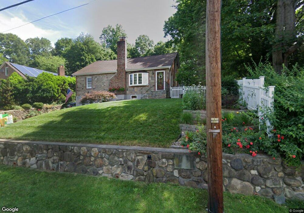
252 S Middletown Rd Pearl River, NY 10965
Estimated Value: $634,000 - $698,000
3
Beds
2
Baths
1,596
Sq Ft
$419/Sq Ft
Est. Value
About This Home
This home is located at 252 S Middletown Rd, Pearl River, NY 10965 and is currently estimated at $668,835, approximately $419 per square foot. 252 S Middletown Rd is a home located in Rockland County with nearby schools including Pearl River High School and St Margaret School.
Ownership History
Date
Name
Owned For
Owner Type
Purchase Details
Closed on
Dec 17, 1996
Sold by
Plaia Rose Louise and Plaia Venessa
Bought by
Sherrock Marie and Sherrock Sean
Current Estimated Value
Home Financials for this Owner
Home Financials are based on the most recent Mortgage that was taken out on this home.
Original Mortgage
$125,000
Outstanding Balance
$12,455
Interest Rate
7.48%
Mortgage Type
Construction
Estimated Equity
$656,380
Create a Home Valuation Report for This Property
The Home Valuation Report is an in-depth analysis detailing your home's value as well as a comparison with similar homes in the area
Home Values in the Area
Average Home Value in this Area
Purchase History
| Date | Buyer | Sale Price | Title Company |
|---|---|---|---|
| Sherrock Marie | $200,000 | First American Title | |
| Sherrock Marie | -- | First American Title |
Source: Public Records
Mortgage History
| Date | Status | Borrower | Loan Amount |
|---|---|---|---|
| Open | Sherrock Marie | $125,000 |
Source: Public Records
Tax History Compared to Growth
Tax History
| Year | Tax Paid | Tax Assessment Tax Assessment Total Assessment is a certain percentage of the fair market value that is determined by local assessors to be the total taxable value of land and additions on the property. | Land | Improvement |
|---|---|---|---|---|
| 2024 | $14,409 | $182,300 | $50,700 | $131,600 |
| 2023 | $14,409 | $182,300 | $50,700 | $131,600 |
| 2022 | $4,552 | $182,300 | $50,700 | $131,600 |
| 2021 | $12,210 | $182,300 | $50,700 | $131,600 |
| 2020 | $11,555 | $182,300 | $50,700 | $131,600 |
| 2019 | $4,231 | $182,300 | $50,700 | $131,600 |
| 2018 | $10,935 | $182,300 | $50,700 | $131,600 |
| 2017 | $10,553 | $182,300 | $50,700 | $131,600 |
| 2016 | $10,222 | $182,300 | $50,700 | $131,600 |
| 2015 | -- | $182,300 | $50,700 | $131,600 |
| 2014 | -- | $182,300 | $50,700 | $131,600 |
Source: Public Records
Map
Nearby Homes
- 332 S Middletown Rd
- 25 Meyer Oval
- 148 Meyer Oval
- 167 Meyer Oval
- 210 Rockland Rd
- 109 S John St
- 80 Lenape Rd
- 163 S William St Unit 163-165
- 363 Gilbert Ave
- 159 Martin Place
- 29 Michael Roberts Ct
- 104 Montvale Ave
- 167 S Main St
- 92 Montvale Ave
- 10 Mountain View Ave
- 7 Main St
- 0 Montvale Ave
- 55 Montvale Ave
- 74 Oldert Dr
- 359 Orangeburg Rd
- 248 S Middletown Rd
- 256 S Middletown Rd
- 242 S Middletown Rd
- 198 Gilbert Ave
- 249 S Middletown Rd
- 212 Gilbert Ave
- 241 S Middletown Rd
- 257 S Middletown Rd
- 180 Gilbert Ave
- 194 Gilbert Ave
- 274 S Middletown Rd
- 276 S Middletown Rd
- 261 S Middletown Rd
- 214 Gilbert Ave
- 196 Gilbert Ave
- 237 S Middletown Rd
- 6 Kerry Ct
- 5 Kerry Ct
- 210 Gilbert Ave
- 280 S Middletown Rd