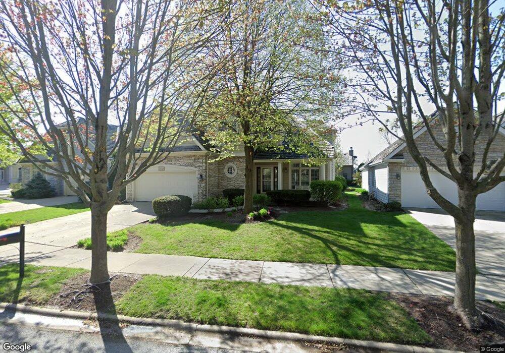
2521 Arborside Ln Unit 44 Aurora, IL 60502
Eola Yards NeighborhoodEstimated Value: $670,000 - $839,000
4
Beds
3
Baths
3,094
Sq Ft
$232/Sq Ft
Est. Value
About This Home
This home is located at 2521 Arborside Ln Unit 44, Aurora, IL 60502 and is currently estimated at $716,867, approximately $231 per square foot. 2521 Arborside Ln Unit 44 is a home located in DuPage County with nearby schools including Gwendolyn Brooks Elementary School, Francis Granger Middle School, and Metea Valley High School.
Ownership History
Date
Name
Owned For
Owner Type
Purchase Details
Closed on
Apr 18, 2011
Sold by
Aronoff Gail
Bought by
Lee Kevin S and Lee Leanne Y
Current Estimated Value
Home Financials for this Owner
Home Financials are based on the most recent Mortgage that was taken out on this home.
Original Mortgage
$322,000
Interest Rate
4.81%
Mortgage Type
New Conventional
Purchase Details
Closed on
Mar 1, 1998
Sold by
Kensington Homes Inc
Bought by
Aronoff Max and Aronoff Gail
Home Financials for this Owner
Home Financials are based on the most recent Mortgage that was taken out on this home.
Original Mortgage
$170,000
Interest Rate
7.09%
Create a Home Valuation Report for This Property
The Home Valuation Report is an in-depth analysis detailing your home's value as well as a comparison with similar homes in the area
Home Values in the Area
Average Home Value in this Area
Purchase History
| Date | Buyer | Sale Price | Title Company |
|---|---|---|---|
| Lee Kevin S | $402,500 | First American Title | |
| Aronoff Max | $330,000 | -- |
Source: Public Records
Mortgage History
| Date | Status | Borrower | Loan Amount |
|---|---|---|---|
| Previous Owner | Lee Kevin S | $322,000 | |
| Previous Owner | Aronoff Max | $170,000 |
Source: Public Records
Tax History Compared to Growth
Tax History
| Year | Tax Paid | Tax Assessment Tax Assessment Total Assessment is a certain percentage of the fair market value that is determined by local assessors to be the total taxable value of land and additions on the property. | Land | Improvement |
|---|---|---|---|---|
| 2024 | $13,360 | $183,707 | $38,785 | $144,922 |
| 2023 | $12,765 | $165,070 | $34,850 | $130,220 |
| 2022 | $12,061 | $149,820 | $31,370 | $118,450 |
| 2021 | $11,747 | $144,470 | $30,250 | $114,220 |
| 2020 | $11,890 | $144,470 | $30,250 | $114,220 |
| 2019 | $11,480 | $137,410 | $28,770 | $108,640 |
| 2018 | $12,354 | $145,870 | $30,020 | $115,850 |
| 2017 | $11,771 | $140,920 | $29,000 | $111,920 |
| 2016 | $11,570 | $135,240 | $27,830 | $107,410 |
| 2015 | $11,463 | $128,400 | $26,420 | $101,980 |
| 2014 | $12,047 | $130,880 | $26,710 | $104,170 |
| 2013 | $11,922 | $127,800 | $26,900 | $100,900 |
Source: Public Records
Map
Nearby Homes
- 2428 Ridgewood Ct
- 1148 Drury Ln
- 1129 Drury Ln
- 1176 Heathrow Ln
- 970 Waterside Ct
- 1771 Briarheath Dr
- 1110 Oakhill Dr
- 2762 Shetland Ln
- 322 4th St
- 2420 Glenford Dr
- 1037 Parkhill Cir
- 1648 Mcclure Rd Unit 814
- 1671 Sheffer Rd
- 1008 Asbury Dr
- 1425 Mcclure Rd Unit 10
- 973 Parkhill Cir Unit 973-B
- 2578 Crestview Dr
- 1229 Pennsbury Ln
- 921 Parkhill Cir
- Lot 1 Reckinger Rd
- 1230 Arborside Dr
- 2511 Arborside Ln
- 1220 Arborside Dr
- 1226 Arborside Dr
- 1214 Arborside Dr
- 2520 Arborside Ln
- 1229 Arborside Dr
- 1235 Arborside Dr
- 1223 Arborside Dr
- 1260 Arborside Dr
- 1241 Arborside Dr
- 1217 Arborside Dr Unit 44
- 1208 Arborside Dr
- 1247 Arborside Dr
- 1211 Arborside Dr
- 1253 Arborside Dr
- 1259 Arborside Dr
- 2222 Brookside Ln
- 2214 Brookside Ln
- 1202 Arborside Dr